Fitxer:Africa-countries-northern.png
From Wikipedia, the free encyclopedia
No hi ha cap versió amb una resolució més gran.
Africa-countries-northern.png (360 × 392 píxels, mida del fitxer: 10 Ko, tipus MIME: image/png)
| Aquest fitxer i la informació mostrada a continuació provenen del dipòsit multimèdia lliure Wikimedia Commons. |


Resum
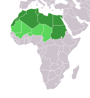
English: Map of countries in geo-political North Africa — as considered by the U.N.
- Credits
from en:Image:Africa-countries-northern.png

|
S'autoritza la còpia, la distribució i la modificació d'aquest document sota els termes de la llicència de documentació lliure GNU versió 1.2 o qualsevol altra versió posterior que publiqui la Free Software Foundation; sense seccions invariants, ni textos de portada, ni textos de contraportada. S'inclou una còpia d'aquesta llicència en la secció titulada GNU Free Documentation License.http://www.gnu.org/copyleft/fdl.htmlGFDLGNU Free Documentation Licensetruetrue |
| Aquest fitxer està subjecte a la llicència de Creative Commons Reconeixement i Compartir Igual 3.0 No adaptada. | ||
| ||
| Aquest avís de llicència s'ha afegit a aquest fitxer d'acord amb l'actualització de la llicència GFDL.http://creativecommons.org/licenses/by-sa/3.0/CC BY-SA 3.0Creative Commons Attribution-Share Alike 3.0truetrue |
Llegendes
Afegeix una explicació d'una línia del que representa aquest fitxer
Elements representats en aquest fitxer
representa l'entitat
image/png
a6cf75d1b983b9a714a9e17c881273a0955235ea
10.183 byte
392 píxel
360 píxel
Historial del fitxer
Cliqueu una data/hora per veure el fitxer tal com era aleshores.
| Data/hora | Miniatura | Dimensions | Usuari/a | Comentari | |
|---|---|---|---|---|---|
| actual | 17:22, 17 març 2018 | | 360 × 392 (10 Ko) | Maphobbyist | Montenegro border |
| 23:00, 31 març 2016 |  | 360 × 392 (10 Ko) | Fry1989 | Reverted to version as of 16:12, 13 January 2014 (UTC) | |
| 11:37, 7 nov 2015 |  | 360 × 392 (10 Ko) | Hpyounes | correction | |
| 18:12, 13 gen 2014 |  | 360 × 392 (10 Ko) | VVVF | See http://unstats.un.org/unsd/methods/m49/m49regin.htm | |
| 17:59, 13 gen 2014 |  | 360 × 392 (13 Ko) | VVVF | Reverted to version as of 20:15, 9 July 2011. See http://unstats.un.org/unsd/methods/m49/m49regin.htm | |
| 14:47, 20 jul 2011 |  | 360 × 392 (7 Ko) | Kahusi | See http://unstats.un.org/unsd/methods/m49/m49regin.htm | |
| 22:15, 9 jul 2011 |  | 360 × 392 (13 Ko) | Maphobbyist | South Sudan has become independent on July 9, 2011. Sudan and South Sudan are shown with the new international border between them. | |
| 13:13, 5 maig 2006 |  | 360 × 392 (4 Ko) | Hautala | optimized with png | |
| 18:30, 20 abr 2005 |  | 360 × 392 (14 Ko) | Yonghokim | map of countries in Northern Africa. from en:Image:Africa-countries-northern.png {{GFDL}} |
Ús del fitxer
No hi ha pàgines que utilitzin aquest fitxer.
Ús global del fitxer
Utilització d'aquest fitxer en altres wikis:
- Utilització a ce.wikipedia.org
- Utilització a es.wikipedia.org
- Utilització a fr.wikipedia.org
- Utilització a he.wikipedia.org
- Utilització a ru.wikipedia.org
- Utilització a sc.wikipedia.org
- Utilització a sv.wikinews.org
Metadades
Aquest fitxer conté informació addicional, probablement afegida per la càmera digital o l'escàner utilitzat per a crear-lo o digitalitzar-lo. Si s'ha modificat posteriorment, alguns detalls poden no reflectir les dades reals del fitxer modificat.
| Resolució horitzontal | 37,8 ppc |
|---|---|
| Resolució vertical | 37,8 ppc |
| Data i hora de modificació del fitxer | 23:35, 27 març 2004 |