File:Chiseldon_station_site_geograph-3304501-by-Ben-Brooksbank.jpg
From Wikipedia, the free encyclopedia
Size of this preview: 800 × 460 pixels. Other resolutions: 320 × 184 pixels | 640 × 368 pixels | 1,024 × 589 pixels | 1,280 × 736 pixels | 2,355 × 1,355 pixels.
Original file (2,355 × 1,355 pixels, file size: 2.49 MB, MIME type: image/jpeg)
| This is a file from the Wikimedia Commons. Information from its description page there is shown below. Commons is a freely licensed media file repository. You can help. |
Summary
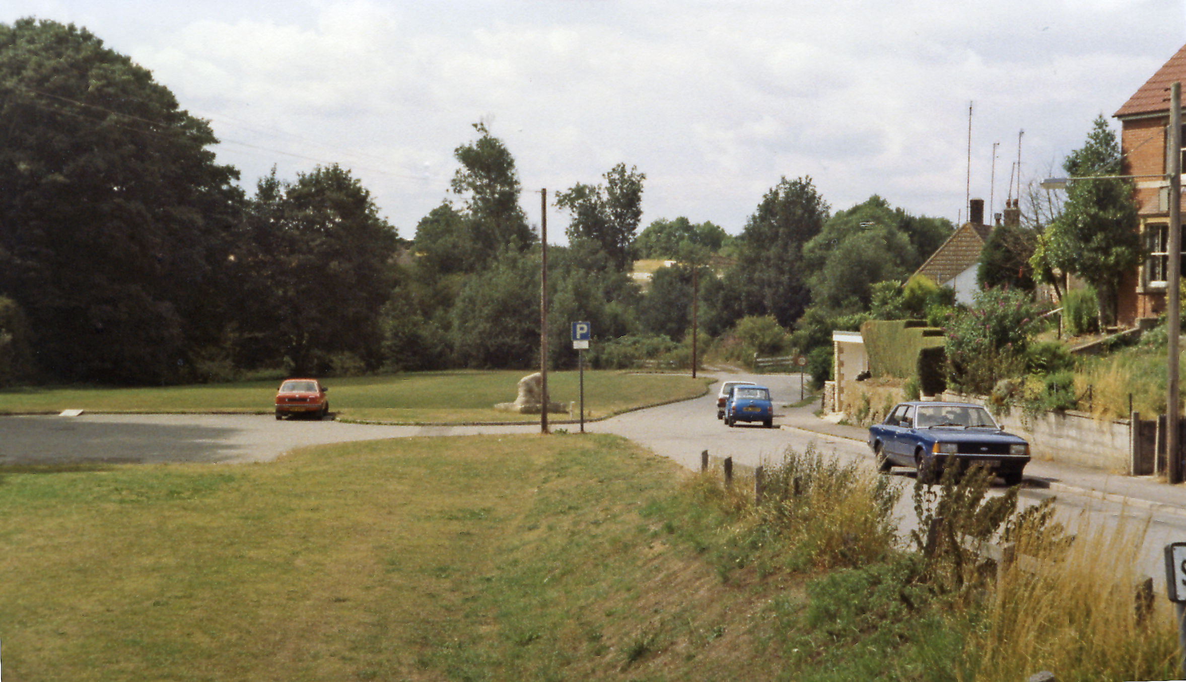
| DescriptionChiseldon station site geograph-3304501-by-Ben-Brooksbank.jpg |
English: Site of Chiseldon station, 1984. View NW, towards Swindon and Cheltenham: ex-GWR (M&SWJR) Cheltenham - Cirencester - Swindon - Marlborough - Andover Junction line. The station was closed with the whole line from 11/9/61. In the centre can be seen the very ancient memorial stone depicted in SU1879 : Memorial stone, Station Road, Chiseldon, Swindon, but it is not obvious where the stone was in relation to the station. |
| Date | |
| Source | From geograph.org.uk |
| Author | Ben Brooksbank |
| Permission (Reusing this file) |
Creative Commons Attribution Share-alike license 2.0 |
| Attribution (required by the license) InfoField | Ben Brooksbank / Site of Chiseldon station, 1984 / |
InfoField | Ben Brooksbank / Site of Chiseldon station, 1984 |
| Camera location | 51° 31′ 00.54″ N, 1° 43′ 54.31″ W | View this and other nearby images on: OpenStreetMap |
|---|
Licensing

|
This image was taken from the Geograph project collection. See this photograph's page on the Geograph website for the photographer's contact details. The copyright on this image is owned by Ben Brooksbank and is licensed for reuse under the Creative Commons Attribution-ShareAlike 2.0 license.
|
This file is licensed under the Creative Commons Attribution-Share Alike 2.0 Generic license.
Attribution: Ben Brooksbank
- You are free:
- to share – to copy, distribute and transmit the work
- to remix – to adapt the work
- Under the following conditions:
- attribution – You must give appropriate credit, provide a link to the license, and indicate if changes were made. You may do so in any reasonable manner, but not in any way that suggests the licensor endorses you or your use.
- share alike – If you remix, transform, or build upon the material, you must distribute your contributions under the same or compatible license as the original.
Captions
Add a one-line explanation of what this file represents
Items portrayed in this file
depicts
some value
5 August 1984
51°31'0.538"N, 1°43'54.314"W
image/jpeg
443daa0f9782777ae4c058d749a634b09667226e
2,609,046 byte
1,355 pixel
2,355 pixel
File history
Click on a date/time to view the file as it appeared at that time.
| Date/Time | Thumbnail | Dimensions | User | Comment | |
|---|---|---|---|---|---|
| current | 15:55, 12 February 2013 | | 2,355 × 1,355 (2.49 MB) | Chevin | == {{int:filedesc}} == {{Information |Description={{en|1='''Site of Chiseldon station, 1984.'''<br/> View NW, towards Swindon and Cheltenham: ex-GWR (M&SWJR) Cheltenham - Cirencester - Swindon - Marlborough - Andover Junction line. The station was clos... |
File usage
The following pages on the English Wikipedia use this file (pages on other projects are not listed):
Global file usage
The following other wikis use this file:
- Usage on www.wikidata.org
Metadata
This file contains additional information, probably added from the digital camera or scanner used to create or digitize it.
If the file has been modified from its original state, some details may not fully reflect the modified file.
| Image title |
|
|---|---|
| Orientation | Normal |
| Horizontal resolution | 157 dpc |
| Vertical resolution | 157 dpc |
| Software used | Adobe Photoshop Elements 3.0 Windows |
| File change date and time | 18:18, 21 January 2013 |
| Color space | Uncalibrated |
| Image width | 2,355 px |
| Image height | 1,355 px |
| Date and time of digitizing | 18:18, 21 January 2013 |
| Date metadata was last modified | 18:18, 21 January 2013 |
| IIM version | 2 |