File:Loessplateau-kl.jpg
From Wikipedia, the free encyclopedia
No higher resolution available.
Loessplateau-kl.jpg (500 × 444 pixels, file size: 31 KB, MIME type: image/jpeg)
| This is a file from the Wikimedia Commons. Information from its description page there is shown below. Commons is a freely licensed media file repository. You can help. |

|
This map image could be re-created using vector graphics as an SVG file. This has several advantages; see Commons:Media for cleanup for more information. If an SVG form of this image is available, please upload it and afterwards replace this template with
{{vector version available|new image name}}.
It is recommended to name the SVG file “Loessplateau-kl.svg”—then the template Vector version available (or Vva) does not need the new image name parameter. |
 | This map image was uploaded in the JPEG format even though it consists of non-photographic data. This information could be stored more efficiently or accurately in the PNG or SVG format. If possible, please upload a PNG or SVG version of this image without compression artifacts, derived from a non-JPEG source (or with existing artifacts removed). After doing so, please tag the JPEG version with {{Superseded|NewImage.ext}} and remove this tag. This tag should not be applied to photographs or scans. If this image is a diagram or other image suitable for vectorisation, please tag this image with {{Convert to SVG}} instead of {{BadJPEG}}. If not suitable for vectorisation, use {{Convert to PNG}}. For more information, see {{BadJPEG}}. |  |
Summary
| DescriptionLoessplateau-kl.jpg |
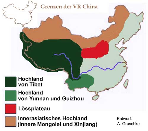
Deutsch: Karte der Hochländer in China |
| Date | |
| Source | Andreas Gruschke (Entwurf und Ausführung) |
| Author | Andreas Gruschke |
Licensing
This file is licensed under the Creative Commons Attribution-Share Alike 2.0 Germany license.
- You are free:
- to share – to copy, distribute and transmit the work
- to remix – to adapt the work
- Under the following conditions:
- attribution – You must give appropriate credit, provide a link to the license, and indicate if changes were made. You may do so in any reasonable manner, but not in any way that suggests the licensor endorses you or your use.
- share alike – If you remix, transform, or build upon the material, you must distribute your contributions under the same or compatible license as the original.

Original upload log
Transferred from de.wikipedia to Commons by Wdwdbot using CommonsHelper.
The original description page was here. All following user names refer to de.wikipedia.
- 2008-07-22 07:38 Gruschke 500×444× (31905 bytes) {{Information |Beschreibung = Karte der Hochländer in China |Quelle = Andreas Gruschke (Entwurf und Ausführung) |Urheber = Andreas Gruschke |Datum = 22.07.2008 |Genehmigung = |Andere Versionen = |Anmerkungen = }}
Captions
Add a one-line explanation of what this file represents
Items portrayed in this file
depicts
22 July 2008
File history
Click on a date/time to view the file as it appeared at that time.
| Date/Time | Thumbnail | Dimensions | User | Comment | |
|---|---|---|---|---|---|
| current | 19:02, 14 September 2013 | | 500 × 444 (31 KB) | File Upload Bot (Magnus Manske) | Transfered from de.wikipedia by User:wdwdbot using CommonsHelper |
File usage
The following pages on the English Wikipedia use this file (pages on other projects are not listed):
Global file usage
The following other wikis use this file:
- Usage on bg.wikipedia.org
- Usage on de.wikipedia.org
- Usage on hr.wikipedia.org
- Usage on id.wikipedia.org
- Usage on nl.wikipedia.org
- Usage on sr.wikipedia.org
- Usage on ta.wikipedia.org
Retrieved from "https://en.wikipedia.org/wiki/File:Loessplateau-kl.jpg"