File:NZ-Southland-satellite.png
From Wikipedia, the free encyclopedia
Size of this preview: 734 × 599 pixels. Other resolutions: 294 × 240 pixels | 588 × 480 pixels | 856 × 699 pixels.
Original file (856 × 699 pixels, file size: 1.15 MB, MIME type: image/png)
| This is a file from the Wikimedia Commons. Information from its description page there is shown below. Commons is a freely licensed media file repository. You can help. |
Summary
| DescriptionNZ-Southland-satellite.png |
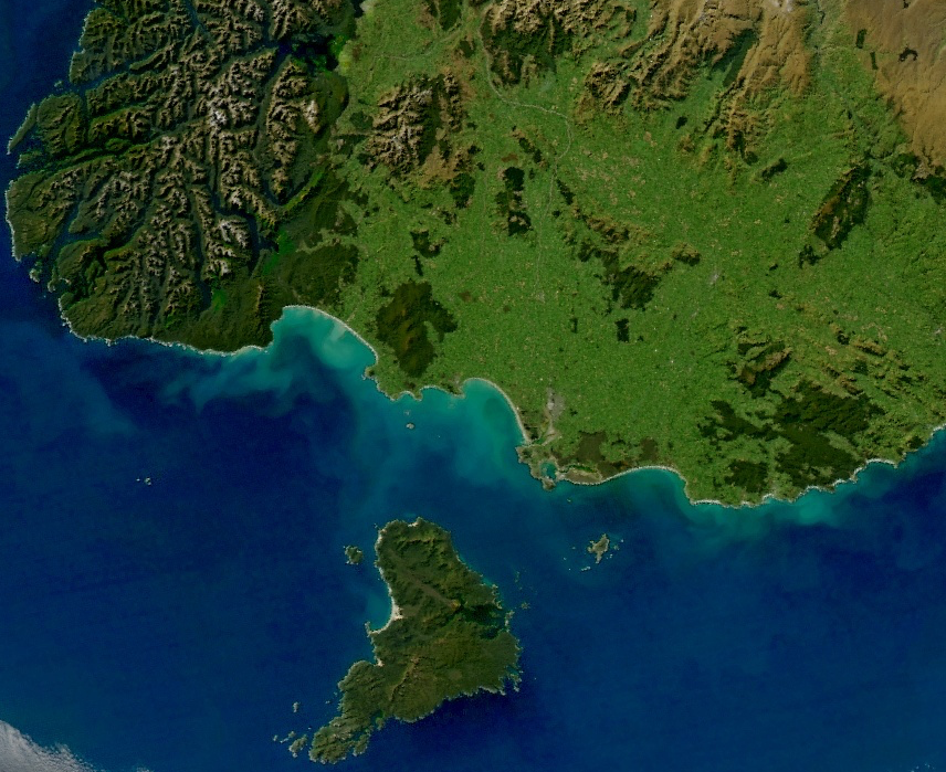
English: View of most of the Southland Region of New Zealand's South Island, including Stewart Island (separated from the mainland by Foveaux Strait) and the southern half of Fiordland National Park. The Southland Syncline, a geological fold line, can be seen stretching from the southeast coast (at The Catlins) northwestwards through the Hokonui Hills (centre).
Source=This file was derived from: Turbid Waters Surround New Zealand.jpg: Author=*Turbid_Waters_Surround_New_Zealand.jpg: Norman Kuring Permission=
|
||||
| Date | |||||
| Source |
|
||||
| Author | Aqua (satellite) MODIS |


Licensing
| Public domainPublic domainfalsefalse |
| This file is in the public domain in the United States because it was solely created by NASA. NASA copyright policy states that "NASA material is not protected by copyright unless noted". (See Template:PD-USGov, NASA copyright policy page or JPL Image Use Policy.) | ||
 |
Warnings:
|
Captions
Satellite image of most of New Zealand's Southland Region, including Stewart Island and southern Fiordland.
Items portrayed in this file
depicts
17 March 2019
File history
Click on a date/time to view the file as it appeared at that time.
| Date/Time | Thumbnail | Dimensions | User | Comment | |
|---|---|---|---|---|---|
| current | 13:00, 16 March 2019 | | 856 × 699 (1.15 MB) | Grutness | User created page with UploadWizard |
File usage
The following pages on the English Wikipedia use this file (pages on other projects are not listed):
Metadata
This file contains additional information, probably added from the digital camera or scanner used to create or digitize it.
If the file has been modified from its original state, some details may not fully reflect the modified file.
| Compression scheme | Uncompressed |
|---|---|
| Pixel composition | RGB |
Retrieved from "https://en.wikipedia.org/wiki/File:NZ-Southland-satellite.png"