File:Oceania_laea_relief_location_map.jpg
From Wikipedia, the free encyclopedia
Size of this preview: 699 × 600 pixels. Other resolutions: 280 × 240 pixels | 560 × 480 pixels | 895 × 768 pixels | 1,181 × 1,013 pixels.
Original file (1,181 × 1,013 pixels, file size: 1,022 KB, MIME type: image/jpeg)
| This is a file from the Wikimedia Commons. Information from its description page there is shown below. Commons is a freely licensed media file repository. You can help. |
Summary
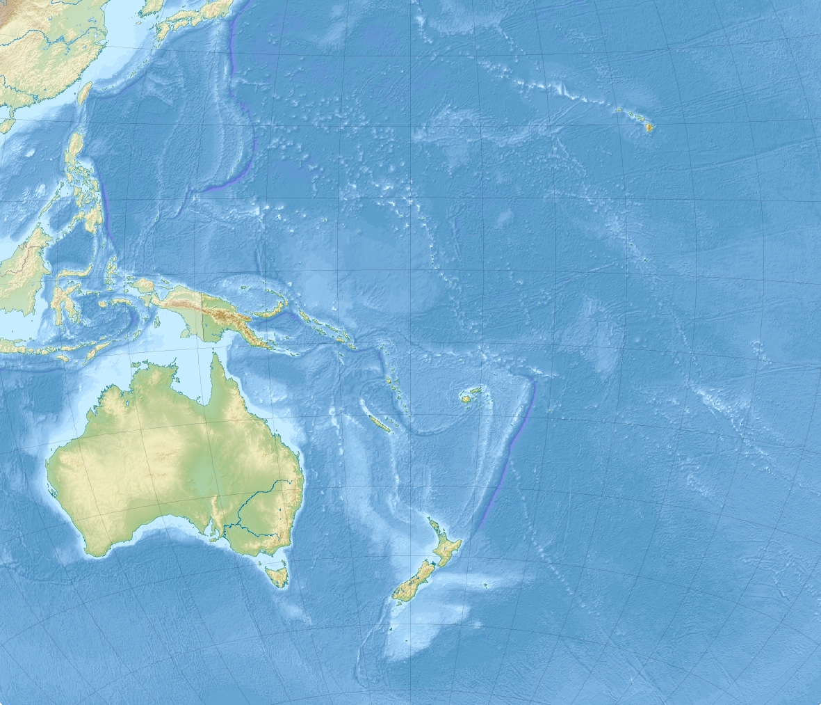
| DescriptionOceania laea relief location map.jpg |
English: Relief location map of Oceania.
|
| Date | |
| Source | Own work |
| Author | Uwe Dedering |
Licensing
I, the copyright holder of this work, hereby publish it under the following licenses:
This file is licensed under the Creative Commons Attribution-Share Alike 3.0 Unported license.
- You are free:
- to share – to copy, distribute and transmit the work
- to remix – to adapt the work
- Under the following conditions:
- attribution – You must give appropriate credit, provide a link to the license, and indicate if changes were made. You may do so in any reasonable manner, but not in any way that suggests the licensor endorses you or your use.
- share alike – If you remix, transform, or build upon the material, you must distribute your contributions under the same or compatible license as the original.

|
Permission is granted to copy, distribute and/or modify this document under the terms of the GNU Free Documentation License, Version 1.2 or any later version published by the Free Software Foundation; with no Invariant Sections, no Front-Cover Texts, and no Back-Cover Texts. A copy of the license is included in the section entitled GNU Free Documentation License.http://www.gnu.org/copyleft/fdl.htmlGFDLGNU Free Documentation Licensetruetrue |
You may select the license of your choice.
Captions
Oceania
Items portrayed in this file
depicts
some value
28 November 2010
File history
Click on a date/time to view the file as it appeared at that time.
| Date/Time | Thumbnail | Dimensions | User | Comment | |
|---|---|---|---|---|---|
| current | 14:03, 28 November 2010 | | 1,181 × 1,013 (1,022 KB) | Uwe Dedering | {{Information |Description={{en|1= Relief location map of Oceania. * Projection: Lambert azimuthal equal-area projection. * Area of interest: :* N: 35.0° N :* S: -55.0° N :* W: 110.0° E :* E: 230.0° E (This is -130° E) * Projection center: :* NS: -10 |
File usage
The following pages on the English Wikipedia use this file (pages on other projects are not listed):
- 1917 Samoa earthquake
- 1953 Suva earthquake
- 1977 Tonga earthquake
- 1993 Guam earthquake
- 1999 Ambrym earthquake
- 2002 Port Vila earthquake
- 2004 Tasman Sea earthquake
- 2006 Tonga earthquake
- 2007 Solomon Islands earthquake
- 2009 Samoa earthquake and tsunami
- 2009 Vanuatu earthquakes
- 2010 Solomon Islands earthquake
- 2013 Solomon Islands earthquake
- 2018 Fiji earthquakes
- 2021 Kermadec Islands earthquakes
- 2021 Loyalty Islands earthquake
- Auckland
- Ball's Pyramid
- Banc Capel
- Bonin Islands
- Canterbury Bight
- Cook Strait
- Fuaʻamotu International Airport
- Graveyard Seamounts
- Havre Seamount
- Hjort Trench
- Ikurangi
- List of highest points of Oceanian countries
- Lord Howe Island Airport
- Louisiade Plateau
- Macquarie Island
- Macquarie Island Station
- Milford Sound
- Monowai (seamount)
- Mont Mokoto
- Mont Orohena
- Mont Puke
- Mount Bates
- Mount Otemanu
- Mount Pahia
- New Caledonian barrier reef
- Perseverance Harbour
- Port Moresby
- Roi Mata
- Rose Atoll Marine National Monument
- Sissano Lagoon
- Taputapuatea
- Taputapuatea marae
- Te Manga
- Te Rua Manga
- Torres Strait
- Tupuangi Formation
- ʻAta
- User:Auric/Moresby Island, New Guinea
- User:Fraenir/AncientDNA
- User:Jarda2020/2022 Gisborne earthquake
- User:Ty654/List of earthquakes exceeding magnitude 8+
- User:Ty654/List of earthquakes from 1900-1949 exceeding magnitude 7+
- User:Ty654/List of earthquakes from 1910-1919 exceeding magnitude 6+
- User:Ty654/List of earthquakes from 1920-1929 exceeding magnitude 6+
- User:Ty654/List of earthquakes from 1930-1939 exceeding magnitude 6+
- User:Ty654/List of earthquakes from 1940-1949 exceeding magnitude 6+
- User:Ty654/List of earthquakes from 1950-1954 exceeding magnitude 6+
- User:Ty654/List of earthquakes from 1950-1999 exceeding magnitude 7+
- User:Ty654/List of earthquakes from 1955-1959 exceeding magnitude 6+
- User:Ty654/List of earthquakes from 1960-1964 exceeding magnitude 6+
- User:Ty654/List of earthquakes from 1965-1969 exceeding magnitude 6+
- User:Ty654/List of earthquakes from 1970-1974 exceeding magnitude 6+
- User:Ty654/List of earthquakes from 1975-1979 exceeding magnitude 6+
- User:Ty654/List of earthquakes from 1980-1984 exceeding magnitude 6+
- User:Ty654/List of earthquakes from 1985-1989 exceeding magnitude 6+
- User:Ty654/List of earthquakes from 1990-1994 exceeding magnitude 6+
- User:Ty654/List of earthquakes from 1995-1999 exceeding magnitude 6+
- User:Ty654/List of earthquakes from 2000-2004 exceeding magnitude 6+
- User:Ty654/List of earthquakes from 2000-present exceeding magnitude 7+
- User:Ty654/List of earthquakes from 2005-2009 exceeding magnitude 6+
- User:Ty654/List of earthquakes from 2010-2014 exceeding magnitude 6+
- User:Ty654/List of earthquakes from 2015-2019 exceeding magnitude 6+
- User:Usernameformeisthis/sandbox
- Template:Infobox body of water/testcases
- Module:Location map/data/Oceania
- Module:Location map/data/Oceania/doc
Global file usage
The following other wikis use this file:
- Usage on ar.wikipedia.org
- Usage on ast.wikipedia.org
- Usage on az.wikipedia.org
- Usage on ban.wikipedia.org
- Usage on bar.wikipedia.org
- Usage on ba.wikipedia.org
- Usage on be.wikipedia.org
- Usage on bg.wikipedia.org
View more global usage of this file.
Metadata
This file contains additional information, probably added from the digital camera or scanner used to create or digitize it.
If the file has been modified from its original state, some details may not fully reflect the modified file.
| _error | 0 |
|---|