Portal:Colorado
Wikipedia portal for content related to the U.S. State of Colorado / From Wikipedia, the free encyclopedia
Portal maintenance status: (May 2023)
|
Previous events: |
|---|
Colorado events
|
List of Featured articles |
|---|

The Colorado Portal


WikiProject Colorado
You need not be either an expert or a resident.
You only need an active interest in the Centennial State.
Request an article about a Colorado topic here or volunteer here.
Colorado Events
- Wikimedia US Mountain West Spring 2024 online meeting, Tuesday, May 14, 2024, 8:00-9:00 PM MDT
- Wikimedia US Mountain West Summer 2024 online meeting, Tuesday, August 13, 2024, 8:00-9:00 PM MDT
- Wikimedia US Mountain West Autumn 2024 online meeting, Tuesday, November 12, 2024, 8:00-9:00 PM MST
Colorado Facts
- Date admitted to Union: August 1, 1876 (38th State)
- Demonym: Coloradan
- Capital: Denver
- Elected state officers:
- Governor: Jared Polis (D) (2019–)
- Lieutenant Governor: Dianne Primavera (D) (2019–)
- Secretary of State: Jena Griswold (D) (2019–)
- Treasurer: Dave Young (D) (2019–)
- Attorney General: Phil Weiser (D) (2019–)
- Colorado General Assembly:
- Colorado Senate:
- D-23 R-12 (2023–2024}
- Colorado House of Representatives:
- D-46 R-19 (2023–2024}
- Colorado Senate:
- Colorado Supreme Court:
- Brian Boatright, Chief Justice (2021–)
- Monica Márquez (2010-)
- William Hood, III (2014–)
- Richard Gabriel (2015–)
- Melissa Hart (2017–)
- Carlos Samour, Jr (2018–)
- Maria Berkenkotter (2021–)
- U.S. Senators:
- Class 2. John Hickenlooper (D) (2021–)
- Class 3. Michael Bennet (D) (2009–)
- 1. Diana DeGette (D) (1997–)
- 2. Joe Neguse (D) (2019–)
- 3. Lauren Boebert (R) (2021–)
- 4. Ken Buck (R) (2015–)
- 5. Doug Lamborn (R) (2007–)
- 6. Jason Crow (D) (2019–)
- 7. Brittany Pettersen (D) (2023-)
- 8. Yadira Caraveo (D) (2023–)
- Total area: 104,094 square miles (269,602 km2) (eighth most extensive state)
- Highest elevation: Mount Elbert 14,440 feet (4,401.2 m) (third highest state)
- Mean elevation: 6,800 feet (2,070 m) (highest state)
- Lowest elevation: Arikaree River 3,317 feet (1,011 m) (highest state)
- Population (2020 census): 5,773,714 (21st most populous state)
- Population density: 55.47 per square mile (21.40 km−2) (39th most densely populated state)
- Number of counties: 64 counties (including two consolidated city and county governments)
- Number of municipalities: 273 municipalities, comprising 2 consolidated city and county governments, 73 cities, and 198 towns
- Time zone: MST=UTC−07, MDT=UTC−06
- USPS code: CO
- ISO 3166 code: US-CO
- Adjacent U.S. states: Wyoming, Nebraska, Kansas, Oklahoma, New Mexico, Arizona, Utah (tied for third most)
- State government website: Colorado.gov
- State tourism website: Colorado.com
State Symbols
| State flag: |  State seal: State seal:  |
| State motto: | NIL SINE NUMINE (Latin: Nothing without providence) |
| State nickname: | The Centennial State |
| State slogan: | Colorful Colorado |
| State amphibian: | Western Tiger Salamander (Ambystoma mavortium) |
| State bird: | Lark Bunting (Calamospiza melanocoryus Stejneger) |
| State cactus: | Claret Cup Cactus (Echinocereus triglochidiatus) |
| State fish: | Greenback Cutthroat Trout (Oncorhynchus clarki somias) |
| State flower: | Rocky Mountain Columbine (Aquilegia caerulea) |
| State grass: | Blue Grama (Bouteloua gracilis) |
| State insect: | Colorado Hairstreak Butterfly (Hypaurotis cysaluswas) |
| State mammal: | Rocky Mountain Bighorn Sheep (Ovis canadensis) |
| State pets: | Colorado shelter pets (Canis lupus familiaris & Felis catus) |
| State reptile: | Western Painted Turtle (Chrysemys picta bellii) |
| State tree: | Colorado Blue Spruce (Picea pungens) |
| State fossil: | Stegosaurus (Stegosaurus armatus) |
| State gemstone: | Aquamarine |
| State mineral: | Rhodochrosite |
| State rock: | Yule Marble |
| State soil: | Seitz soil |
| State folk dance: | Square Dance |
| State ship: | USS Colorado (SSN-788) |
| State songs: | Where the Columbines Grow & Rocky Mountain High |
| State sport: | Pack Burro Racing |
| State highway route marker: |  |
| State tartan: |  |
| Commemorative U.S. coin: | |
| Commemorative U.S. stamp: | 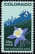 |
Subcategories

Featured article - show another 
Interstate 70 (I-70) is a transcontinental Interstate Highway in the United States, stretching from Cove Fort, Utah, to Baltimore, Maryland. In Colorado, the highway traverses an east–west route across the center of the state. In western Colorado, the highway connects the metropolitan areas of Grand Junction and Denver via a route through the Rocky Mountains. In eastern Colorado, the highway crosses the Great Plains, connecting Denver with metropolitan areas in Kansas and Missouri. Bicycles and other non-motorized vehicles, normally prohibited on Interstate Highways, are allowed on those stretches of I-70 in the Rockies where no other through route exists.
The United States Department of Transportation (USDOT) lists the construction of I-70 among the engineering marvels undertaken in the Interstate Highway System and cites four major accomplishments: the section through the Dakota Hogback, Eisenhower Tunnel, Vail Pass, and Glenwood Canyon. The Eisenhower Tunnel, with a maximum elevation of 11,158 feet (3,401 m) and length of 1.7 miles (2.7 km), is the longest mountain tunnel and highest point along the Interstate Highway System. The portion through Glenwood Canyon was completed on October 14, 1992. This was one of the final pieces of the Interstate Highway System to open to traffic and is one of the most expensive rural highways per mile built in the country. The Colorado Department of Transportation (CDOT) earned the 1993 Outstanding Civil Engineering Achievement Award from the American Society of Civil Engineers for the completion of I-70 through the canyon. (Full article...)Selected mountain - show another

Selected biography - show another
.jpg)
Gilpin served as the first governor of the Colorado Territory. His administration was consumed largely with the defense of the new territory in the early days of the American Civil War and was brought down after only one year by scandalous financial dealings. After the demise of his political career, he made a large fortune as a land speculator in New Mexico, although his dealings were questionable and possibly illegal. (Full article...)
Selected article - show another
State Highway 82 (SH 82) is an 85.3-mile-long (137.3 km) state highway in the U.S. state of Colorado. Its western half provides the principal transportation artery of the Roaring Fork Valley on the Colorado Western Slope, beginning at Interstate 70 (I-70) and U.S. Highway 6 (US 6) in Glenwood Springs southeast past Carbondale, Basalt and Aspen. From there it continues up the valley to cross the Continental Divide at Independence Pass. On the Eastern Slope, it follows Lake Creek past some of Colorado's highest mountains to Twin Lakes Reservoir, where it ends at US 24 south of Leadville.
At 12,095 feet (3,687 m) above sea level, the traverse of Independence Pass is the highest paved crossing of the Continental Divide in North America, and the highest paved through road on Colorado's state highway network. The pass is closed during the winter months, isolating Aspen from the east and making Highway 82 the only way to reach the popular ski resort town by road. A private foundation has worked with the Colorado Department of Transportation (CDOT), which maintains the road, to undo environmental damage to the alpine tundra created when a disused stagecoach route built across the pass during the Colorado Silver Boom of the 1880s became Highway 82 in the early 20th century. (Full article...)Selected image - show another

A painting by Albert Bierstadt, 1876
National Parks in Colorado

The 23 national parks in Colorado:
- Amache National Historic Site
- Arapaho National Recreation Area
- Bent's Old Fort National Historic Site
- Black Canyon of the Gunnison National Park
- Browns Canyon National Monument
- Camp Hale-Continental Divide National Monument
- Canyons of the Ancients National Monument
- Chimney Rock National Monument
- Colorado National Monument
- Continental Divide National Scenic Trail
- Curecanti National Recreation Area
- Dinosaur National Monument
- Florissant Fossil Beds National Monument
- Great Sand Dunes National Park and Preserve
- Hovenweep National Monument
- Mesa Verde National Park and World Heritage Site
- Old Spanish National Historic Trail
- Pony Express National Historic Trail
- Rocky Mountain National Park
- Sand Creek Massacre National Historic Site
- Santa Fe National Historic Trail
- Yucca House National Monument
Interesting facts- View different entries

- Las Animas County, Colorado's most extensive county, is more than 4.56 times the size of Rhode Island, 2.44 times the size of Delaware, and 98% the size of Connecticut.
- The Colorado Organic Act of 1861 defined Colorado as an ellipsoidal rectangle bound by the parallels 37°N and 41°N latitude and the meridians 25°W and 32°W longitude from the Washington Meridian.
- 160 years of subsequent government land surveys redefined the state boundaries as a ellipsoidal polygon of 697 sides.
- The southwestern corner monument of the Territory of Colorado later became the common boundary point of the U.S. states of Colorado, New Mexico, Arizona, and Utah known as the Four Corners.
- Colorado, Wyoming, and Utah are the only three U.S. states with no natural boundaries.
- Although Colorado and Wyoming have the same shape and both measure four degrees of latitude by seven degrees of longitude, Colorado is 6.42% more extensive than Wyoming because it lies closer to the equator.
- Gilpin County and Clear Creek County are the only two Colorado counties to retain their original 1861 boundaries.
- All 21 of the highest U.S. counties by mean elevation are in Colorado.
- Jefferson County borders ten other Colorado counties.
- The City and County of Denver and Delta County each border only three other Colorado counties.
- Twelve Colorado counties have the same name as their county seat.
- Nine Colorado counties have no incorporated municipalities other than their county seat.
Did you know (auto-generated) - load new batch

- ... that Aymara legislator Rafael Quispe's humorous style of political activism led one Bolivian parliamentarian to describe him as the "Chapulín Colorado" of the Legislative Assembly?
- ... that following the killing of Richard Ward by a Colorado sheriff's deputy, the deputy received an award for the injuries that he allegedly sustained during the incident?
- ... that Parkville lost out on becoming the Colorado Territory's capital by eleven votes and is now a ghost town largely buried under mining waste?
- ... that the 1976 Big Thompson River flood took place several hours before Colorado's 100th anniversary of statehood?
- ... that Charles Johnson received the most votes for student body president at the University of Colorado Boulder, even though he had already been disqualified from running?
- ... that "The Potato King of Colorado" survived a shipwreck, mined for gold in Australia, and helped establish an alcohol-free Methodist colony?
- ... that the No. 1–ranked 2023 Colorado Mines Orediggers, "college football's nerdiest contender", featured players with pigtails and a drawn-on blue mustache, a friar's haircut, and Harry Potter cosplay?
Related WikiProjects
Related portals
Resources
Associated Wikimedia
The following Wikimedia Foundation sister projects provide more on this subject:
-
 Commons
Free media repository -
 Wikibooks
Free textbooks and manuals -
 Wikidata
Free knowledge base -
 Wikinews
Free-content news -
 Wikiquote
Collection of quotations -
 Wikisource
Free-content library -
 Wikiversity
Free learning tools -
 Wikivoyage
Free travel guide -
 Wiktionary
Dictionary and thesaurus