File:ECOWAS_map.png
De Wikipedia, l'encyclopédie encyclopedia
Pas de plus haute résolution disponible.
ECOWAS_map.png (360 × 392 pixels, taille du fichier : 10 kio, type MIME : image/png)
Ce fichier et sa description proviennent de Wikimedia Commons.
| DescriptionECOWAS map.png |
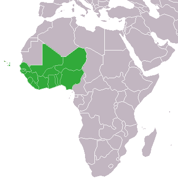
English: Map of African, with African Union member states in dark green and states with suspended membership in light green |
| Date | (UTC) |
| Source | |
| Auteur |
Original téléversé par Theunixgeek sur Wikipédia anglais.
|


Moi, en tant que détenteur des droits d’auteur sur cette œuvre, je la publie sous la licence suivante :
Ce fichier est disponible selon les termes de la licence Creative Commons Attribution – Partage dans les Mêmes Conditions 3.0 (non transposée).
- Vous êtes libre :
- de partager – de copier, distribuer et transmettre cette œuvre
- d’adapter – de modifier cette œuvre
- Sous les conditions suivantes :
- paternité – Vous devez donner les informations appropriées concernant l'auteur, fournir un lien vers la licence et indiquer si des modifications ont été faites. Vous pouvez faire cela par tout moyen raisonnable, mais en aucune façon suggérant que l’auteur vous soutient ou approuve l’utilisation que vous en faites.
- partage à l’identique – Si vous modifiez, transformez, ou vous basez sur cette œuvre, vous devez distribuer votre contribution sous la même licence ou une licence compatible avec celle de l’original.
Journal des téléversements d’origine
This image is a derivative work of the following images:
- File:Map_of_the_African_Union_with_Suspended_States.svg licensed with Cc-by-sa-3.0
- 2010-03-29T19:33:05Z Roxanna 1000x1000 (128410 Bytes) Reverted to version as of 07:36, 19 February 2010
- 2010-03-29T19:25:59Z Roxanna 500x500 (50468 Bytes) ... but I think Mauritania is still suspended
- 2010-03-29T19:21:17Z Roxanna 500x500 (64647 Bytes) Officially Eritrea seems not yet to be outside of the AU...
- 2010-02-19T07:36:33Z Tomeasy 1000x1000 (128410 Bytes) Changed status of Eritrea from "suspended" to outside of the African Union due to withdrawal of this country.
- 2009-11-21T14:09:51Z Rotsee 1000x1000 (203340 Bytes) {{Information |Description={{en|Map of the African Union with Suspended States in Light Green}} |Source=Transferred from [http://en.wikipedia.org en.wikipedia] (Original text : ''Based on information in the [[:en:African Unio
Téléversé avec derivativeFX
Légendes
Ajoutez en une ligne la description de ce que représente ce fichier
Éléments décrits dans ce fichier
dépeint
15 octobre 2010
image/png
Historique du fichier
Cliquer sur une date et heure pour voir le fichier tel qu'il était à ce moment-là.
| Date et heure | Vignette | Dimensions | Utilisateur | Commentaire | |
|---|---|---|---|---|---|
| actuel | 23 mars 2020 à 04:40 | | 360 × 392 (10 kio) | Uglemat | Morocco not a member |
| 22 octobre 2017 à 18:56 |  | 360 × 392 (8 kio) | Casabus | + Morocco | |
| 27 octobre 2012 à 04:21 |  | 360 × 392 (10 kio) | GeoMauri | Update | |
| 9 juillet 2011 à 17:28 |  | 360 × 392 (14 kio) | Maphobbyist | Check | |
| 9 juillet 2011 à 17:22 |  | 360 × 392 (15 kio) | Maphobbyist | South Sudan has become independent on July 9, 2011. Sudan and South Sudan are shown with the new international border between them. | |
| 31 janvier 2011 à 04:55 |  | 360 × 392 (15 kio) | Scottbp | Guinea readmitted. | |
| 14 décembre 2010 à 01:30 |  | 360 × 392 (10 kio) | Helmandsare | Removed Mauritania. | |
| 9 décembre 2010 à 08:49 |  | 360 × 392 (10 kio) | Helmandsare | Reclassified Côte d'Ivoire as a suspended member. | |
| 16 octobre 2010 à 00:58 |  | 360 × 392 (10 kio) | Helmandsare | {{Information |Description={{en|Map of African, with African Union member states in dark green and states with suspended membership in light green}} |Source=*File:Map_of_the_African_Union_with_Suspended_States.svg |Date=2010-10-15 22:57 (UTC) |Autho |
Utilisation du fichier
Aucune page n’utilise ce fichier.
Usage global du fichier
Les autres wikis suivants utilisent ce fichier :
- Utilisation sur de.wikipedia.org
Métadonnées
Ce fichier contient des informations supplémentaires, probablement ajoutées par l'appareil photo numérique ou le numériseur utilisé pour le créer.
Si le fichier a été modifié depuis son état original, certains détails peuvent ne pas refléter entièrement l'image modifiée.
| Résolution horizontale | 37,79 pt/cm |
|---|---|
| Résolution verticale | 37,79 pt/cm |
Ce document provient de « https://fr.wikipedia.org/wiki/Fichier:ECOWAS_map.png ».