File:Location_Portugal_EU_Europe.png
De Wikipedia, l'encyclopédie encyclopedia
Taille de cet aperçu : 714 × 600 pixels. Autres résolutions : 286 × 240 pixels | 572 × 480 pixels | 915 × 768 pixels | 1 219 × 1 024 pixels | 2 048 × 1 720 pixels.
Fichier d’origine (2 048 × 1 720 pixels, taille du fichier : 239 kio, type MIME : image/png)
Ce fichier et sa description proviennent de Wikimedia Commons.


Description
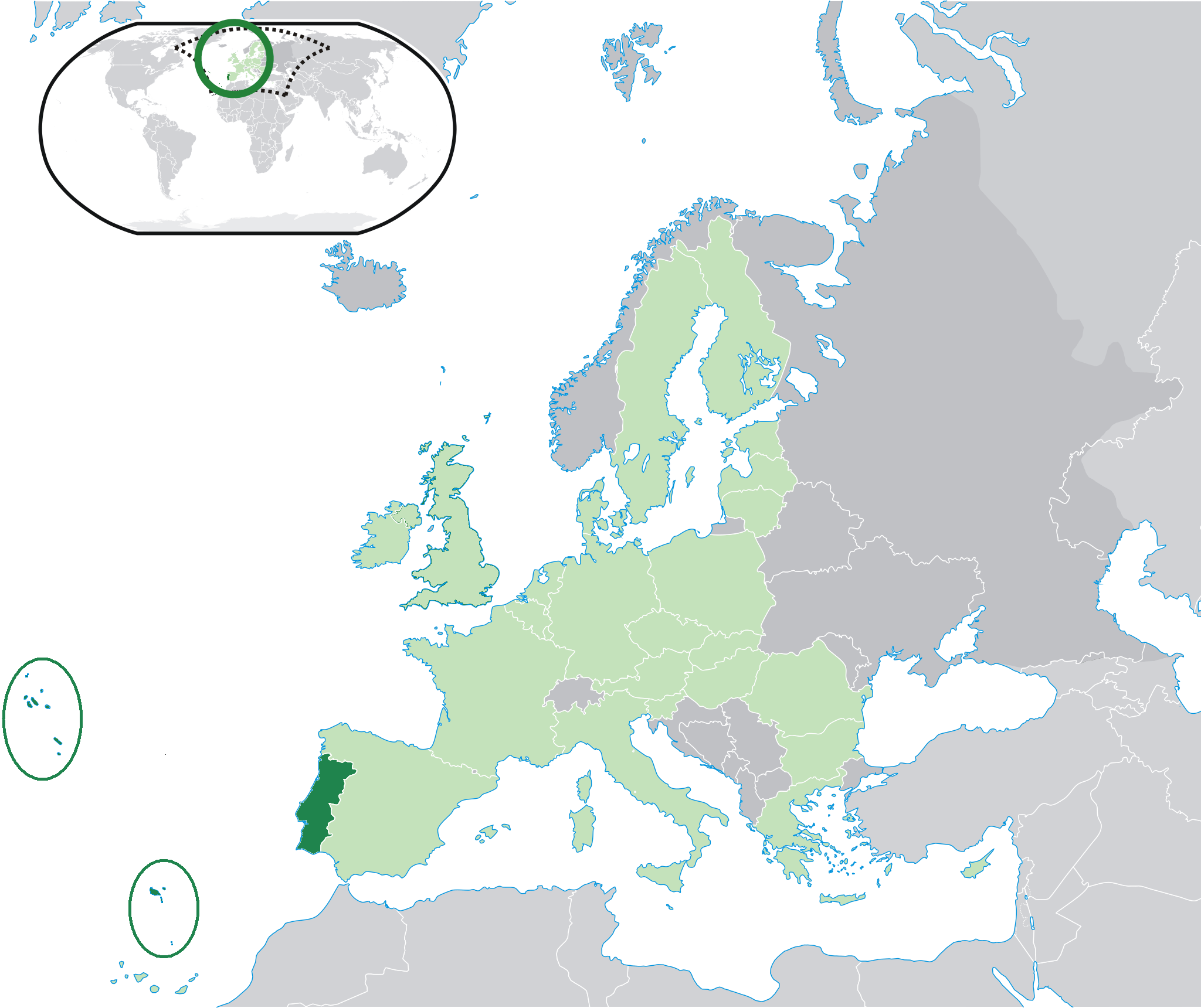
| DescriptionLocation Portugal EU Europe.png | Location map: Portugal (dark green) / European Union (light green) / Europe (dark grey); inspired by and consistent with general country locator maps by User:Vardion, et al. |
| Date | |
| Source | Travail personnel |
| Auteur | Quizimodo |
| Autres versions |
|


Conditions d’utilisation
| Public domainPublic domainfalsefalse |
| Cette œuvre a été placée dans le domaine public par son auteur, I, Quizimodo. Ceci s’applique dans le monde entier. Dans certains pays, ceci peut ne pas être possible ; dans ce cas : I, Quizimodo accorde à toute personne le droit d’utiliser cette œuvre dans n’importe quel but, sans aucune condition, sauf celles requises par la loi. |
Légendes
Ajoutez en une ligne la description de ce que représente ce fichier
Éléments décrits dans ce fichier
dépeint
Valeur sans élément de Wikidata
17 juin 2007
Historique du fichier
Cliquer sur une date et heure pour voir le fichier tel qu'il était à ce moment-là.
| Date et heure | Vignette | Dimensions | Utilisateur | Commentaire | |
|---|---|---|---|---|---|
| actuel | 26 juillet 2009 à 21:47 | | 2 048 × 1 720 (239 kio) | The Ogre | Small correction |
| 24 juillet 2009 à 16:37 |  | 2 048 × 1 720 (241 kio) | The Ogre | Still better visivility of islans (in agreement with the fact that the Savage islands ar a part of the Madeira archipelago) | |
| 24 juillet 2009 à 16:30 |  | 2 048 × 1 720 (241 kio) | The Ogre | Better visibility of islands in the Atlantic | |
| 24 juillet 2009 à 16:13 |  | 2 048 × 1 720 (240 kio) | The Ogre | Small corrections - included the islands of Corvo and Flores in the Azores, and the Desertas and Savage islands in Madeira. | |
| 18 juin 2007 à 03:06 |  | 2 056 × 1 710 (176 kio) | Quizimodo~commonswiki | image (updated) | |
| 17 juin 2007 à 12:13 |  | 2 056 × 1 710 (227 kio) | Quizimodo~commonswiki | image (tweaked) | |
| 17 juin 2007 à 12:06 |  | 2 056 × 1 710 (227 kio) | Quizimodo~commonswiki | image (tweaked) | |
| 17 juin 2007 à 09:53 |  | 2 056 × 1 710 (227 kio) | Quizimodo~commonswiki | image (tweaked) | |
| 17 juin 2007 à 09:18 |  | 2 056 × 1 710 (223 kio) | Quizimodo~commonswiki | image (tweaked) | |
| 17 juin 2007 à 08:45 |  | 2 056 × 1 710 (227 kio) | Quizimodo~commonswiki | {{Information |Description=Location map: Portugal (dark green) / European Union (light green) / Europe (dark grey); inspired by and consistent with general country locator maps by User:Vardion, et al |Source=self-made |Date= |Author= [[User:Quizimodo|Quiz |
Utilisation du fichier
La page suivante utilise ce fichier :
Usage global du fichier
Les autres wikis suivants utilisent ce fichier :
- Utilisation sur bcl.wikipedia.org
- Utilisation sur ceb.wikipedia.org
- Utilisation sur de.wikinews.org
- Utilisation sur dv.wikipedia.org
- Utilisation sur dz.wikipedia.org
- Utilisation sur es.wikipedia.org
- Utilisation sur es.wikiquote.org
- Utilisation sur eu.wiktionary.org
- Utilisation sur gag.wikipedia.org
- Utilisation sur got.wikipedia.org
- Utilisation sur gu.wikipedia.org
- Utilisation sur ka.wikipedia.org
- Utilisation sur kn.wikipedia.org
- Utilisation sur ku.wiktionary.org
- Utilisation sur no.wikipedia.org
- Utilisation sur pl.wiktionary.org
- Utilisation sur pt.wikinews.org
- Utilisation sur ro.wikipedia.org
- Utilisation sur ro.wikibooks.org
- Utilisation sur te.wikipedia.org
- Utilisation sur ug.wikipedia.org
- Utilisation sur zh-classical.wikipedia.org
Ce document provient de « https://fr.wikipedia.org/wiki/Fichier:Location_Portugal_EU_Europe.png ».