Attēls:Map_of_Sealand.png
From Wikipedia, the free encyclopedia
Sākotnējais fails (1 024 × 1 047 pikseļi, faila izmērs: 36 KB, MIME tips: image/png)
| Šis fails ir no Vikikrātuves. Tā apraksts no attēla lapas Vikikrātuvē ir parādīts zemāk. Vikikrātuve ir brīvi licencēta failu krātuve. Tu vari tai palīdzēt. |
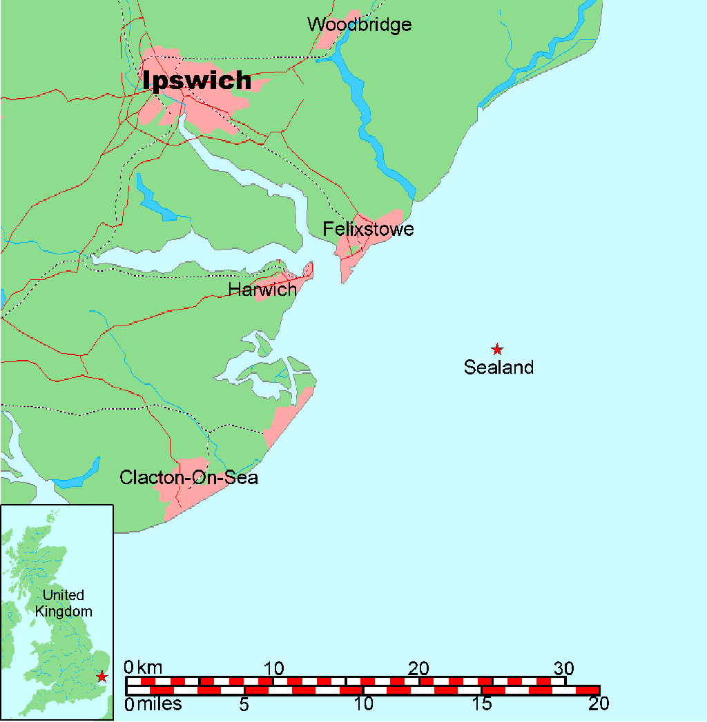
Map of Sealand
This is a map of the coast of England near Ipswich, showing the location of Sealand. See also Image:Map of Sealand with territorial waters.png for a map including the boundaries of the territorial waters of the United Kingdom.
- A vector graphic file for the map without the territorial waters can be found at Image:Map of Sealand with territorial waters.svg
- A PNG graphic file for the map without the territorial waters can be found at Image:Map of Sealand with territorial waters.png
- The OpenOffice.org source file can be found at Image:Map of Sealand with territorial waters.sxd
Map generated by DEMIS World Map Server[dead link] and edited by Chris 73
| Licensing:
This image was created by Chris 73. The image is licensed under a dual license; please choose either of the two licenses below as desired. Attribution to Wikipedia or another project of the Wikimedia foundation is required for both licenses if the image is used outside of projects of the Wikimedia foundation. Attribution to me is not required.
Šis fails tiek izplatīts saskaņā ar licences Creative Commons Atsauce-Līdzīgi Noteikumi 3.0 Vispārējiem noteikumiem. Atsauce: Chris 73 / Wikimedia Commons
"I want to use the image. How do I do that?" You can use this image freely for any purpose, including commercial use, provided that you license it under one of the above licenses. My suggestion is to use the following text:
For privacy reasons please use only "Chris 73" as author. If necessary, please translate the text in your language. For electronic use please include the links in the text as shown, for printed use please print the text as shown. If you use the image I would appreciate it if you would let me know on my talk page, but this is not required as long as you follow one of the above licenses. |

Captions
Šajā failā attēlotais
attēlo
image/png
checksum angļu
34f3ef2f462502262b691755e68610a453275942
data size angļu
37 294 Baits
1 047 pikselis
1 024 pikselis
Faila hronoloģija
Uzklikšķini uz datums/laiks kolonnā esošās saites, lai apskatītos, kā šis fails izskatījās tad.
| Datums/Laiks | Attēls | Izmēri | Dalībnieks | Komentārs | |
|---|---|---|---|---|---|
| tagadējais | 2005. gada 26. janvāris, plkst. 13.00 | | 1 024 × 1 047 (36 KB) | Chris 73 | |
| 2005. gada 26. janvāris, plkst. 12.28 |  | 1 024 × 1 048 (36 KB) | Chris 73 | changed scale and also stretched a bit | |
| 2005. gada 26. janvāris, plkst. 08.24 |  | 998 × 733 (32 KB) | Chris 73 | Map of Sealand |
Faila lietojums
Šo failu izmanto šajā 1 lapā:
Globālais faila lietojums
Šīs Vikipēdijas izmanto šo failu:
- Izmantojums be-tarask.wikipedia.org
- Izmantojums bg.wikipedia.org
- Izmantojums ca.wikipedia.org
- Izmantojums cy.wikipedia.org
- Izmantojums da.wikipedia.org
- Izmantojums et.wikipedia.org
- Izmantojums gl.wikipedia.org
- Izmantojums is.wikipedia.org
- Izmantojums it.wikipedia.org
- Izmantojums ja.wikivoyage.org
- Izmantojums ms.wikipedia.org
- Izmantojums nn.wikipedia.org
- Izmantojums no.wikipedia.org
- Izmantojums scn.wikipedia.org
- Izmantojums sv.wikipedia.org
- Izmantojums uk.wikipedia.org
- Izmantojums www.wikidata.org