File:Juniperus_communis_range_map.gif
維基百科,自由的 encyclopedia
此为最大尺寸。
Juniperus_communis_range_map.gif (664 × 580像素,文件大小:19 KB,MIME类型:image/gif)
摘要
| 描述Juniperus communis range map.gif |
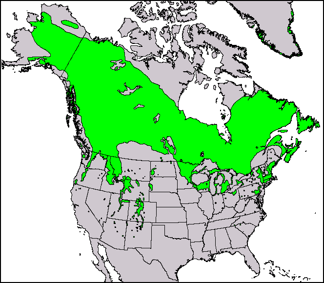
English: This North American range map of Juniperus communis, the common juniper, was published in a USGS publication: Conifers. Climate-Vegetation Atlas of North America. USGS. Retrieved on 2007-11-11. Maps and ArcView shapefiles can also be downloaded here: Little, Jr., Elbert L. Atlas. USGS. Archived from the original on 2007-07-17. Retrieved on 2007-11-11. |
||||
| 日期 | |||||
| 来源 | Thompson, Robert S.; Katherine H. Anderson and Patrick J. Bartlein (1999年) 《 Atlas of Relations Between Climatic Parameters and Distributions of Important Trees and Shrubs in North America》、U.S. Geological Survey (Professional Paper 1650 A&B) | ||||
| 作者 | Robert S. Thompson, Katherine H. Anderson, and Patrick J. Bartlein | ||||
| 授权 (二次使用本文件) |
|
||||
| 其他版本 |
This and other maps were originally produced by Elbert L. Little, Jr. of the U.S. Department of Agriculture's Forest Service.  |
| Page | Caption |
|---|---|
| Species distribution | A species range map represents the region where individuals of a species can be found. This is the North American range map of Juniperus communis, the common juniper. |
许可协议
原始上传日志
原始描述頁面位於這裡。下列使用者名稱均來自en.wikipedia。
| 日期/时间 | 大小 | 用户 | 备注 |
|---|---|---|---|
| 2010-12-29 14:39:43 | 664 × 580 | Threelovemonkeys | {{Information |Description = This is a species range map of Juniperus communis, published in a USGS publication. |Source = Robert S. Thompson, Katherine H. Anderson and Patrick J. Bartlein. 1999. Atlas of Relations Between Climatic Parameters |
说明
添加一行文字以描述该文件所表现的内容
此文件中描述的项目
描繪內容
1999
文件历史
点击某个日期/时间查看对应时刻的文件。
| 日期/时间 | 缩略图 | 大小 | 用户 | 备注 | |
|---|---|---|---|---|---|
| 当前 | 2017年4月11日 (二) 01:25 | | 664 × 580(19 KB) | FastilyClone | Transferred from en.wikipedia (MTC!) |
文件用途
以下页面使用本文件:
全域文件用途
以下其他wiki使用此文件:
- en.wikipedia.org上的用途
- fa.wikipedia.org上的用途
- uk.wikipedia.org上的用途
- vi.wikipedia.org上的用途