Payl:New_York_Locator_Map_with_US.PNG
From Wikipedia, the free encyclopedia
Walay mas taas nga resolusyon.
New_York_Locator_Map_with_US.PNG (425 × 330 pixels, size sa payl: 20 KB, MIME type: image/png)
Kining maong payl gikan sa Wikimedia Commons ug mahimong gigamit sa ubang proyekto. Ang deskripsyon niini didto gipakita sa ubos.
Mubong sugid:

|
This locator map image could be re-created using vector graphics as an SVG file. This has several advantages; see Commons:Media for cleanup for more information. If an SVG form of this image is available, please upload it and afterwards replace this template with
{{vector version available|new image name}}.
It is recommended to name the SVG file “New York Locator Map with US.svg”—then the template Vector version available (or Vva) does not need the new image name parameter. |
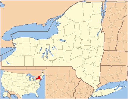
| DeskripsyonNew York Locator Map with US.PNG | Locator Map of New York, United States |
| Petsa | |
| Gigikanan | taken from US Census website [1] and modified by User:Ruhrfisch, User:Huebi, and User:Appraiser |
| Tagsulat | US Census, User:Ruhrfisch, User:Huebi, and User:Appraiser |
| Pagtugot (Paggamit pag-usab niini nga file) |
US Census / US Government work is public domain, my modifications licensed under the GNU Free Documentation License |
Pagtugot

|
Gitugot ang pagkopya, pag-apud-apod o/ug pag-usab ning maong dokumento ubos sa mga termino sa GNU Free Documentation License, Version 1.2 o mas bag-ong bersiyon nga gimantala sa Free Software Foundation; nga walay Invariant Sections, walay Front-Cover Texts, ug walay Back-Cover Texts. Ang kopya sa lisensiya gilakip sa bahin nga giulohang GNU Free Documentation License.http://www.gnu.org/copyleft/fdl.htmlGFDLGNU Free Documentation Licensetruetrue |
| This file is licensed under the Creative Commons Attribution-Share Alike 3.0 Unported license. | ||
| Attribution: We, Ruhrfisch and Appraiser | ||
| ||
| This licensing tag was added to this file as part of the GFDL licensing update.http://creativecommons.org/licenses/by-sa/3.0/CC BY-SA 3.0Creative Commons Attribution-Share Alike 3.0truetrue |
This file is licensed under the Creative Commons Attribution-Share Alike 2.5 Generic license.
- Libre ka:
- sa pagsabwag – sa pagkopya, pag-apod-apod ug pagsabwag sa hinimo
- sa pag-remix – sa pag-adap sa binuhat
- Ubos sa mosunod nga mga kondisyon:
- atribusyon – Kinahanglan nimo nga hatagan ang angay nga kredito, maghatag usa ka link sa lisensya, ug ipakita kung adunay mga pagbag-o. Mahimo nimo kini buhaton sa bisan unsang makatarunganon nga paagi, apan dili sa bisan unsang paagi nga nagsugyot nga gi-endorso ka sa licensor o ang imong paggamit.
- share parehas – Kung imong gi-remix, gibag-o, o gibase sa materyal, kinahanglan nimo nga iapod-apod ang imong mga kontribusyon sa ilawom sa parehas o katugma nga lisensya sama sa orihinal.
You may select the license of your choice.
and
| Public domainPublic domainfalsefalse |
This image or file is a work of a United States Census Bureau employee, taken or made as part of that person's official duties. As a work of the U.S. federal government, the image is in the public domain.
English ∙ español ∙ 日本語 ∙ македонски ∙ മലയാളം ∙ português do Brasil ∙ русский ∙ українська ∙ עברית ∙ +/− |
 |
made by kasey klase
Captions
Add a one-line explanation of what this file represents
Items portrayed in this file
depicts English
copyright status English
copyrighted English
Kaagi sa payl
I-klik ang petsa/oras aron makit-an ang hulagway sa payl niadtong panahona.
| Petsa/Takna | Thumbnail | Mga dimensyon | Tiggamit | Komento | |
|---|---|---|---|---|---|
| kasamtangan | 05:50, 26 Hunyo 2013 | | 425 × 330 (20 KB) | Zyxw | Same width & height as File:New York Locator Map.PNG for use with mapping templates. Inset is File:Map of USA NY.svg. Smaller file size. |
| 15:35, 14 Marso 2008 |  | 429 × 334 (27 KB) | Appraiser | {{Information| |Description= Locator Map of New York, United States |Source= taken from US Census website [http://factfinder.census.gov/] and modified by User:Ruhrfisch, User:Huebi, and User:Appraiser |Date= March 2008 |Author= US Census, [[U |
Mga paggamit sa payl
Ang mosunod nga 2 panid misumpay niining payl:
Global nga paggamit sa payl
Kining ubang wiki naggamit ning maong payl:
- Paggamit sa ar.wikipedia.org
- Paggamit sa azb.wikipedia.org
- Paggamit sa be-tarask.wikipedia.org
- Paggamit sa bs.wikipedia.org
- Paggamit sa ca.wikipedia.org
- Paggamit sa cy.wikipedia.org
- Paggamit sa de.wikipedia.org
- Paggamit sa en.wikipedia.org
- Fleischmanns, New York
- Margaretville, New York
- Andover, New York
- Angelica, New York
- Lisle, New York
- Ellicottville, New York
- Little Valley, New York
- Big Flats, New York
- Horseheads, New York
- Andes, New York
- Delhi, New York
- Franklin, Delaware County, New York
- Fishkill, New York
- Mayfield, New York
- Lowville, New York
- Leicester, New York
- Lima, New York
- Livonia, New York
- Cherry Valley, New York
- Lodi, New York
- Edwards, New York
- Hermon, New York
- Avoca, New York
- Candor, New York
- Castile, New York
- West Valley Demonstration Project
- Cuylerville, New York
- West Valley, New York
- Camp Unirondack
View more global usage of this file.
Gikuha gikan sa "https://ceb.wikipedia.org/wiki/Payl:New_York_Locator_Map_with_US.PNG"