Shrikhandi Bhittha
Village in Bihar, India From Wikipedia, the free encyclopedia
Shrikhandi Bhittha or Bhitthamore is an Indian village in the Mithila region of Bihar, situated near the Indo-Nepal border, on the banks of the perennial Ratnawati (Raato) river.[1][2][3]
Bhitthamore | |
|---|---|
Village | |
| Shrikhandi Bhittha | |
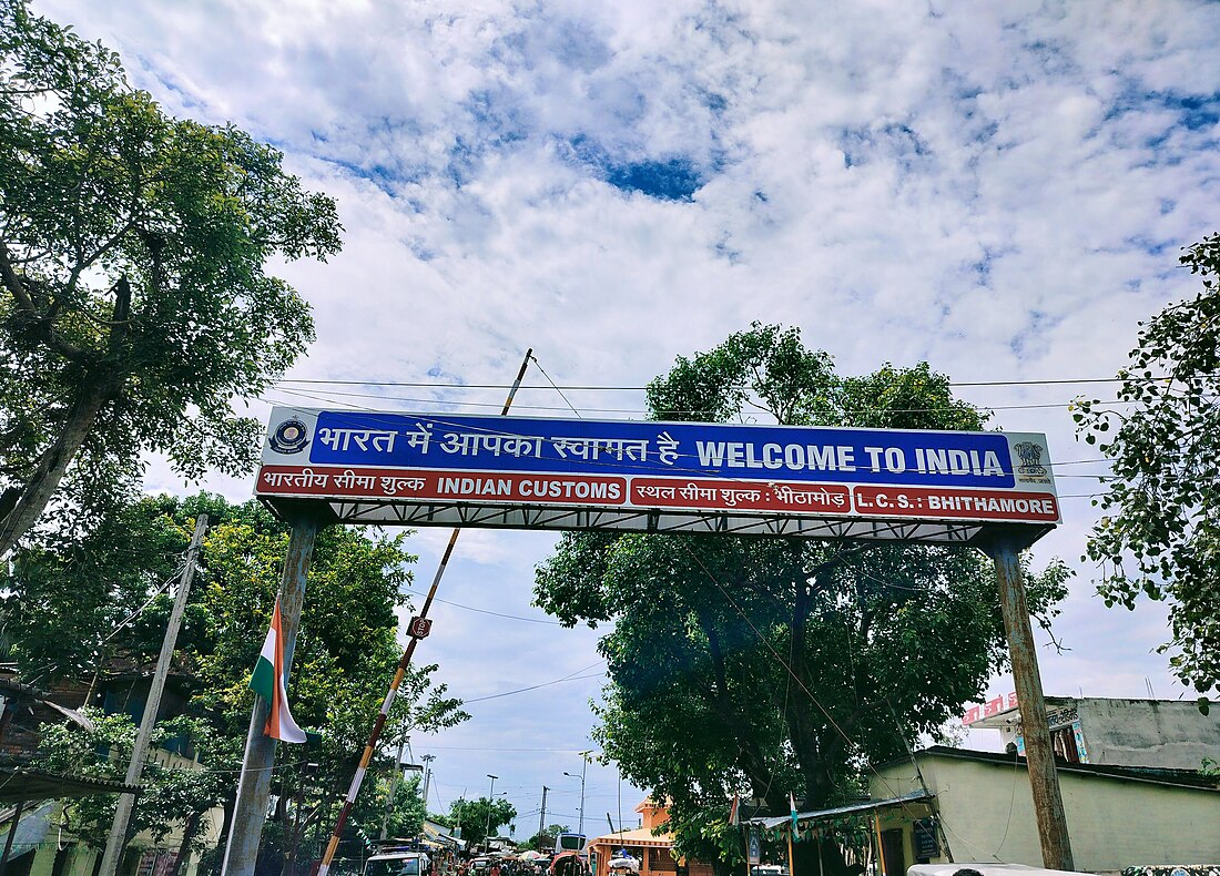
Indian Customs Bhitthamore , Maa Bhagwati Mandir | |
| Coordinates: 26°37′46″N 85°46′11″E | |
| Country | |
| State | Bihar |
| District | Sitamarhi |
| Block | Sursand |
| Gram Panchayat | Shrikhandi Bhittha Purvi |
| Police Station | Bhittha |
| Government | |
| • Body | Gram panchayat |
| Elevation | 64 m (210 ft) |
| Population (2011) | |
| • Total | 23,795 |
| Language | |
| • Official | Maithili, Hindi |
| Time zone | UTC+5:30 |
| PIN | 843331 |
| Telephone Code | 06228 |
| Vehicle registration | BR-30 |
Geography
The village has a border checkpoint at the crossing to Malibara, Jaleshwar, Nepal. Bhitthamore is about 30 kilometres east of its district headquarters, Sitamarhi. National Highway 227 passes through Bhitthamore. Thus it is a gateway to Janakpur, Nepal and parts of Sitamarhi & Madhubani along the border side.[1][4]
Festivals
The major festival of this area is Chhath Puja in which people offer prayers to Lord Sun. Holi, Diwali, Dussehra, Makar Sankranti, and Eid al-Fitr are also celebrated.[5]
Education
This is the educational hub of the area. There are many private as well as government-run schools.
- Rajkiya Madhya Vidyalaya Shrikhandi Bhittha
- Upgraded High School Bhittha Bazaar
- Middle School "Kanya"
- High School Shrikhandi Bhittha, Bhitthamore [6]
- Saraswati Shishu Mandir
- Delhi Public School
- Top Infant Public School
- Muskan Public School
- Indian Public School
Economy
It is a developing urban area with a primarily agricultural economy. over the past few years it has shown steady economic growth, this is mainly due to the international border, modernization, changing lifestyles and technical advancement in various fields.[1]
Due to its growing economy, growing demand, improved connectivity & infrastructure, it has become a known centre for trade & commerce.[7]
The village contains a market place named Bhitthamore.[8]
Transportation
Regular bus services are available to various locations in Bihar, with connections to other locations throughout the region. The nearest Nepali airport is 18 kilometres (11 mi) away, at Janakpur; in India, the nearest airport is Darbhanga Airport, 76 kilometres (47 mi) away.[9][10]
The Sitamarhi-Bhitthamore Road is important for religious reasons as it connects Janakpur, which houses a 200-year-old Janki Temple with Sitamarhi—considered to be the birthplace of Goddess Sita.[9]

National Highway 227 (Old NH-104) passes through Bhitthamore. Thus it is a gateway to Janakpur, Nepal and parts of Sitamarhi & Madhubani along the border side.[11] This road keeps on making headlines of news due to the floods & international border sharing with Nepal.[12]
Health
Although Shrikhandi Bhittha Primary Health Center (Hindi: प्राथमिक स्वास्थ्य केन्द्र, श्रीखंडी भिट्ठा) is available , still there is plenty of room to develop a Hospital as people bound to travel Sitamarhi for any emergency situation.[13]
Bhithamore Land Port
Land Port Bhithamore is located in the Sitamarhi district of Bihar along the international border between India and Nepal.[14][15]
Landmark
Maa Bhagwati sthal (Hindi: मां भगवती स्थल)
Krishneshwar Nath Mahadev Mandir (कृष्णेस्वर नाथ महादेव मंदिर)
Mahavir sthan (Hindi: महावीर स्थान)
Shalhesh sthan (Hindi: शलहेस स्थान)
Raato Bridge (Hindi: रातो पुल)
Pani Tanki (Hindi: पानी टंकी)

References
External links
Wikiwand in your browser!
Seamless Wikipedia browsing. On steroids.
Every time you click a link to Wikipedia, Wiktionary or Wikiquote in your browser's search results, it will show the modern Wikiwand interface.
Wikiwand extension is a five stars, simple, with minimum permission required to keep your browsing private, safe and transparent.


