Binntal
From Wikipedia, the free encyclopedia
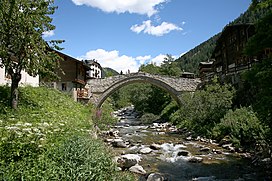
The Binn Valley (German: Binntal) is a valley of the Alps, located on the north side of the Lepontine Alps in the Swiss canton of Valais. The valley is drained by the Binna, a tributary of the Rhone, at Grengiols. The valley is named after Binn (1,400 m), the main settlement. Other villages or localities are Ausserbinn (1,291 m), Heiligkreuz (1,458 m) and Fäld (1,547 m).
| Binn Valley | |
|---|---|
 The Binna at Binn | |
| Naming | |
| Native name | Binntal (German) |
| Geography | |
| Country | |
| Canton | |
| Coordinates | 46°22′00″N 8°11′30″E |
This article includes a list of references, related reading, or external links, but its sources remain unclear because it lacks inline citations. (May 2023) |
The mountains in the Binntal generally exceed 3,000 metres. The highest are the Helsenhorn, the Turbhorn and the Ofenhorn. On the upper east side of the valley, the Albrun Pass connects it with the Italian Valle Devero.
See also
References
- Swisstopo maps
External links
- Nature park Binntal valais.ch
Wikiwand in your browser!
Seamless Wikipedia browsing. On steroids.
Every time you click a link to Wikipedia, Wiktionary or Wikiquote in your browser's search results, it will show the modern Wikiwand interface.
Wikiwand extension is a five stars, simple, with minimum permission required to keep your browsing private, safe and transparent.
