Christchurch
City in Canterbury, New Zealand / From Wikipedia, the free encyclopedia
Dear Wikiwand AI, let's keep it short by simply answering these key questions:
Can you list the top facts and stats about Christchurch?
Summarize this article for a 10 year old
Christchurch (/ˈkraɪstʃɜːrtʃ/; Māori: Ōtautahi) is the largest city in the South Island of New Zealand and the seat of the Canterbury Region. Christchurch lies on the South Island's east coast, just north of Banks Peninsula on Pegasus Bay. The Avon River (Ōtākaro) flows through the centre of the city, with an urban park along its banks.
Christchurch
| |
|---|---|
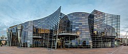
Clockwise from top: City skyline, Christchurch Central City, Sumner Beach, Christchurch Art Gallery, aerial view of Hagley Park, New Regent Street | |
|
| |
| Nickname: The Garden City | |
| Motto(s): | |
| Coordinates: 43°32′S 172°37′E | |
| Country | New Zealand |
| Island | South Island |
| Region | Canterbury |
| Communities |
|
| Wards |
|
| Settled by the UK | 1848 |
| Named for | Christ Church, Oxford |
| NZ Parliament | Banks Peninsula Christchurch Central Christchurch East Ilam Selwyn Waimakariri Wigram Te Tai Tonga (Māori) |
| Government | |
| • Mayor | Phil Mauger |
| • MPs | |
| • Territorial authority | Christchurch City Council |
| Area | |
| • Territorial | 1,426 km2 (551 sq mi) |
| • Land | 1,415.47 km2 (546.52 sq mi) |
| • Urban | 295.15 km2 (113.96 sq mi) |
| • Metro | 2,408.1 km2 (929.8 sq mi) |
| Elevation | 20 m (70 ft) |
| Population (June 2023)[4] | |
| • Territorial | 396,200 |
| • Density | 280/km2 (720/sq mi) |
| • Urban | 384,800 |
| • Urban density | 1,300/km2 (3,400/sq mi) |
| • Metro | 521,881 |
| • Metro density | 220/km2 (560/sq mi) |
| • Demonym | Cantabrian |
| Time zone | UTC+12:00 (NZST) |
| • Summer (DST) | UTC+13:00 (NZDT) |
| Postcode(s) | 8011, 8013, 8014, 8022, 8023, 8024, 8025, 8041, 8042, 8051, 8052, 8053, 8061, 8062, 8081, 8082, |
| Area code | 03 |
| Local iwi | Kāti Māmoe, Ngāi Tahu |
| Website | ChristchurchNZ.com |

The first inhabitants migrated to the area sometime between 1000 and 1250 AD.[5] They hunted moa, which led to the birds' extinction by 1450, and destroyed much of the mataī and tōtara forest. The first iwi to settle the area that would later become known as Christchurch were the Waitaha, who migrated to the area in the 16th century. They were followed later by the Kāti Māmoe, who conquered the Waitaha. In the 16th and 17th centuries, the Ngāi Tahu migrated to the area and subjugated the Kāti Māmoe.[5]
The city's territorial authority population is 396,200 people, and includes a number of smaller urban areas as well as rural areas.[4] The population of the urban area is 384,800 people.[4] Christchurch is the second-largest city by urban area population in New Zealand, after Auckland.[lower-alpha 1] It is the major urban area of an emerging sub-region known as Greater Christchurch.[8] Notable smaller urban areas within this sub-region include Rangiora and Kaiapoi in Waimakariri District, north of the Waimakariri River, and Rolleston and Lincoln in Selwyn District to the south.
Christchurch became a city by royal charter on 31 July 1856, making it officially the oldest established city in New Zealand. The Canterbury Association, which settled the Canterbury Plains, named the city after Christ Church, Oxford. The new settlement was laid out in a grid pattern centred on Cathedral Square; during the 19th century there were few barriers to the rapid growth of the urban area, except for the Pacific to the east and the Port Hills to the south. Agriculture is the historic mainstay of Christchurch's economy. The early presence of the University of Canterbury and the heritage of the city's academic institutions in association with local businesses has fostered a number of technology-based industries. Christchurch is one of five Antarctic gateway cities, hosting Antarctic support bases for several nations.[9]
The city suffered a series of earthquakes between September 2010 and January 2012, with the most destructive occurring at 12.51 p.m. on 22 February 2011, in which 185 people were killed and thousands of buildings across the city suffered severe damage, with a few central city buildings collapsing. By late 2013, 1,500 buildings in the city had been demolished, leading to ongoing recovery and rebuilding projects. The city later became the site of a terrorist attack targeting two mosques on 15 March 2019.


