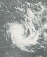
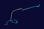
The 1973–74 Australian region cyclone season was the third most active tropical cyclone season in the Australian Region.
| 1973–74 Australian region cyclone season | |
|---|---|
 Season summary map | |
| Seasonal boundaries | |
| First system formed | 17 November 1973 |
| Last system dissipated | 23 March 1974 |
| Strongest storm | |
| Name | Pam |
| • Maximum winds | 205 km/h (125 mph) (10-minute sustained) |
| • Lowest pressure | 928 hPa (mbar) |
| Seasonal statistics | |
| Tropical lows | 19 |
| Tropical cyclones | 19 |
| Severe tropical cyclones | 10 |
| Total fatalities | Unknown |
| Total damage | Unknown |
| Related articles | |
Season summary

Systems
Severe Tropical Cyclone Ines
On November 17, Ines formed offshore the Top End. Moving westward, the cyclone passed north of Bathurst and Melville islands. Thereafter, Ines curved southwestward and intensified into a 130 km/h (80 mph) cyclone while nearing Troughton Island. The storm made landfall in Kimberley, Western Australia on November 19. Ines slowly weakened after moving inland and dissipated on November 24.[1]
Tropical Cyclone Annie
Cyclone Annie developed northwest of Western Australia on November 21. By December 8, it dissipated.[2]
Severe Tropical Cyclone Beryl
Beryl formed just south of the Lesser Sunda Islands on November 26. The cyclone strengthened, peaking with winds of 125 km/h (80 mph) on December 1. Three days later, Beryl made landfall near Carnarvon, Western Australia and quickly dissipated. Minor wind damage was reported.[3]
Tropical Cyclone Natalie–Lottie
Cyclone Lottie struck Fiji's Southern Lau Group on December 10. High seas caused the ship Uluilakeba to capsize killing more than 85 people.[4][5]
Severe Tropical Cyclone Cecily
The next system, Cecily, developed near the Cocos Islands on December 11. Cecily moved south-southwestward and peaked with winds of 125 km/h (80 mph). On December 19, the cyclone dissipated.[6]
Tropical Cyclone Una
Una formed southwest of Solomon Islands on December 15. It struck Queensland before dissipating on December 20.
Severe Tropical Cyclone Deidre–Delinda
Cyclone Deidre developed in the vicinity of the Cocos Islands on December 20. Moving generally west-southwestward across the Indian Ocean, it crossed the 80°E on December 25.[7]
Tropical Cyclone Erica
Tropical Cyclone Erica brought heavy rainfall to portions of Western Australia.[8]
Tropical Cyclone Fiona–Gwenda
Fiona-Gwenda was operationally considered two different tropical cyclones.[9]
Tropical Cyclone Vera
On January 18, Cyclone Vera developed offshore Queensland. After moving northeastward, it then curved to the southeast. On January 20, Vera crossed 160°E and entered the South Pacific basin.
Tropical Cyclone Wanda
This cyclone existed from 24 January to 27 January 1974 and led to extensive flooding over southeast Queensland. Although this tropical cyclone was relatively weak, it dropped enormous quantities of rain on south-eastern Queensland and north-eastern New South Wales over the Australia Day (26–27 January) weekend, resulting in some of the worst flooding seen in a century. The Queensland state capital, Brisbane, fared particularly badly, with fourteen lives lost and parts of the city submerged under 2 metres of the Brisbane River. (See 1974 Brisbane flood.) In northern New South Wales, a further two fatalities were reported. The cyclone's final toll: 16 dead, over 300 injured; 56 homes destroyed, a further 1,600 submerged; 8000 people left homeless.[10]
Severe Tropical Cyclone Pam
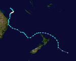
During 4 February Severe Tropical Cyclone Pam moved south-westwards into the Australian region as a Category 5 severe tropical cyclone, with peak 10-minute sustained wind speeds estimated at 205 km/h (125 mph).[11] Over the next couple of days, Pam passed about 500 km (310 mi) to the east of Brisbane, as it gradually weakened and recurved south-eastwards.[11][12] The system was last noted during 7 February as it moved back into the South Pacific basin.[11]
Tropical Cyclone Yvonne
Cyclone Yvonne developed on February 8 and struck the Cape York Peninsula.
Severe Tropical Cyclone Helen
On February 28, Cyclone Helen formed offshore Western Australia. Moving generally westward, it dissipated on March 8.
Severe Tropical Cyclone Zoe
Cyclone Zoe was named and detected on 9 March 1974 when it was northeast of Brisbane. In the following days it moved steadily southward[13] and interacted with an already-exiting trough in the easterlies to produce sustained and very heavy rainfall all along the coast from Brisbane south almost to Sydney. In the four days between 10 and 13 March, Brisbane received 419.4 millimetres (16.51 in)[14] and some places in the Northern Rivers region of New South Wales received as much as 700 millimetres (28 in).[15] With catchments already saturated by heavy January rains, record flooding occurred on the Richmond River,[16] which reached a height of 12.17 metres (39.9 ft).
Severe Tropical Cyclone Isobel
Cyclone Isobel existed over the South-East Indian Ocean from March 9 to March 17.
Severe Tropical Cyclone Jessie
Jessie developed between Indonesia and Western Australia on March 16. Moving west-southwestward, it was last noted on March 25.
Tropical Cyclone Jenny
Cyclone Jenny struck northern Western Australia.
Tropical Cyclone Alice
The final system, Cyclone Alice, existed offshore the east coast of Australia from March 21 to March 23.
See also
References
Wikiwand in your browser!
Seamless Wikipedia browsing. On steroids.
Every time you click a link to Wikipedia, Wiktionary or Wikiquote in your browser's search results, it will show the modern Wikiwand interface.
Wikiwand extension is a five stars, simple, with minimum permission required to keep your browsing private, safe and transparent.


