File:Israel_outline_binyamin.png
From Wikipedia, the free encyclopedia
Size of this preview: 800 × 427 pixels. Other resolutions: 320 × 171 pixels | 640 × 342 pixels | 1,182 × 631 pixels.
Original file (1,182 × 631 pixels, file size: 116 KB, MIME type: image/png)
| This is a file from the Wikimedia Commons. Information from its description page there is shown below. Commons is a freely licensed media file repository. You can help. |
Summary
| DescriptionIsrael outline binyamin.png |
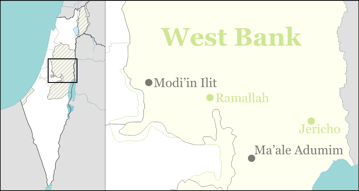
English: Location map for Israeli localities in the Binyamin Regional Council (Judea and Samaria Area) in the West Bank. Also for some other localities in the central WB, some in Megilot Regional Council. |
| Date | |
| Source | Own work |
| Author | Ynhockey |
Licensing
I, the copyright holder of this work, hereby publish it under the following licenses:
This file is licensed under the Creative Commons Attribution-Share Alike 3.0 Unported license.
- You are free:
- to share – to copy, distribute and transmit the work
- to remix – to adapt the work
- Under the following conditions:
- attribution – You must give appropriate credit, provide a link to the license, and indicate if changes were made. You may do so in any reasonable manner, but not in any way that suggests the licensor endorses you or your use.
- share alike – If you remix, transform, or build upon the material, you must distribute your contributions under the same or compatible license as the original.

|
Permission is granted to copy, distribute and/or modify this document under the terms of the GNU Free Documentation License, Version 1.2 or any later version published by the Free Software Foundation; with no Invariant Sections, no Front-Cover Texts, and no Back-Cover Texts. A copy of the license is included in the section entitled GNU Free Documentation License.http://www.gnu.org/copyleft/fdl.htmlGFDLGNU Free Documentation Licensetruetrue |
You may select the license of your choice.
Captions
Add a one-line explanation of what this file represents
Items portrayed in this file
depicts
3 May 2009
File history
Click on a date/time to view the file as it appeared at that time.
| Date/Time | Thumbnail | Dimensions | User | Comment | |
|---|---|---|---|---|---|
| current | 17:25, 1 September 2016 | | 1,182 × 631 (116 KB) | Number 57 | Updated Israel map |
| 22:49, 2 May 2009 |  | 1,182 × 631 (39 KB) | Ynhockey | Fixed location of Ma'ale Adumim | |
| 22:15, 2 May 2009 |  | 1,186 × 633 (39 KB) | Ynhockey | {{Information |Description={{en|1=Location map for Israeli localities in the Binyamin Regional Council (Judea and Samaria Area) in the West Bank. Also for some other localities in the central WB, some in Megilot Regional Council.}} |Source=Own work by upl |
File usage
The following pages on the English Wikipedia use this file (pages on other projects are not listed):
- 2017 Halamish stabbing attack
- Adei Ad
- Almog
- Almon (Israeli settlement)
- Alon (Israeli settlement)
- Amihai
- Ateret
- Beit Aryeh-Ofarim
- Beit El
- Beit HaArava
- Beit Horon
- Dolev
- Eli (Israeli settlement)
- Ganei Modi'in
- Geva Binyamin
- Gilgal (Israeli settlement)
- Giv'at Asaf
- Giv'at Ze'ev
- Giv'on HaHadasha
- Halamish
- Hashmonaim
- Kalya
- Kedar (Israeli settlement)
- Kfar Adumim
- Kfar HaOranim
- Killing of Benjamin Achimeir
- Killing of Yehuda Shoham
- Kokhav HaShahar
- Kokhav Ya'akov
- Leshem (Israeli settlement)
- Ma'ale Efrayim
- Ma'ale Levona
- Ma'ale Mikhmas
- Ma'ale Shlomo
- Matityahu (Israeli settlement)
- Mevo'ot Yeriho
- Mevo Horon
- Migron (Israeli settlement)
- Mishor Adumim
- Mitzpe Hagit
- Mitzpe Yeriho
- Na'ale
- Na'aran (Israeli settlement)
- Na'omi
- Nahliel
- Neria (Israeli settlement)
- Netiv HaGdud
- Neveh Erez
- Nili (Israeli settlement)
- Nofei Prat
- Ofra
- Peduel
- Petza'el
- Psagot
- Rimonim
- Shilo (Israeli settlement)
- Talmon
- Tomer
- Vered Yeriho
- Yafit
- Yishuv HaDa'at
- Yitav
- User:Lipkin.Aaron/sandbox
- Wikipedia talk:WikiProject Israel Palestine Collaboration/Current Article Issues/Archive 8
- Module:Location map/data/Israel binyamin
- Module:Location map/data/Israel binyamin/doc
Global file usage
The following other wikis use this file:
- Usage on el.wikipedia.org
- Usage on fa.wikipedia.org
- Usage on id.wikipedia.org
- Usage on lad.wikipedia.org
- Usage on si.wikipedia.org
- Usage on ur.wikipedia.org
- Usage on uz.wikipedia.org
- Usage on www.wikidata.org
Metadata
This file contains additional information, probably added from the digital camera or scanner used to create or digitize it.
If the file has been modified from its original state, some details may not fully reflect the modified file.
| Horizontal resolution | 37.8 dpc |
|---|---|
| Vertical resolution | 37.8 dpc |
Retrieved from "https://en.wikipedia.org/wiki/File:Israel_outline_binyamin.png"