File:Relief_Map_of_Northern_Ireland.png
From Wikipedia, the free encyclopedia
Size of this preview: 705 × 599 pixels. Other resolutions: 282 × 240 pixels | 565 × 480 pixels | 806 × 685 pixels.
Original file (806 × 685 pixels, file size: 689 KB, MIME type: image/png)
| This is a file from the Wikimedia Commons. Information from its description page there is shown below. Commons is a freely licensed media file repository. You can help. |
Summary
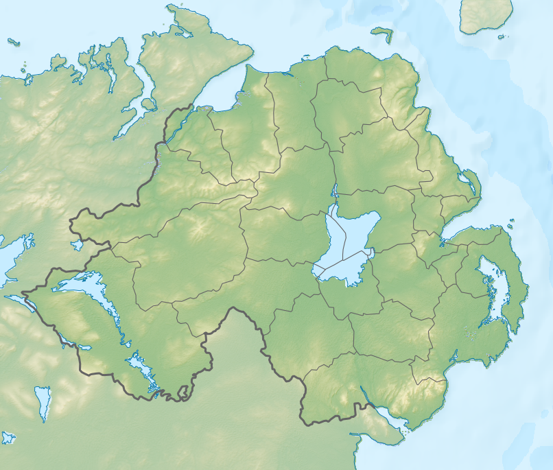
| DescriptionRelief Map of Northern Ireland.png |
Русский: Физическая карта Северной Ирландии.
English: Relief map of Northern Ireland.
|
| Date | |
| Source |
|
| Author | Nzeemin |
| Other versions |
|

Licensing
I, the copyright holder of this work, hereby publish it under the following license:
This file is licensed under the Creative Commons Attribution-Share Alike 3.0 Unported license.
- You are free:
- to share – to copy, distribute and transmit the work
- to remix – to adapt the work
- Under the following conditions:
- attribution – You must give appropriate credit, provide a link to the license, and indicate if changes were made. You may do so in any reasonable manner, but not in any way that suggests the licensor endorses you or your use.
- share alike – If you remix, transform, or build upon the material, you must distribute your contributions under the same or compatible license as the original.
Captions
Add a one-line explanation of what this file represents
Items portrayed in this file
depicts
3 October 2012
File history
Click on a date/time to view the file as it appeared at that time.
| Date/Time | Thumbnail | Dimensions | User | Comment | |
|---|---|---|---|---|---|
| current | 13:13, 3 October 2012 | | 806 × 685 (689 KB) | Nzeemin | fixed lost bathymetry |
| 12:49, 3 October 2012 |  | 806 × 685 (646 KB) | Nzeemin | User created page with UploadWizard |
File usage
More than 100 pages use this file. The following list shows the first 100 pages that use this file only. A full list is available.
- 1951 Open Championship
- 1978 British Army Gazelle downing
- 1985 Newry mortar attack
- 1990 Armagh City roadside bomb
- 1990 British Army Gazelle shootdown
- 1991 Cappagh killings
- 1994 British Army Lynx shootdown
- 1997 Coalisland attack
- Ambush at Drumnakilly
- Annalong Forest
- Attack on Cloghoge checkpoint
- Attack on Derryard checkpoint
- Ballygawley bus bombing
- Ballysaggart Lough
- Ballysallagh Forest
- Battle of Benburb
- Battle of Lisnagarvey
- Battle of Newry Road
- Battle of Scarrifholis
- Belmore Mountain
- Ben Crom
- Benbradagh
- Black Mountain (Belfast)
- Bohill Forest
- Border campaign (Irish Republican Army)
- Break of Dromore
- Castleward Forest
- Castlewellan Forest Park
- Claudy bombing
- Clea Lake
- Clonoe ambush
- Coagh ambush
- Copeland Islands
- Cuilcagh
- Donard Forest
- Droppin Well bombing
- Drumkeeragh Forest
- Drummuckavall ambush
- Glasdrumman ambush
- Glenanne barracks bombing
- Greysteel massacre
- Kingsmill massacre
- La Mon restaurant bombing
- Lambeg, County Antrim
- Lisburn van bombing
- Lough Beg
- Lough Erne
- Lough Erne Challenge
- Lough Neagh
- Loughgall ambush
- Marble Arch Caves
- Mourne Mountains
- Mullacreevie ambush
- Mullaghcarn
- Murlough Nature Reserve
- Northern Ireland Open (golf)
- Occupation of Cullaville
- Operation Conservation
- Portbraddon Cave
- Portmore Lough
- Portstewart Golf Club
- Proxy bomb
- RFA Fort Victoria bombing
- Remembrance Day bombing
- Ring of Gullion
- Roe Estuary Nature Reserve
- Rostrevor Forest
- Royal County Down Golf Club
- Royal Portrush Golf Club
- Sawel Mountain
- Scawt Hill
- Shimna River
- Slemish
- Slieve Beagh
- Slieve Bearnagh
- Slieve Croob
- Slieve Donard
- Slieve Gallion
- Slieve Gullion
- Slieve Muck
- Slieve Rushen
- St Patrick's Purgatory
- St Tiernach's Park
- Teebane bombing
- Theophilus Jones (soldier)
- Thiepval barracks bombing
- Tollymore Forest Park
- Trostan
- Tullyvallen massacre
- Warrenpoint ambush
- Waterloo Bay
- Williamite War in Ireland
- Talk:Shimna River
- User:Hike395/MtnComboBoxMtnTest
- User:Michael!/Project:Location map templates/United Kingdom
- User:Penguin2006/Fair Head
- Template:Infobox landform
- Template:Infobox landform/doc
- Template:Infobox landform/sandbox
- Template:Infobox mountain/testcases
View more links to this file.
Global file usage
The following other wikis use this file:
- Usage on ar.wikipedia.org
- Usage on az.wikipedia.org
- Usage on ba.wikipedia.org
- Usage on bg.wikipedia.org
- Белфаст
- Оума
- Банбридж
- Коулрейн
- Страбан
- Балимина
- Кукстаун
- Ларн
- Нютаунардс
- Енискилън
- Холиуд
- Нюри
- Арма
- Нюкасъл (Северна Ирландия)
- Бангор (Северна Ирландия)
- Лърган
- Крейгейвън
- Мойра
- Портадаун
- Пойнцпас
- Уорънпойнт
- Даунпатрик
- Лисбърн
- Хилсбъроу (Северна Ирландия)
- Дроумор
- Балигауън
- Сейнтфийлд
- Балинахинч
- Каридъф
- Комбър
- Кросгар
- Донахади
- Дъндоналд
- Килкийл
- Ратфриланд
- Антрим
- Баликасъл
- Баликлеър
- Балимъни
- Бушмилс
- Карнлох
- Крумлин
- Грийнайланд
- Нютаунаби
- Портръш
- Рандалстаун (Северна Ирландия)
- Коулайланд
View more global usage of this file.
Metadata
This file contains additional information, probably added from the digital camera or scanner used to create or digitize it.
If the file has been modified from its original state, some details may not fully reflect the modified file.
| Horizontal resolution | 23.64 dpc |
|---|---|
| Vertical resolution | 23.64 dpc |
| Software used |