File:A33_road_map.png
From Wikipedia, the free encyclopedia
No higher resolution available.
A33_road_map.png (250 × 425 pixels, file size: 48 KB, MIME type: image/png)
| This is a file from the Wikimedia Commons. Information from its description page there is shown below. Commons is a freely licensed media file repository. You can help. |
Summary
| DescriptionA33 road map.png |
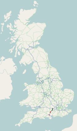
English: Map of the united kingdom showing the A33 road. Map generated using data from OpenStreetMap and licensed under CC-by-SA. |
| Date |
|
| Source |
Transferred from en.wikipedia by SreeBot
|
| Author | Rcsprinter123 at en.wikipedia |
Licensing
Rcsprinter123 at en.wikipedia, the copyright holder of this work, hereby publishes it under the following license:
This file is licensed under the Creative Commons Attribution-Share Alike 3.0 Unported, 2.5 Generic, 2.0 Generic and 1.0 Generic license.
Attribution: Rcsprinter123 at en.wikipedia
- You are free:
- to share – to copy, distribute and transmit the work
- to remix – to adapt the work
- Under the following conditions:
- attribution – You must give appropriate credit, provide a link to the license, and indicate if changes were made. You may do so in any reasonable manner, but not in any way that suggests the licensor endorses you or your use.
- share alike – If you remix, transform, or build upon the material, you must distribute your contributions under the same or compatible license as the original.
Original upload log
The original description page was here. All following user names refer to en.wikipedia.
Upload date | User | Bytes | Dimensions | Comment
- 2011-02-14 16:13 (UTC) | Rcsprinter123 | 48797 (bytes) | 250×425 | {{Information |Description = Map of the united kingdom showing the [[A33 road]].Map generated using data from OpenStreetMap and licensed under CC-by-SA. |Source = Roaders Digest - The SABRE Wiki |Date = ~~~~~ |Author = Ope
Captions
Add a one-line explanation of what this file represents
Items portrayed in this file
depicts
14 February 2011
image/png
90b6f71b4b4fdbcdead68a8d7d5c5357986d4f41
48,797 byte
425 pixel
250 pixel
File history
Click on a date/time to view the file as it appeared at that time.
| Date/Time | Thumbnail | Dimensions | User | Comment | |
|---|---|---|---|---|---|
| current | 11:41, 29 August 2011 | | 250 × 425 (48 KB) | SreeBot |
File usage
The following pages on the English Wikipedia use this file (pages on other projects are not listed):
Global file usage
The following other wikis use this file:
- Usage on de.wikipedia.org
- Usage on nl.wikipedia.org
- Usage on www.wikidata.org
Retrieved from "https://en.wikipedia.org/wiki/File:A33_road_map.png"