File:Administrative_boundaries_of_the_borough_of_Solln_in_Munich.png
From Wikipedia, the free encyclopedia
Size of this preview: 637 × 600 pixels. Other resolutions: 255 × 240 pixels | 510 × 480 pixels | 816 × 768 pixels | 1,087 × 1,024 pixels | 1,406 × 1,324 pixels.
Original file (1,406 × 1,324 pixels, file size: 553 KB, MIME type: image/png)
| This is a file from the Wikimedia Commons. Information from its description page there is shown below. Commons is a freely licensed media file repository. You can help. |
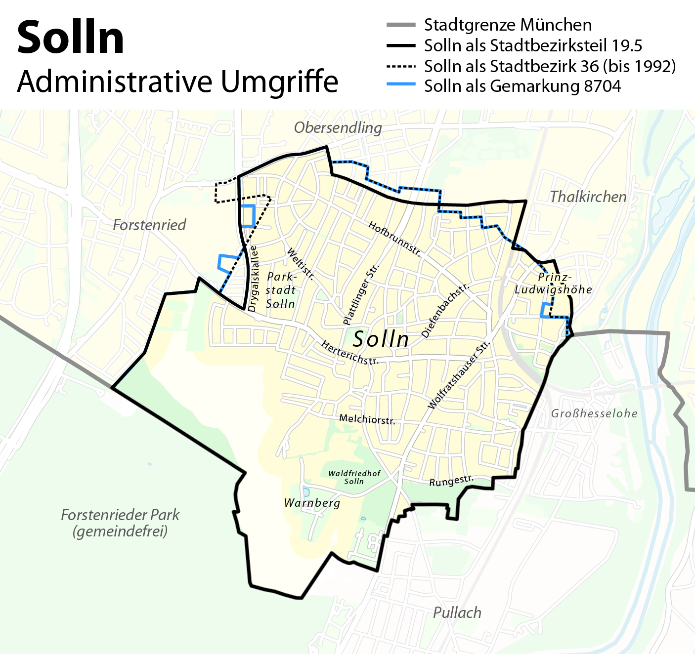
| DescriptionAdministrative boundaries of the borough of Solln in Munich.png |
Deutsch: Administrative Umgriffe des Münchener Stadtteils Solln
English: Administrative boundaries of the borough of Solln in Munich |
| Date | see file history |
| Source | Own work, using OpenStreetMap data for the background |
| Author | Maximilian Dörrbecker (Chumwa) |
| Permission (Reusing this file) |
All OpenStreetMap data and maps are Creative Commons "CC-BY-SA 2.0" licensed This file is licensed under the Creative Commons Attribution-Share Alike 2.0 Generic license.
|
| Other versions |
Region München:
Stadt München:
|


.png)


.png)
.png)


Captions
Add a one-line explanation of what this file represents
Items portrayed in this file
depicts
image/png
4bb5689b8c2085e537550a97c146ae24ed996b27
565,912 byte
1,324 pixel
1,406 pixel
File history
Click on a date/time to view the file as it appeared at that time.
| Date/Time | Thumbnail | Dimensions | User | Comment | |
|---|---|---|---|---|---|
| current | 12:31, 10 August 2012 | | 1,406 × 1,324 (553 KB) | Chumwa | anderer Ansatz |
| 21:40, 8 August 2012 |  | 1,075 × 957 (270 KB) | Chumwa | {{Information |Description= *{{ de }} Kartenserie der Münchner Stadtbezirke *{{ en }} Boroughs of Munich map series |Source={{own}}, using OpenStreetMap data for the background |Date=see file history |Author=[[:de:User:Chumwa|Maximilian Dörrbecke... |
File usage
No pages on the English Wikipedia use this file (pages on other projects are not listed).
Global file usage
The following other wikis use this file:
- Usage on de.wikipedia.org
- Usage on fr.wikipedia.org
- Usage on www.wikidata.org
Metadata
This file contains additional information, probably added from the digital camera or scanner used to create or digitize it.
If the file has been modified from its original state, some details may not fully reflect the modified file.
| Horizontal resolution | 118.11 dpc |
|---|---|
| Vertical resolution | 118.11 dpc |
| Software used |