File:Africa_topography_map_with_borders.png
From Wikipedia, the free encyclopedia
Size of this preview: 605 × 600 pixels. Other resolutions: 242 × 240 pixels | 484 × 480 pixels | 775 × 768 pixels | 1,033 × 1,024 pixels | 2,067 × 2,048 pixels | 2,663 × 2,639 pixels.
Original file (2,663 × 2,639 pixels, file size: 4.07 MB, MIME type: image/png)
| This is a file from the Wikimedia Commons. Information from its description page there is shown below. Commons is a freely licensed media file repository. You can help. |
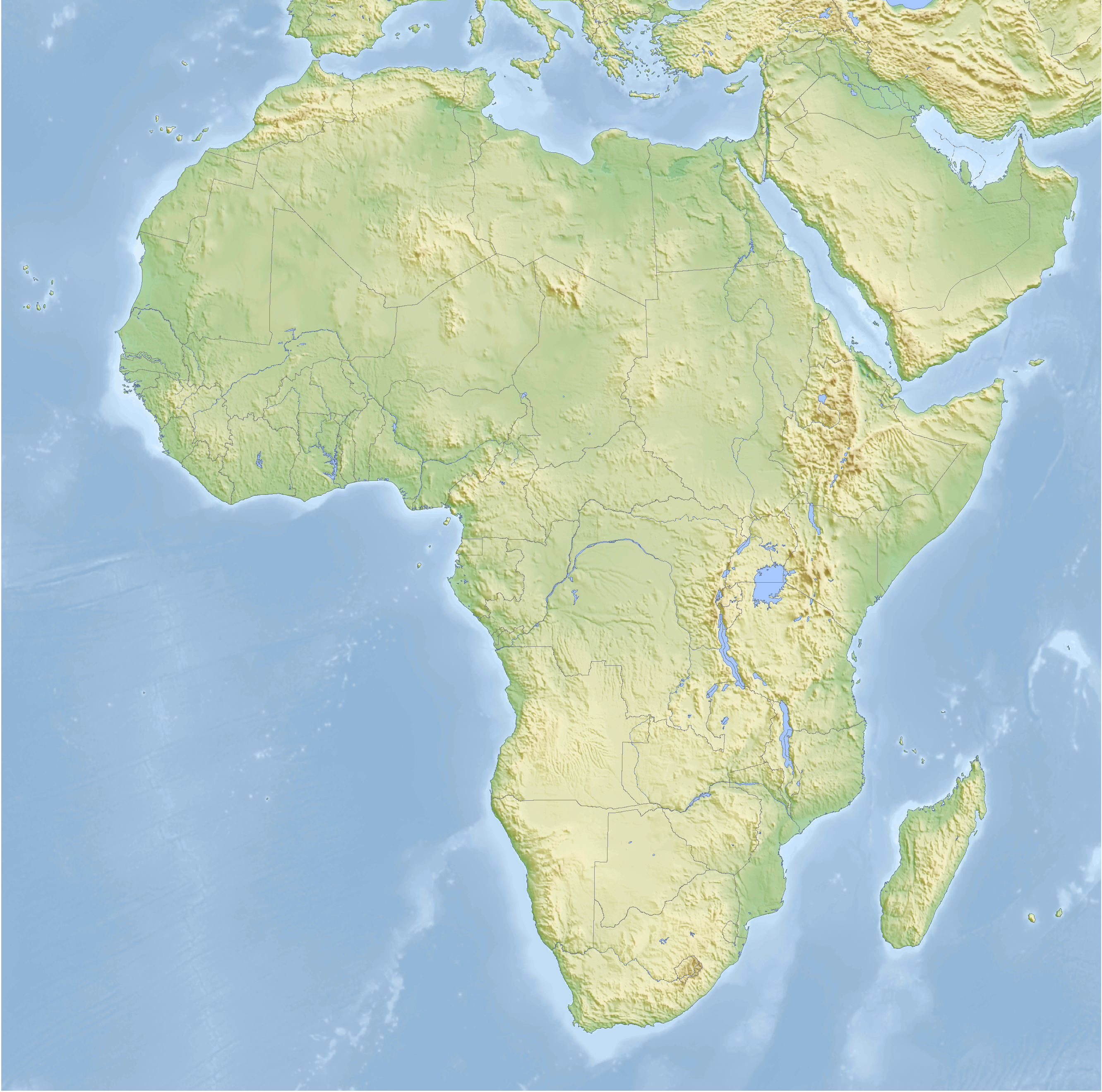
| DescriptionAfrica topography map with borders.png | Topographic map of Africa with political boundaries, Cassini cylindrical projection |
| Date | |
| Source | self-made, using GMT |
| Author | Bamse |
| Other versions | without borders |
The map has been created with the Generic Mapping Tools: https://www.generic-mapping-tools.org/ using one or more of these public-domain datasets for the relief:
বাংলা ∙ English ∙ español ∙ français ∙ italiano ∙ 日本語 ∙ македонски ∙ sicilianu ∙ 中文(简体) ∙ 中文(繁體) ∙ +/− |

|
Permission is granted to copy, distribute and/or modify this document under the terms of the GNU Free Documentation License, Version 1.2 or any later version published by the Free Software Foundation; with no Invariant Sections, no Front-Cover Texts, and no Back-Cover Texts. A copy of the license is included in the section entitled GNU Free Documentation License.http://www.gnu.org/copyleft/fdl.htmlGFDLGNU Free Documentation Licensetruetrue |
| This file is licensed under the Creative Commons Attribution-Share Alike 3.0 Unported license. | ||
| ||
| This licensing tag was added to this file as part of the GFDL licensing update.http://creativecommons.org/licenses/by-sa/3.0/CC BY-SA 3.0Creative Commons Attribution-Share Alike 3.0truetrue |

|
This map has been made or improved in the German Kartenwerkstatt (Map Lab). You can propose maps to improve as well.
azərbaycanca ∙ čeština ∙ Deutsch ∙ Deutsch (Sie-Form) ∙ English ∙ español ∙ français ∙ italiano ∙ latviešu ∙ magyar ∙ Nederlands ∙ Plattdüütsch ∙ polski ∙ português ∙ română ∙ sicilianu ∙ slovenščina ∙ suomi ∙ македонски ∙ русский ∙ ქართული ∙ հայերեն ∙ বাংলা ∙ ไทย ∙ +/−
|
Captions
Add a one-line explanation of what this file represents
Items portrayed in this file
depicts
19 February 2008
image/png
8f6ef5884c96c53362121cb8897239e23f5f07aa
4,270,162 byte
2,639 pixel
2,663 pixel
File history
Click on a date/time to view the file as it appeared at that time.
| Date/Time | Thumbnail | Dimensions | User | Comment | |
|---|---|---|---|---|---|
| current | 06:52, 25 February 2008 | | 2,663 × 2,639 (4.07 MB) | Bamse | |
| 06:49, 25 February 2008 |  | 3,196 × 3,167 (5.04 MB) | Bamse | ||
| 02:17, 19 February 2008 |  | 2,664 × 2,639 (4.11 MB) | Bamse | {{Information |Description=Topographic map of Africa with political boundaries, Cassini cylindrical projection |Source=self-made, using GMT |Date=19-02-2008 |Author= Bamse |Permission= |other_versions=[[:Image:Africa topography map.png|with |
File usage
No pages on the English Wikipedia use this file (pages on other projects are not listed).
Global file usage
The following other wikis use this file:
- Usage on ar.wikipedia.org
- Usage on azb.wikipedia.org
- Usage on de.wikipedia.org
- Usage on es.wikipedia.org
- Usage on pt.wikipedia.org