File:All_Saints_church,_Milton_Keynes_Village_-_geograph.org.uk_-_728891.jpg
From Wikipedia, the free encyclopedia
No higher resolution available.
All_Saints_church,_Milton_Keynes_Village_-_geograph.org.uk_-_728891.jpg (640 × 480 pixels, file size: 96 KB, MIME type: image/jpeg)
| This is a file from the Wikimedia Commons. Information from its description page there is shown below. Commons is a freely licensed media file repository. You can help. |
Summary
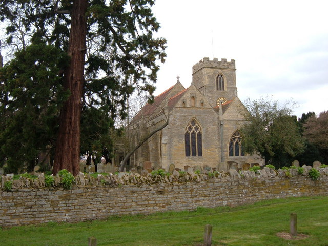
| DescriptionAll Saints church, Milton Keynes Village - geograph.org.uk - 728891.jpg |
English: All Saints church, Milton Keynes Village The church in the village that gives the town its name. The church is located on the old willen road. |
| Date | |
| Source | From geograph.org.uk |
| Author | Mr Biz |
| Attribution (required by the license) InfoField | Mr Biz / All Saints church, Milton Keynes Village / |
InfoField | Mr Biz / All Saints church, Milton Keynes Village |
| Camera location | 52° 02′ 38″ N, 0° 42′ 21″ W | View this and other nearby images on: OpenStreetMap |
|---|
| Object location | 52° 02′ 38″ N, 0° 42′ 23″ W | View this and other nearby images on: OpenStreetMap |
|---|
Licensing

|
This image was taken from the Geograph project collection. See this photograph's page on the Geograph website for the photographer's contact details. The copyright on this image is owned by Mr Biz and is licensed for reuse under the Creative Commons Attribution-ShareAlike 2.0 license.
|
This file is licensed under the Creative Commons Attribution-Share Alike 2.0 Generic license.
Attribution: Mr Biz
- You are free:
- to share – to copy, distribute and transmit the work
- to remix – to adapt the work
- Under the following conditions:
- attribution – You must give appropriate credit, provide a link to the license, and indicate if changes were made. You may do so in any reasonable manner, but not in any way that suggests the licensor endorses you or your use.
- share alike – If you remix, transform, or build upon the material, you must distribute your contributions under the same or compatible license as the original.
Captions
Add a one-line explanation of what this file represents
Items portrayed in this file
depicts
18 March 2008
52°2'38.22"N, 0°42'20.52"W
52°2'37.61"N, 0°42'23.04"W
image/jpeg
4c94dcccc363bc9cb8c92fd417ea57e2d19c5b3b
98,615 byte
480 pixel
640 pixel
File history
Click on a date/time to view the file as it appeared at that time.
| Date/Time | Thumbnail | Dimensions | User | Comment | |
|---|---|---|---|---|---|
| current | 03:58, 19 February 2011 | | 640 × 480 (96 KB) | GeographBot | == {{int:filedesc}} == {{Information |description={{en|1=All Saints church, Milton Keynes Village The church in the village that gives the town its name. The church is located on the old willen road.}} |date=2008-03-18 |source=From [http://www.geograph.o |
File usage
The following pages on the English Wikipedia use this file (pages on other projects are not listed):
Global file usage
The following other wikis use this file:
- Usage on ceb.wikipedia.org
- Usage on dag.wikipedia.org
- Usage on lld.wikipedia.org
- Usage on nl.wikipedia.org
- Usage on pl.wikipedia.org
- Usage on sv.wikipedia.org
- Usage on www.wikidata.org
- Usage on zh-min-nan.wikipedia.org
Metadata
This file contains additional information, probably added from the digital camera or scanner used to create or digitize it.
If the file has been modified from its original state, some details may not fully reflect the modified file.
| _error | 0 |
|---|