File:Avalon-map.png
From Wikipedia, the free encyclopedia
Avalon-map.png (330 × 250 pixels, file size: 22 KB, MIME type: image/png)
| This is a file from the Wikimedia Commons. Information from its description page there is shown below. Commons is a freely licensed media file repository. You can help. |
Summary
| DescriptionAvalon-map.png |
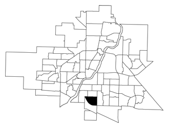
English: A map showing the location of the Avalon neighbourhood in relation to the other neighbourhoods in Saskatoon. |
||
| Date | |||
| Source | http://www.saskatoon.ca/DEPARTMENTS/Community%20Services/PlanningDevelopment/BusinessLicenseMappingAndResearch/DemographicAndHousingData/Documents/2007/avalon.pdf | ||
| Author | City of Saskatoon - Planning & Development Branch | ||
| Permission (Reusing this file) |
|
Licensing

|
The copyright holder of this file allows anyone to use it for any purpose, provided that the copyright holder is properly attributed. Redistribution, derivative work, commercial use, and all other use is permitted. |
|
Attribution |
Captions
Items portrayed in this file
depicts
2007
image/png
96170b3a88dd57fc13f16043a09a7bf908444df8
22,707 byte
250 pixel
330 pixel
File history
Click on a date/time to view the file as it appeared at that time.
| Date/Time | Thumbnail | Dimensions | User | Comment | |
|---|---|---|---|---|---|
| current | 17:53, 10 January 2010 | | 330 × 250 (22 KB) | Drm310 | {{Information |Description={{en|1=Location map of the Avalon neighbourhood in Saskatoon, Saskatchewan, Canada.}} |Source={{own}} |Author=Drm310 |Date=2010-01-10 |Permission= |other_versions= }} Category:Avalon [[Category:Maps of Saska |
File usage
Global file usage
The following other wikis use this file:
- Usage on ur.wikipedia.org
- Usage on www.wikidata.org