File:Bredhurst_Village_Sign_-_geograph.org.uk_-_1044559.jpg
From Wikipedia, the free encyclopedia
Size of this preview: 450 × 599 pixels. Other resolutions: 180 × 240 pixels | 481 × 640 pixels.
Original file (481 × 640 pixels, file size: 81 KB, MIME type: image/jpeg)
| This is a file from the Wikimedia Commons. Information from its description page there is shown below. Commons is a freely licensed media file repository. You can help. |
Summary
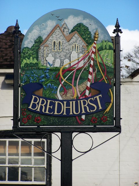
| DescriptionBredhurst Village Sign - geograph.org.uk - 1044559.jpg |
English: Brehurst Village Sign On The Street, Bell Public House in background.
Shows St Peter's Church. |
| Date | |
| Source | From geograph.org.uk |
| Author | David Anstiss |
| Attribution (required by the license) InfoField | David Anstiss / Bredhurst Village Sign / |
InfoField | David Anstiss / Bredhurst Village Sign |
| Camera location | 51° 19′ 52″ N, 0° 34′ 33″ E | View this and other nearby images on: OpenStreetMap |
|---|
| Object location | 51° 19′ 52″ N, 0° 34′ 34″ E | View this and other nearby images on: OpenStreetMap |
|---|
Licensing

|
This image was taken from the Geograph project collection. See this photograph's page on the Geograph website for the photographer's contact details. The copyright on this image is owned by David Anstiss and is licensed for reuse under the Creative Commons Attribution-ShareAlike 2.0 license.
|
This file is licensed under the Creative Commons Attribution-Share Alike 2.0 Generic license.
Attribution: David Anstiss
- You are free:
- to share – to copy, distribute and transmit the work
- to remix – to adapt the work
- Under the following conditions:
- attribution – You must give appropriate credit, provide a link to the license, and indicate if changes were made. You may do so in any reasonable manner, but not in any way that suggests the licensor endorses you or your use.
- share alike – If you remix, transform, or build upon the material, you must distribute your contributions under the same or compatible license as the original.
Captions
Add a one-line explanation of what this file represents
Items portrayed in this file
depicts
some value
51°19'51.78"N, 0°34'32.52"E
12 November 2008
51°19'52.39"N, 0°34'33.96"E
image/jpeg
37dc4ea2307be2145550d763e2a8acbb0dbd353c
83,278 byte
640 pixel
481 pixel
File history
Click on a date/time to view the file as it appeared at that time.
| Date/Time | Thumbnail | Dimensions | User | Comment | |
|---|---|---|---|---|---|
| current | 20:46, 23 February 2011 | | 481 × 640 (81 KB) | GeographBot | == {{int:filedesc}} == {{Information |description={{en|1=Brehurst Village Sign On The Street, Bell Public House in background. Shows St Peter's Church.}} |date=2008-11-12 |source=From [http://www.geograph.org.uk/photo/1044559 geograph.org.uk] |author=[ht |
File usage
The following pages on the English Wikipedia use this file (pages on other projects are not listed):
Metadata
This file contains additional information, probably added from the digital camera or scanner used to create or digitize it.
If the file has been modified from its original state, some details may not fully reflect the modified file.
| _error | 0 |
|---|