File:Francophone_Africa.png
From Wikipedia, the free encyclopedia
Size of this preview: 600 × 599 pixels. Other resolutions: 240 × 240 pixels | 480 × 480 pixels | 997 × 996 pixels.
Original file (997 × 996 pixels, file size: 158 KB, MIME type: image/png)
| This is a file from the Wikimedia Commons. Information from its description page there is shown below. Commons is a freely licensed media file repository. You can help. |

|
File:Francophone Africa.svg is a vector version of this file. It should be used in place of this PNG file when not inferior.
File:Francophone Africa.png → File:Francophone Africa.svg
For more information, see Help:SVG.
|
 |
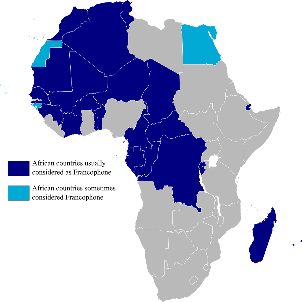
Map highlighting Francophone Africa, made by myself.
| Public domainPublic domainfalsefalse |
| I, the copyright holder of this work, release this work into the public domain. This applies worldwide. In some countries this may not be legally possible; if so: I grant anyone the right to use this work for any purpose, without any conditions, unless such conditions are required by law. |
Captions
Add a one-line explanation of what this file represents
Countries in Africa that are Francophones
Items portrayed in this file
depicts
image/png
File history
Click on a date/time to view the file as it appeared at that time.
| Date/Time | Thumbnail | Dimensions | User | Comment | |
|---|---|---|---|---|---|
| current | 15:29, 11 February 2023 | | 997 × 996 (158 KB) | +JMJ+ | rephrased the text |
| 15:21, 11 February 2023 |  | 997 × 996 (157 KB) | +JMJ+ | Better base map - File:BlankMap-Africa.svg | |
| 21:57, 19 July 2011 |  | 360 × 388 (14 KB) | Rosss | Added South Sudan | |
| 01:09, 15 August 2007 |  | 360 × 392 (14 KB) | Rosss | Added Réunion, Mauritius, Seychelles, Comoros, Mayotte, Scattered Islands, Cape Verde, Guinea Bisau, Sao Tome e Principe, and the insular part of Equatorial Guinea. | |
| 17:37, 20 November 2006 |  | 360 × 392 (13 KB) | Aaker | Map highlighting Francophone Africa. Made by myself. | |
| 17:36, 20 November 2006 |  | 360 × 392 (13 KB) | Aaker | Map highlighting Francophone Africa, made by myself. | |
| 17:33, 20 November 2006 |  | 360 × 392 (13 KB) | Aaker | Map highlighting Francophone Africa, made by myself, 2006. Carte marquant l'Afrique francophone. | |
| 17:32, 20 November 2006 |  | 360 × 392 (13 KB) | Aaker | Map highlighting Francophone Africa, made by myself, 2006. Carte marquant l'Afrique francophone. | |
| 15:46, 11 November 2006 |  | 360 × 392 (13 KB) | Aaker | Map highlighting Francophone Africa, made by myself. |
File usage
The following pages on the English Wikipedia use this file (pages on other projects are not listed):
Global file usage
The following other wikis use this file:
- Usage on ar.wikipedia.org
- Usage on ast.wikipedia.org
- Usage on de.wikipedia.org
- Usage on es.wikipedia.org
- Usage on fa.wikipedia.org
- Usage on he.wikipedia.org
- Usage on hy.wikipedia.org
- Usage on hyw.wikipedia.org
- Usage on it.wikipedia.org
- Usage on ja.wikipedia.org
- Usage on mr.wikipedia.org
- Usage on pt.wikipedia.org
- Usage on tl.wikipedia.org
- Usage on tr.wiktionary.org
- Usage on ur.wikipedia.org
- Usage on zh.wikipedia.org
Metadata
This file contains additional information, probably added from the digital camera or scanner used to create or digitize it.
If the file has been modified from its original state, some details may not fully reflect the modified file.
| Short title |
|
|---|---|
| Horizontal resolution | 37.79 dpc |
| Vertical resolution | 37.79 dpc |
| Software used |
Retrieved from "https://en.wikipedia.org/wiki/File:Francophone_Africa.png"