File:IranMarkazi.png
From Wikipedia, the free encyclopedia
Size of this preview: 648 × 599 pixels. Other resolutions: 260 × 240 pixels | 519 × 480 pixels | 879 × 813 pixels.
Original file (879 × 813 pixels, file size: 25 KB, MIME type: image/png)
| This is a file from the Wikimedia Commons. Information from its description page there is shown below. Commons is a freely licensed media file repository. You can help. |
Summary

|
File:IranMarkazi-SVG.svg is a vector version of this file. It should be used in place of this PNG file.
File:IranMarkazi.png → File:IranMarkazi-SVG.svg
For more information, see Help:SVG.
|
 |
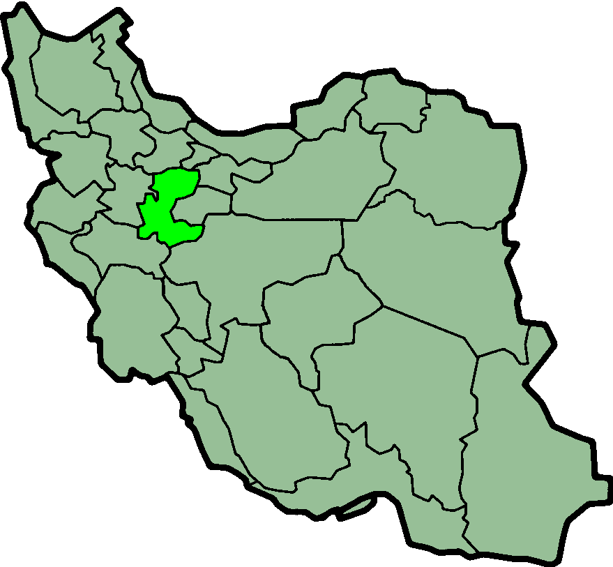
Province of Markazi, Iran Created by Morwen
Licensing
| This file is licensed under the Creative Commons Attribution-Share Alike 3.0 Unported license. Subject to disclaimers. | ||
| ||
| This licensing tag was added to this file as part of the GFDL licensing update.http://creativecommons.org/licenses/by-sa/3.0/CC BY-SA 3.0Creative Commons Attribution-Share Alike 3.0truetrue |

|
Permission is granted to copy, distribute and/or modify this document under the terms of the GNU Free Documentation License, Version 1.2 or any later version published by the Free Software Foundation; with no Invariant Sections, no Front-Cover Texts, and no Back-Cover Texts. A copy of the license is included in the section entitled GNU Free Documentation License. Subject to disclaimers.http://www.gnu.org/copyleft/fdl.htmlGFDLGNU Free Documentation Licensetruetrue |
| DescriptionIranMarkazi.png |
Province of Markazi, Iran Deutsch: Lage der Provinz Markazi im Iran
Nederlands: Locatie van Markazi |
| Date | (UTC) |
| Source | http://en.wikipedia.org/wiki/Image:IranMarkazi.png |
| Author | Morven |
| Permission (Reusing this file) |
GFDL |
Captions
Add a one-line explanation of what this file represents
Items portrayed in this file
depicts
30 January 2004
File history
Click on a date/time to view the file as it appeared at that time.
| Date/Time | Thumbnail | Dimensions | User | Comment | |
|---|---|---|---|---|---|
| current | 00:02, 24 June 2013 | | 879 × 813 (25 KB) | BasilLeaf | بروزرسانی مرز بین استانهای یزد و خراسان جنوبی، تهران و البرز، فارس و یزد و اصفهان |
| 11:55, 12 November 2010 |  | 879 × 813 (41 KB) | M samadi | Quality improved, Border of some provinces updated. | |
| 13:11, 13 October 2010 |  | 200 × 185 (13 KB) | Amin19850 | Tehran & Alborz Province is divided | |
| 17:04, 8 November 2006 |  | 200 × 185 (11 KB) | Raymond | transparent background, improved color palette | |
| 06:01, 6 September 2005 |  | 200 × 185 (22 KB) | Roozbeh | updated with new Khorasan(s) and expandion of Yazd | |
| 22:55, 30 August 2005 |  | 200 × 185 (20 KB) | Kotoito | Province of Markazi, Iran Created by Morwen |
File usage
More than 100 pages use this file. The following list shows the first 100 pages that use this file only. A full list is available.
- Amanabad, Markazi
- Amanabad Rural District
- Amiriyeh Rural District
- Anbarteh
- Anjirak, Markazi
- Arak County
- Arezumand
- Ashtian County
- Astaneh, Markazi
- Ban, Iran
- Bazneh
- Borzeh
- Bourvari
- Central District (Arak County)
- Central District (Ashtian County)
- Central District (Delijan County)
- Central District (Farahan County)
- Central District (Khomeyn County)
- Central District (Khondab County)
- Central District (Komijan County)
- Central District (Mahallat County)
- Central District (Saveh County)
- Central District (Shazand County)
- Central District (Tafresh County)
- Central District (Zarandieh County)
- Chenas
- Davudabad
- Davudabad Rural District
- Delaram, Markazi
- Delijan
- Delijan County
- Enaj
- Farahan County
- Farmahin
- Fasharud
- Garakan
- Gazavand
- Gharqabad
- Gili, Iran
- Gurchak
- Hajji Beyg
- Hasanabad, Arak
- Hendudar
- Jamalkeh
- Kamareh District
- Karahrud
- Karvansara, Markazi
- Kazaz
- Khaltabad
- Kharqan District
- Khenejin
- Khenejin District
- Khomeyn
- Khomeyn County
- Khondab
- Khondab County
- Khurheh, Markazi
- Komijan
- Komijan County
- Kudarz
- Kudzar
- Kuhin, Markazi
- Mahallat County
- Makkan, Markazi
- Mamuniyeh
- Mashhad-e Miqan Rural District
- Masumiyeh Rural District
- Milajerd
- Milajerd District
- Moshkabad Rural District
- Nakhcheer
- Naraq
- Nowbaran
- Nowbaran District
- Parandak, Markazi
- Qarah Kahriz District
- Qurchi Bashi
- Ravanj
- Razeqan
- Rowshanai
- Sangak, Iran
- Sarband District (Iran)
- Saruq, Markazi
- Saruq District
- Saveh County
- Sedeh Rural District (Arak County)
- Senjan
- Shahsavaran
- Shamsabad Rural District (Arak County)
- Shazand
- Tafresh County
- Tarkhuran
- Tureh
- Visman
- Zalian
- Zalian District
- Zambar, Iran
- Zarandieh County
- Zaviyeh
- User:AlexNebraska/Images of Iran
View more links to this file.
Global file usage
The following other wikis use this file:
- Usage on ar.wikipedia.org
- Usage on bn.wikipedia.org
- Usage on ca.wikipedia.org
- Usage on ckb.wikipedia.org
- Usage on cy.wikipedia.org
- Usage on da.wikipedia.org
- Usage on el.wikipedia.org
- Usage on eo.wikipedia.org
- Usage on fa.wikinews.org
- Usage on glk.wikipedia.org
- Usage on gl.wikipedia.org
- Usage on hi.wikipedia.org
- Usage on hr.wikipedia.org
- Usage on id.wikipedia.org
- Usage on incubator.wikimedia.org
- Usage on it.wikipedia.org
- Provincia di Markazi
- Province dell'Iran
- Khomeyn
- Arak (Iran)
- Shahrestān di Arak
- Shahrestān di Ashtian
- Shahrestān di Delijan
- Shahrestān di Khomeyn
- Shahrestān di Khondab
- Shahrestān di Komeijan
- Shahrestān di Mahalat
- Shahrestān di Saveh
- Shahrestān di Shazand
- Shahrestān di Tafresh
- Shahrestān di Zarandiyeh
- Template:Provincia di Markazi
- Davudabad
- Karahrud
- Senjan
- Javarsian
- Ashtian
- Delijan
View more global usage of this file.
Metadata
This file contains additional information, probably added from the digital camera or scanner used to create or digitize it.
If the file has been modified from its original state, some details may not fully reflect the modified file.
| Horizontal resolution | 37.79 dpc |
|---|---|
| Vertical resolution | 37.79 dpc |
Retrieved from "https://en.wikipedia.org/wiki/File:IranMarkazi.png"