File:Israel_Syria_Locator.png
From Wikipedia, the free encyclopedia
No higher resolution available.
Israel_Syria_Locator.png (204 × 165 pixels, file size: 9 KB, MIME type: image/png)
| This is a file from the Wikimedia Commons. Information from its description page there is shown below. Commons is a freely licensed media file repository. You can help. |

|
This file was moved to Wikimedia Commons from en.wikipedia using a bot script. All source information is still present. It requires review. Additionally, there may be errors in any or all of the information fields; information on this file should not be considered reliable and the file should not be used until it has been reviewed and any needed corrections have been made. Once the review has been completed, this template should be removed. For details about this file, see below. Check now! |
Summary
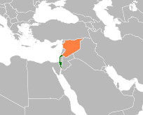
| DescriptionIsrael Syria Locator.png |
English: Israel-Syria locator |
| Date | (UTC) |
| Source | Author |
| Author | en:User:Supreme Deliciousness, based on Wikipedia blank map. File:BlankMap-World6.svg |
Licensing
| Public domainPublic domainfalsefalse |
| I, the copyright holder of this work, release this work into the public domain. This applies worldwide. In some countries this may not be legally possible; if so: I grant anyone the right to use this work for any purpose, without any conditions, unless such conditions are required by law. |
Original upload log
The original description page was here. All following user names refer to en.wikipedia.
| Upload date | User | Bytes | Dimensions | Comment |
|---|---|---|---|---|
| 2010-03-10 01:38:09 | Supreme Deliciousness | 9687 | 204×165 | {{Information |Description = Israel-Syria locator |Source = |Date = ~~~~~ |Author = Me |Permission = |other_versions = }} == {{int:filedesc}} == Own work, based on Wikipedia blank map. http://commons.wikimedia.org/wiki/Fil |
Captions
Add a one-line explanation of what this file represents
Items portrayed in this file
depicts
10 March 2010
File history
Click on a date/time to view the file as it appeared at that time.
| Date/Time | Thumbnail | Dimensions | User | Comment | |
|---|---|---|---|---|---|
| current | 18:13, 13 April 2010 | | 204 × 165 (9 KB) | Avicennasis | {{BotMoveToCommons|en.wikipedia|year={{subst:CURRENTYEAR}}|month={{subst:CURRENTMONTHNAME}}|day={{subst:CURRENTDAY}}}} == Summary == {{Information |Description = {{en|Israel-Syria locator}} |Source = Author |Date = 01:38, 10 March 2010 (UTC) |Author = [[: |
File usage
The following pages on the English Wikipedia use this file (pages on other projects are not listed):
Global file usage
The following other wikis use this file:
- Usage on ar.wikipedia.org
- Usage on az.wikipedia.org
- Usage on ca.wikipedia.org
- Usage on ckb.wikipedia.org
- Usage on da.wikipedia.org
- Usage on de.wikipedia.org
- Usage on el.wikipedia.org
- Usage on es.wikipedia.org
- Usage on fa.wikipedia.org
- Usage on fr.wikipedia.org
- Usage on he.wikipedia.org
- Usage on id.wikipedia.org
- Usage on it.wikipedia.org
- Usage on ja.wikipedia.org
- Usage on mzn.wikipedia.org
- Usage on pt.wikipedia.org
- Usage on ru.wikipedia.org
- Usage on tg.wikipedia.org
- Usage on tr.wikipedia.org
- Usage on www.wikidata.org
Retrieved from "https://en.wikipedia.org/wiki/File:Israel_Syria_Locator.png"