File:Kidderminster_town_centre,_Kidderminster,_Worcs,_geograph_6411691_by_P_L_Chadwick.jpg
From Wikipedia, the free encyclopedia
Size of this preview: 798 × 599 pixels. Other resolutions: 320 × 240 pixels | 639 × 480 pixels | 1,023 × 768 pixels | 1,024 × 769 pixels.
Original file (1,024 × 769 pixels, file size: 571 KB, MIME type: image/jpeg)
| This is a file from the Wikimedia Commons. Information from its description page there is shown below. Commons is a freely licensed media file repository. You can help. |
Summary
| DescriptionKidderminster town centre, Kidderminster, Worcs, geograph 6411691 by P L Chadwick.jpg |
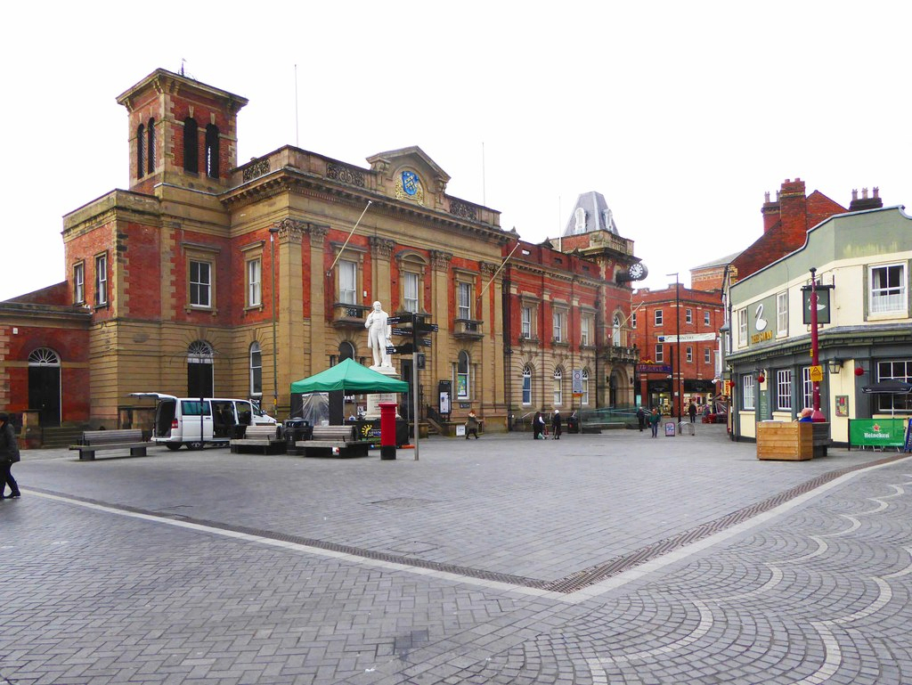
English: Kidderminster town centre, Kidderminster, Worcs
This area at the junction of Vicar Street and Exchange Street is probably the heart of the town centre. It's bounded by Kidderminster Town Hall and The Swan public house. It has recently been partially redesigned so that traffic and pedestrians intermingle, which seems to be the fashion of the moment. It has resulted in some fancy paving but the scheme has caused a lot of controversy as many residents feel the new arrangements could lead to potentially fatal accidents. |
||
| Date | |||
| Source | geograph.org.uk | ||
| Author | P L Chadwick | ||
| Permission (Reusing this file) |
This file is licensed under the Creative Commons Attribution-Share Alike 2.0 Generic license. Attribution: P L Chadwick
|
||
| Attribution (required by the license) InfoField | P L Chadwick / Kidderminster town centre, Kidderminster, Worcs / | ||
InfoField | P L Chadwick / Kidderminster town centre, Kidderminster, Worcs |

| Camera location | 52° 23′ 13″ N, 2° 14′ 53″ W | View this and other nearby images on: OpenStreetMap |
|---|
| Object location | 52° 23′ 13″ N, 2° 14′ 54″ W | View this and other nearby images on: OpenStreetMap |
|---|
Captions
Add a one-line explanation of what this file represents
Items portrayed in this file
depicts
7 March 2020
52°23'12.66"N, 2°14'52.80"W
52°23'12.98"N, 2°14'53.88"W
image/jpeg
File history
Click on a date/time to view the file as it appeared at that time.
| Date/Time | Thumbnail | Dimensions | User | Comment | |
|---|---|---|---|---|---|
| current | 16:34, 17 June 2020 | | 1,024 × 769 (571 KB) | G-13114 | {{Information |description={{en|1=Kidderminster town centre, Kidderminster, Worcs This area at the junction of Vicar Street and Exchange Street is probably the heart of the town centre. It's bounded by Kidderminster Town Hall and The Swan public house. It has recently been partially redesigned so that traffic and pedestrians intermingle, which seems to be the fashion of the moment. It has resulted in some fancy paving but the scheme has caused a lot of controversy as many residents feel the... |
File usage
The following pages on the English Wikipedia use this file (pages on other projects are not listed):
Global file usage
The following other wikis use this file:
- Usage on de.wikipedia.org
- Usage on sv.wikipedia.org
- Usage on ur.wikipedia.org
- Usage on www.wikidata.org