File:Map_of_Cowley_Co,_Ks,_USA.png
From Wikipedia, the free encyclopedia
Original file (1,024 × 1,052 pixels, file size: 329 KB, MIME type: image/png)
| This is a file from the Wikimedia Commons. Information from its description page there is shown below. Commons is a freely licensed media file repository. You can help. |
Summary
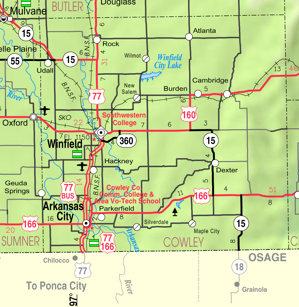
| DescriptionMap of Cowley Co, Ks, USA.png |
English: Map of Cowley County, Kansas, USA |
||
| Date | |||
| Source | Kansas 2005–2006 Official Transportation Map [1] (map legend), copied at a resolution of 300 pixels/inch from the original PDF file. | ||
| Author | Designed and published by the Kansas Department of Transportation. | ||
| Permission (Reusing this file) |
|
Licensing
| Public domainPublic domainfalsefalse |
| This work has been released into the public domain by its author, Kansas Department of Transportation. This applies worldwide. In some countries this may not be legally possible; if so: Kansas Department of Transportation grants anyone the right to use this work for any purpose, without any conditions, unless such conditions are required by law. Public domainPublic domainfalsefalse |
Captions
Items portrayed in this file
depicts
February 2005
File history
Click on a date/time to view the file as it appeared at that time.
| Date/Time | Thumbnail | Dimensions | User | Comment | |
|---|---|---|---|---|---|
| current | 05:57, 21 March 2006 | | 1,024 × 1,052 (329 KB) | Moverton | Source: Kansas 2005-2006 Official Transportation Map {{PD-US}} |
File usage
Global file usage
The following other wikis use this file:
- Usage on azb.wikipedia.org
- Usage on cy.wikipedia.org
- Usage on de.wikipedia.org
- Usage on fa.wikipedia.org
- Usage on ms.wikipedia.org
- Usage on nl.wikipedia.org
- Usage on ru.wikipedia.org
- Usage on sh.wikipedia.org
- Usage on simple.wikipedia.org
- Usage on ur.wikipedia.org
- Usage on www.wikidata.org
- Usage on zh.wikipedia.org