File:NSW_in_Australia_map.png
From Wikipedia, the free encyclopedia
No higher resolution available.
NSW_in_Australia_map.png (200 × 186 pixels, file size: 11 KB, MIME type: image/png)
| This is a file from the Wikimedia Commons. Information from its description page there is shown below. Commons is a freely licensed media file repository. You can help. |

|
File:New South Wales in Australia.svg is a vector version of this file. It should be used in place of this PNG file when not inferior.
File:NSW in Australia map.png → File:New South Wales in Australia.svg
For more information, see Help:SVG.
|
 |
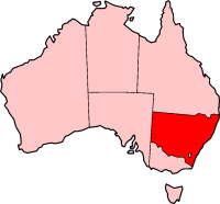
New South Wales location - (from en.wikipedia.org)

|
Permission is granted to copy, distribute and/or modify this document under the terms of the GNU Free Documentation License, Version 1.2 or any later version published by the Free Software Foundation; with no Invariant Sections, no Front-Cover Texts, and no Back-Cover Texts. A copy of the license is included in the section entitled GNU Free Documentation License.http://www.gnu.org/copyleft/fdl.htmlGFDLGNU Free Documentation Licensetruetrue |
| This file is licensed under the Creative Commons Attribution-Share Alike 3.0 Unported license. | ||
| ||
| This licensing tag was added to this file as part of the GFDL licensing update.http://creativecommons.org/licenses/by-sa/3.0/CC BY-SA 3.0Creative Commons Attribution-Share Alike 3.0truetrue |
Captions
Add a one-line explanation of what this file represents
Items portrayed in this file
depicts
File history
Click on a date/time to view the file as it appeared at that time.
| Date/Time | Thumbnail | Dimensions | User | Comment | |
|---|---|---|---|---|---|
| current | 03:24, 27 November 2004 | | 200 × 186 (11 KB) | Jeroen | New South Wales location - (from en.wikipedia.org) |
File usage
More than 100 pages use this file. The following list shows the first 100 pages that use this file only. A full list is available.
- Ashley, New South Wales
- Ashtonfield, New South Wales
- Australian south-east coast drainage division
- Aylmerton, New South Wales
- Bannaby, New South Wales
- Barry, New South Wales
- Belford, New South Wales
- Bombah Point
- Bonshaw, New South Wales
- Boro, New South Wales
- Bulahdelah tornado
- Burning Palms, New South Wales
- Buronga, New South Wales
- Burrewarra Point
- Capital Country
- Cawdor, New South Wales
- Chatsbury bushfires
- Chillingham, New South Wales
- City of Queanbeyan
- Clunes, New South Wales
- Come By Chance, New South Wales
- Cullen Bullen, New South Wales
- Electoral district of Georges River
- Evans Lookout
- Exeter, New South Wales
- Garah, New South Wales
- Ghin-Doo-Ee National Park
- Goolmangar, New South Wales
- Goonellabah, New South Wales
- Goulburn River National Park
- High Range, New South Wales
- Highways in New South Wales
- Honeysuckle Development Corporation
- Horsley, New South Wales
- Ilford, New South Wales
- Kanangra Falls
- Katoomba to Mittagong Trail
- Kelso, New South Wales
- Lake Burrendong
- Lake Cathie, New South Wales
- Lake Illawarra, New South Wales
- Lake Victoria (New South Wales)
- Lemon Tree Passage, New South Wales
- Linden, New South Wales
- Liston, New South Wales
- Lyndhurst, New South Wales
- Mandurama, New South Wales
- Manildra, New South Wales
- Medlow Bath, New South Wales
- Milson Island
- Modanville, New South Wales
- Mogo, New South Wales
- Mororo, New South Wales
- Mount Hutton, New South Wales
- Mount Murray (New South Wales)
- Mount Pleasant, New South Wales
- Mount Royal National Park
- Mount Tilga
- Mount Townsend (Snowy Mountains)
- Muster (census)
- NSW Public Works
- Narrabri Stellar Intensity Interferometer
- Narrow Neck Plateau
- Nepean Gorge
- Newbridge, New South Wales
- Nimbin Rocks
- North Solitary Island
- Perrys Lookdown
- Pigeon House Mountain
- Pilliga, New South Wales
- Ramshead Range
- Salamander Bay
- See Change Festival
- Shark Island (Cronulla Beach)
- Shellharbour, New South Wales
- Southern Tablelands
- Stephens Creek Dam
- Sutton, New South Wales
- Swansea, New South Wales
- Tabletop, New South Wales
- Tallimba
- Tarana, New South Wales
- Terry Hie Hie, New South Wales
- Tintinhull, New South Wales
- Tooraweenah
- Towarri National Park
- Trunkey Creek, New South Wales
- Ulong, New South Wales
- Uriarra, New South Wales
- Valla, New South Wales
- Vincentia, New South Wales
- Wallingat National Park
- Watagans National Park
- Western Division (New South Wales)
- Wilsons Peak
- Windang, New South Wales
- Wingello State Forest
- Wonboyn Lake
- Woodenbong
- Yelgun, New South Wales
View more links to this file.
Global file usage
The following other wikis use this file:
- Usage on bar.wikipedia.org
- Usage on de.wikipedia.org
- Usage on en.wikinews.org
- Usage on hu.wikipedia.org
- Usage on id.wikipedia.org
- Usage on ja.wikipedia.org
- Usage on jv.wikipedia.org
- Usage on lmo.wikipedia.org
- Usage on sh.wikipedia.org
- Usage on su.wikipedia.org
- Usage on uk.wikipedia.org
- Usage on www.wikidata.org
Retrieved from "https://en.wikipedia.org/wiki/File:NSW_in_Australia_map.png"