File:New_Jersey_Turnpike_Crossing_Newark_Bay.jpg
From Wikipedia, the free encyclopedia
Original file (4,000 × 3,000 pixels, file size: 2.41 MB, MIME type: image/jpeg)
| This is a file from the Wikimedia Commons. Information from its description page there is shown below. Commons is a freely licensed media file repository. You can help. |
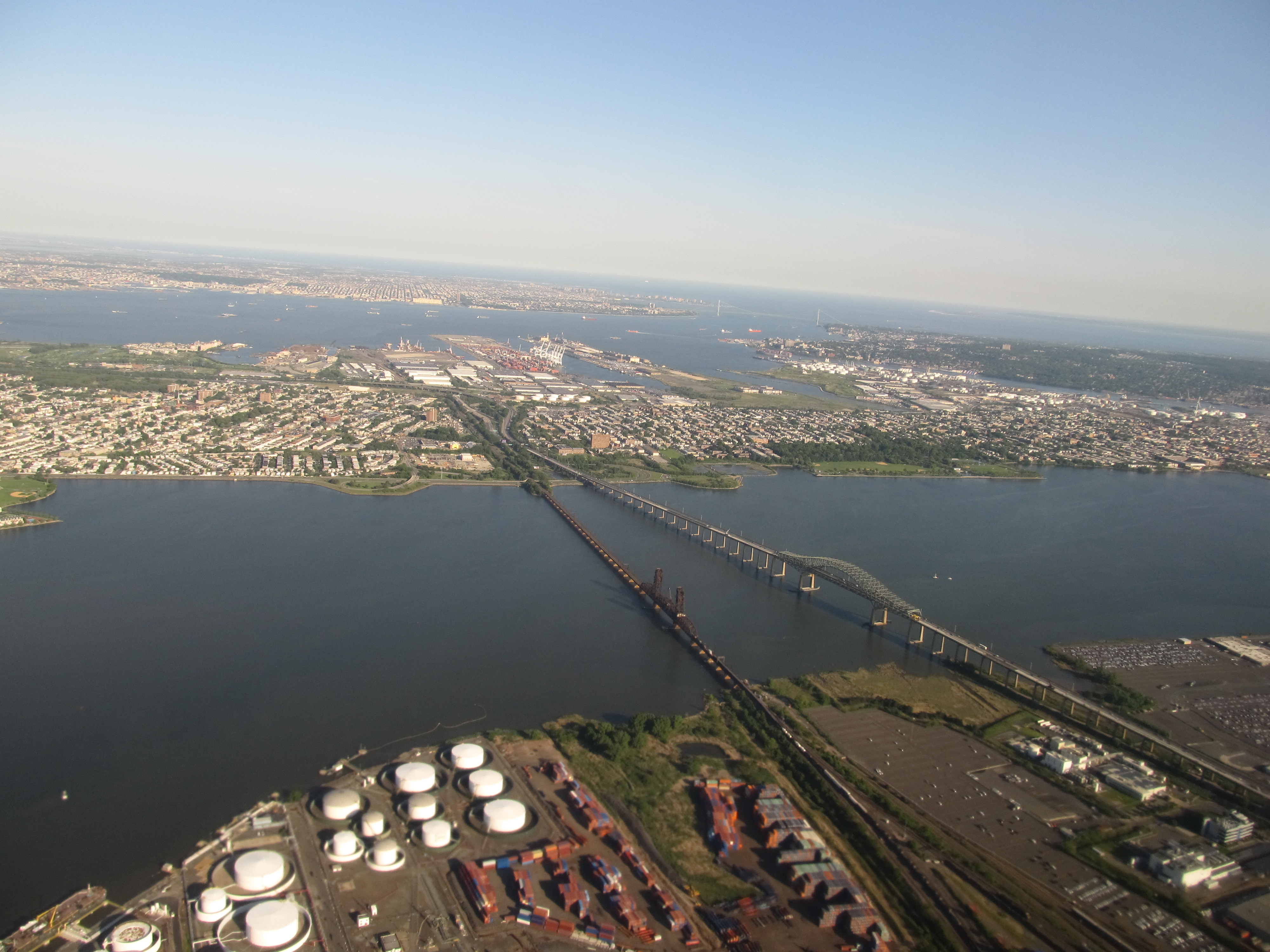
| DescriptionNew Jersey Turnpike Crossing Newark Bay.jpg |
The New Jersey Turnpike (shortened to NJTP and colloquially known to New Jerseyans as "the Turnpike") is a toll road in New Jersey, maintained by the New Jersey Turnpike Authority. According to the International Bridge, Tunnel and Turnpike Association, the Turnpike is the nation's sixth-busiest toll road and is among one of the most heavily traveled highways in the United States. Having a total of 122.40 mi (196.98 km), the Turnpike's southern terminus begins at Interstate 295 (I-295) near the border of Pennsville and Carneys Point Townships in Salem County, one mile east of the Delaware Memorial Bridge. Its northern terminus is located at the George Washington Bridge in Fort Lee, Bergen County. The Turnpike is a major thoroughfare providing access to various localities in New Jersey, as well as Delaware, Pennsylvania, and New York. The route divides into four roadways at Exit 8A, with lanes restricted to carrying only cars, and with lanes for cars, trucks and buses. <a href="http://en.wikipedia.org/wiki/New_Jersey_Turnpike" rel="nofollow">en.wikipedia.org/wiki/New_Jersey_Turnpike</a> <a href="http://en.wikipedia.org/wiki/Wikipedia:Text_of_Creative_Commons_Attribution-ShareAlike_3.0_Unported_License" rel="nofollow">en.wikipedia.org/wiki/Wikipedia:Text_of_Creative_Commons_...</a> |
||
| Date | |||
| Source | Flickr: New Jersey Turnpike Crossing Newark Bay | ||
| Author | Ken Lund | ||
| Permission (Reusing this file) |
This file is licensed under the Creative Commons Attribution-Share Alike 2.0 Generic license.
|
| Camera location | 40° 41′ 37.36″ N, 74° 06′ 46.63″ W | View this and other nearby images on: OpenStreetMap |
|---|
Captions
Items portrayed in this file
depicts
19 May 2012
40°41'37.360"N, 74°6'46.634"W
image/jpeg
File history
Click on a date/time to view the file as it appeared at that time.
| Date/Time | Thumbnail | Dimensions | User | Comment | |
|---|---|---|---|---|---|
| current | 20:09, 26 December 2012 | | 4,000 × 3,000 (2.41 MB) | Flickr upload bot | Uploaded from http://flickr.com/photo/75683070@N00/7238102930 using Flickr upload bot |
File usage
Metadata
This file contains additional information, probably added from the digital camera or scanner used to create or digitize it.
If the file has been modified from its original state, some details may not fully reflect the modified file.
| Camera manufacturer | Canon |
|---|---|
| Camera model | Canon PowerShot SX130 IS |
| Exposure time | 1/400 sec (0.0025) |
| F-number | f/3.4 |
| ISO speed rating | 80 |
| Date and time of data generation | 06:05, 19 May 2012 |
| Lens focal length | 5 mm |
| Orientation | Normal |
| Horizontal resolution | 180 dpi |
| Vertical resolution | 180 dpi |
| File change date and time | 06:05, 19 May 2012 |
| Y and C positioning | Co-sited |
| Exif version | 2.3 |
| Date and time of digitizing | 06:05, 19 May 2012 |
| Meaning of each component |
|
| Image compression mode | 3 |
| Shutter speed | 8.65625 |
| APEX aperture | 3.53125 |
| Exposure bias | −0.33333333333333 |
| Maximum land aperture | 3.53125 APEX (f/3.4) |
| Metering mode | Pattern |
| Flash | Flash did not fire, compulsory flash suppression |
| Supported Flashpix version | 1 |
| Color space | sRGB |
| Focal plane X resolution | 16,393.442622951 |
| Focal plane Y resolution | 16,393.442622951 |
| Focal plane resolution unit | inches |
| Sensing method | One-chip color area sensor |
| File source | Digital still camera |
| Custom image processing | Normal process |
| Exposure mode | Manual exposure |
| White balance | Auto white balance |
| Digital zoom ratio | 1 |
| Scene capture type | Landscape |
| Rating (out of 5) | 0 |