File:Planisphæri_cœleste.jpg
From Wikipedia, the free encyclopedia
Original file (5,812 × 3,972 pixels, file size: 19.07 MB, MIME type: image/jpeg)
| This is a file from the Wikimedia Commons. Information from its description page there is shown below. Commons is a freely licensed media file repository. You can help. |
Summary
| Author |
creator QS:P170,Q1402952 |
|||||||||||||||||||||||||
| Description |
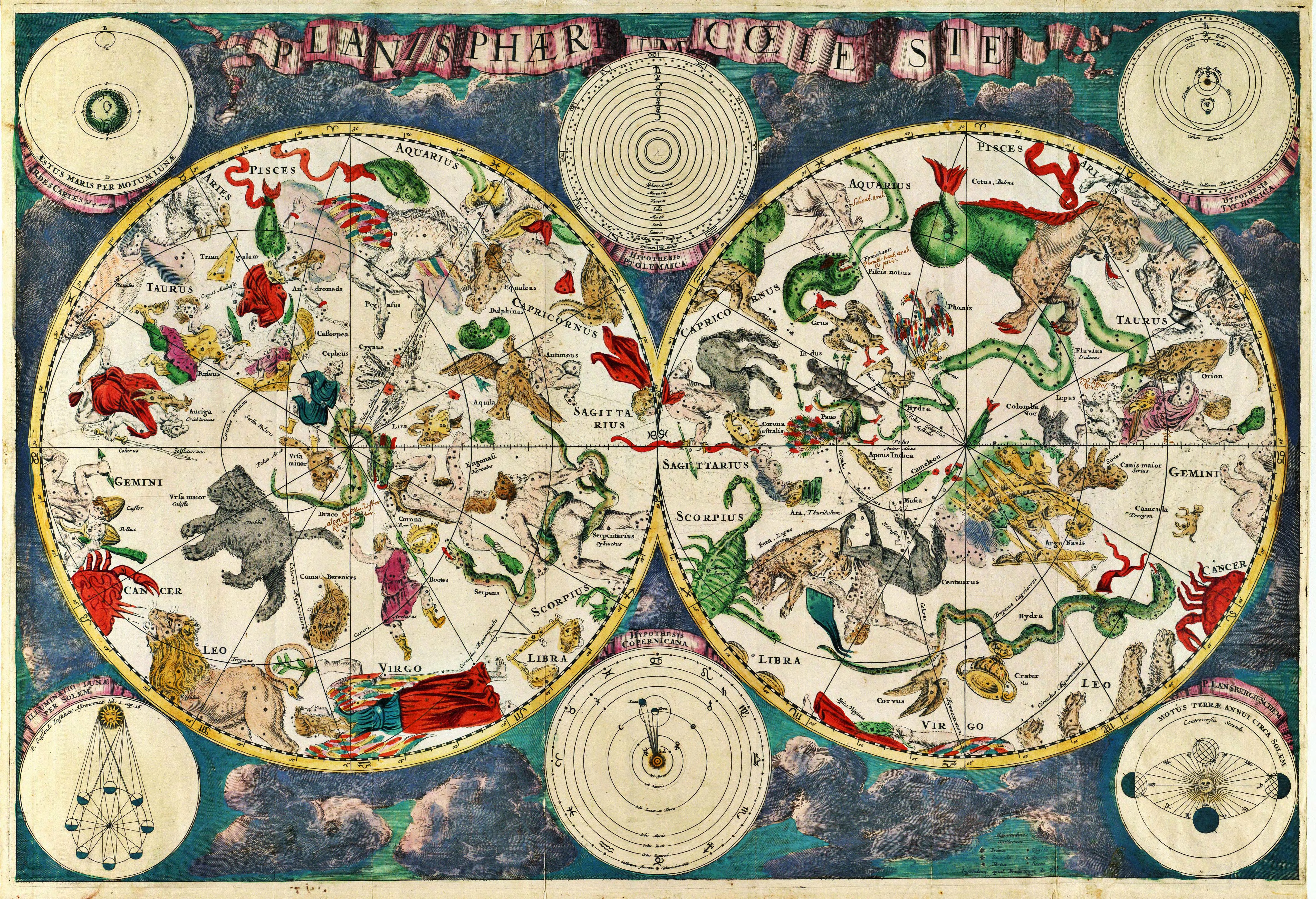
Planisphærium cœleste, denmark, Frederik V English: Celestial map Français : Carte céleste |
|||||||||||||||||||||||||
| Date |
1670 date QS:P571,+1670-00-00T00:00:00Z/9 |
|||||||||||||||||||||||||
| References | Koninklijke Deense Bibliotheek | |||||||||||||||||||||||||
| Source/Photographer | Transferred from en.wikipedia to Commons. Scanned by Janke | |||||||||||||||||||||||||
Original upload log
- 2007-03-10 18:20 Janke 1804×1236×8 (3237455 bytes) Celestial map from the 17th century, by the Dutch cartographer Frederik de Wit. Scanned by uploader
Licensing
|
This is a faithful photographic reproduction of a two-dimensional, public domain work of art. The work of art itself is in the public domain for the following reason:
The official position taken by the Wikimedia Foundation is that "faithful reproductions of two-dimensional public domain works of art are public domain".
This photographic reproduction is therefore also considered to be in the public domain in the United States. In other jurisdictions, re-use of this content may be restricted; see Reuse of PD-Art photographs for details. | |||||
Captions
Items portrayed in this file
depicts
10 March 2007
image/jpeg
File history
Click on a date/time to view the file as it appeared at that time.
| Date/Time | Thumbnail | Dimensions | User | Comment | |
|---|---|---|---|---|---|
| current | 10:01, 23 December 2010 | | 5,812 × 3,972 (19.07 MB) | Joopr | Hogere resolutie |
| 00:18, 29 May 2007 |  | 1,804 × 1,236 (3.09 MB) | STyx | {{Information |Description= {{la}}Planisphæri cœleste {{en}}Celestial map from the 17th century, by the Dutch cartographer Frederik de Wit. {{fr}}Carte céleste du XVII ème siècle, réalisée par le cartographe hollandais Frederik de Wit. {{du}}[http |
File usage
- Astronomy
- Constellation
- Map
- Natural philosophy
- Star chart
- Talk:Astronomy/Archive 2
- User:Sj/olpc dictionary images/500
- Wikipedia:Featured picture candidates/17th century star map
- Wikipedia:Featured picture candidates/March-2007
- Wikipedia:Wikipedia Signpost/2013-01-14/WikiProject report
- Wikipedia:Wikipedia Signpost/Single/2013-01-14
- Portal:Maps/Maps/Historical
- Portal:Maps/Maps/Historical/7
Global file usage
The following other wikis use this file:
- Usage on ar.wikipedia.org
- Usage on ar.wikibooks.org
- Usage on ast.wikipedia.org
- Usage on az.wikipedia.org
- Usage on bar.wikipedia.org
- Usage on ba.wikipedia.org
- Usage on bg.wikipedia.org
- Usage on bn.wikipedia.org
- Usage on ca.wikipedia.org
- Usage on cbk-zam.wikipedia.org
- Usage on ce.wikipedia.org
- Usage on cs.wikipedia.org
- Usage on de.wikipedia.org
- Usage on el.wikipedia.org
- Usage on en.wikiquote.org
- Usage on eo.wikipedia.org
- Usage on es.wikipedia.org
- Usage on fi.wikipedia.org
- Usage on fr.wikipedia.org
- Usage on gl.wikipedia.org
- Usage on gu.wikipedia.org
- Usage on he.wikipedia.org
- Usage on hi.wikipedia.org
- Usage on hr.wikipedia.org
- Usage on hy.wikipedia.org
- Usage on hyw.wikipedia.org
- Usage on id.wikipedia.org
View more global usage of this file.
Metadata
This file contains additional information, probably added from the digital camera or scanner used to create or digitize it.
If the file has been modified from its original state, some details may not fully reflect the modified file.
| _error | 0 |
|---|