File:Puducherry_District_Outline.png
From Wikipedia, the free encyclopedia
Size of this preview: 585 × 600 pixels. Other resolutions: 234 × 240 pixels | 468 × 480 pixels | 1,000 × 1,025 pixels.
Original file (1,000 × 1,025 pixels, file size: 163 KB, MIME type: image/png)
| This is a file from the Wikimedia Commons. Information from its description page there is shown below. Commons is a freely licensed media file repository. You can help. |
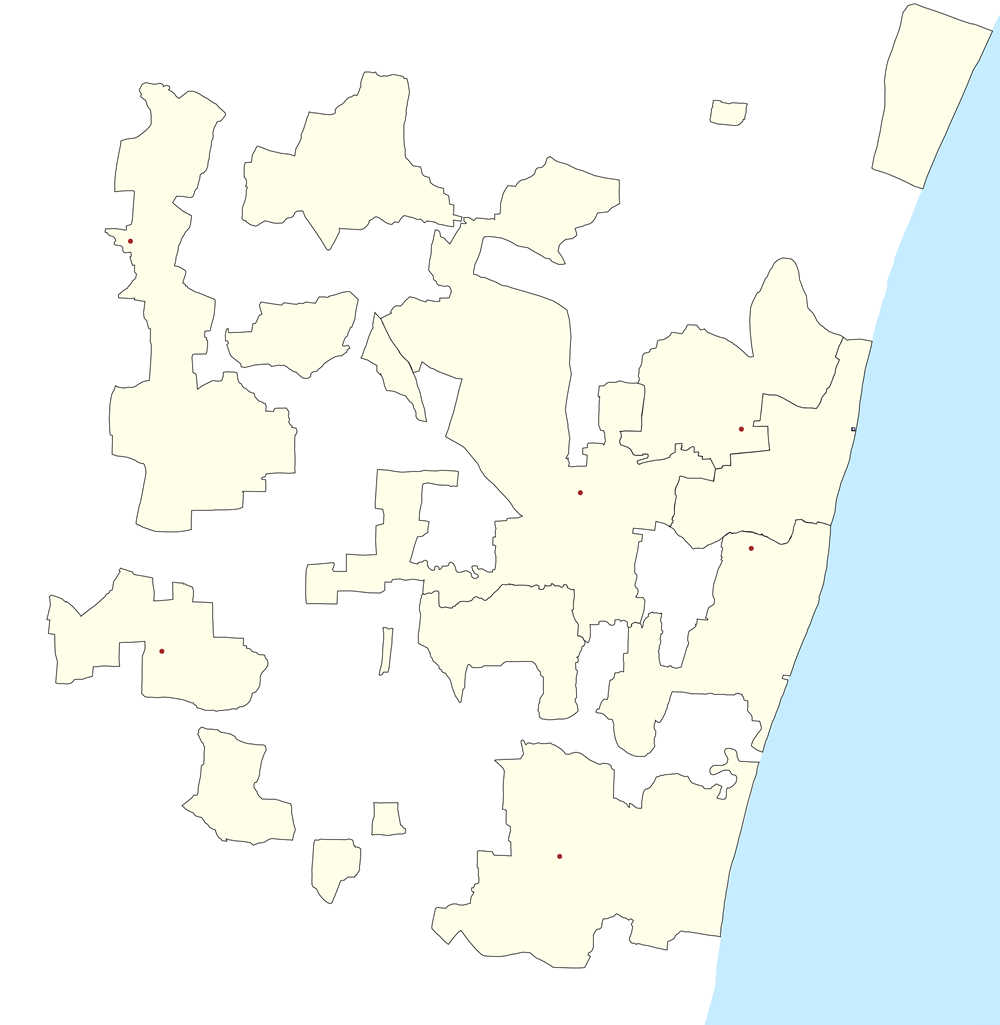
Map showing the location of the first French India Liberated Tribuvane Comnune.
Summary
| DescriptionPuducherry District Outline.png |
English: Puducherry District Outline with Communes |
| Date | |
| Source | Own work |
| Author | Pselvaganapathy |
Licensing
I, the copyright holder of this work, hereby publish it under the following license:
This file is licensed under the Creative Commons Attribution-Share Alike 3.0 Unported license.
- You are free:
- to share – to copy, distribute and transmit the work
- to remix – to adapt the work
- Under the following conditions:
- attribution – You must give appropriate credit, provide a link to the license, and indicate if changes were made. You may do so in any reasonable manner, but not in any way that suggests the licensor endorses you or your use.
- share alike – If you remix, transform, or build upon the material, you must distribute your contributions under the same or compatible license as the original.
Captions
Puducherry District
Items portrayed in this file
depicts
some value
23 February 2013
File history
Click on a date/time to view the file as it appeared at that time.
| Date/Time | Thumbnail | Dimensions | User | Comment | |
|---|---|---|---|---|---|
| current | 07:55, 25 February 2013 | | 1,000 × 1,025 (163 KB) | Pselvaganapathy | Stoke width increased for better map |
| 07:27, 25 February 2013 |  | 1,000 × 1,025 (149 KB) | Pselvaganapathy | Resize to a visible resolution (medium) | |
| 06:51, 25 February 2013 |  | 4,000 × 4,099 (633 KB) | Pselvaganapathy | Reverted to version as of 06:49, 25 February 2013 | |
| 06:50, 25 February 2013 |  | 4,000 × 4,099 (653 KB) | Pselvaganapathy | Reverted to version as of 06:38, 25 February 2013 | |
| 06:49, 25 February 2013 |  | 4,000 × 4,099 (633 KB) | Pselvaganapathy | Changed Colors | |
| 06:38, 25 February 2013 |  | 4,000 × 4,099 (653 KB) | Pselvaganapathy | Color changes in Map | |
| 17:13, 23 February 2013 |  | 4,000 × 4,099 (672 KB) | Pselvaganapathy | User created page with UploadWizard |
File usage
The following pages on the English Wikipedia use this file (pages on other projects are not listed):
- Abishegapakkam
- Andiarpalayam
- Aranganur
- Arikamedu
- Ariyankuppam
- Ariyankuppam (West)
- Bahour
- Bahour (East)
- Bahour Lake
- Basilica of the Sacred Heart of Jesus, Pondicherry
- Chinna Karaiyamputhur
- Dharmapuri (Puducherry)
- Earipakkam
- Embalam
- Immaculate Conception Cathedral, Pondicherry
- Kaduvanur
- Kakkayanthope
- Kalmandapam
- Karaiyamputhur
- Karikalampakkam
- Kariyamanickam
- Kirumampakkam
- Kizhoor, Puducherry
- Korkadu
- Krishnavaram, Puducherry
- Kudiyiruppupalayam
- Kurumbapet
- Kuruvinatham
- Maducarai
- Manakuppam
- Manamedu
- Manappattu
- Manavely
- Mangalam, Puducherry
- Mannadipattu
- Moorthikuppam
- Muthialpet
- Nallavadu
- Nettapakkam
- Nonankuppam
- Our Lady of Angels Church, Puducherry
- Panayadikuppam
- Panchavatee Hanuman Temple
- Pandasozhanallur
- Pannithittu
- Parikkalpattu
- Pillaiyarkuppam, Bahour
- Pondicherry
- Pondicherry Airport
- Puducherry district
- Pudukuppam, Bahour
- Seliamedu
- Sembiapalayam
- Siege of Pondicherry (1748)
- Siege of Pondicherry (1760)
- Siege of Pondicherry (1778)
- Siege of Pondicherry (1793)
- Sooramangalam
- Soriyankuppam
- Thavalakuppam
- Thimmanayakanpalayam
- Thirubuvanai
- Thirukkanur
- Uzhavarkarai
- Varadharaja Perumal Temple, Puducherry
- Vedapureeswarar Temple, Pondicherry
- Veerampattinam
- User:Nvvchar/sandbox/Arikamedu
- User:Pselvaganapathy
- Module:Location map/data/India Pondicherry
- Module:Location map/data/India Puducherry
- Module:Location map/data/India Puducherry/doc
Global file usage
The following other wikis use this file:
- Usage on ar.wikipedia.org
- Usage on azb.wikipedia.org
- ویرامپاتینام
- کادووانور
- مانقالام, پودوچری
- ماناپاتو
- مانامدو
- ماناکوپام
- مادوکارای
- آبیشقاپاکام
- سمبیاپالایام
- سلیامدو
- پودوکوپام, باهور
- پورنانکوپام
- پیلاییارکوپام, باهور
- پاریکالپاتو
- پانیتیتو
- پانداسوژانالور
- پانایادیکوپام
- نونانکوپام
- امبالام
- ایریپاکام
- چینا کاراییامپوتور
- نالاوادو
- مورتیکوپام
- آرانقانور
- سورییانکوپام
- سورامانقالام
- کیژور, پودوچری
- آندیارپالایام
- کیرومامپاکام
- کودییروپوپالایام
- کورکادو
- کاراییامپوتور
- کوروویناتام
- کاریکالامپاکام
- کارییامانیکام
- تاوالاکوپام
- کالمانداپام
- تیمانایاکانپالایام
- کریشناوارام, پودوچری
- باهور (دوغو)
- Usage on bh.wikipedia.org
- Usage on bn.wikipedia.org
- Usage on ceb.wikipedia.org
- Usage on el.wikipedia.org
- Usage on fa.wikipedia.org
View more global usage of this file.
Metadata
This file contains additional information, probably added from the digital camera or scanner used to create or digitize it.
If the file has been modified from its original state, some details may not fully reflect the modified file.
| Horizontal resolution | 37.79 dpc |
|---|---|
| Vertical resolution | 37.79 dpc |
Retrieved from "https://en.wikipedia.org/wiki/File:Puducherry_District_Outline.png"