File:Relief_Map_of_Romania.png
From Wikipedia, the free encyclopedia
Size of this preview: 800 × 572 pixels. Other resolutions: 320 × 229 pixels | 640 × 457 pixels | 806 × 576 pixels.
Original file (806 × 576 pixels, file size: 716 KB, MIME type: image/png)
| This is a file from the Wikimedia Commons. Information from its description page there is shown below. Commons is a freely licensed media file repository. You can help. |
Summary
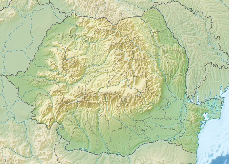
| DescriptionRelief Map of Romania.png |
Русский: Физическая карта Румынии.
English: Relief map of Romania. |
| Date | |
| Source |
|
| Author | Nzeemin |
| Other versions |
|

Licensing
I, the copyright holder of this work, hereby publish it under the following license:
This file is licensed under the Creative Commons Attribution-Share Alike 3.0 Unported license.
- You are free:
- to share – to copy, distribute and transmit the work
- to remix – to adapt the work
- Under the following conditions:
- attribution – You must give appropriate credit, provide a link to the license, and indicate if changes were made. You may do so in any reasonable manner, but not in any way that suggests the licensor endorses you or your use.
- share alike – If you remix, transform, or build upon the material, you must distribute your contributions under the same or compatible license as the original.
Captions
Add a one-line explanation of what this file represents
Items portrayed in this file
depicts
image/png
File history
Click on a date/time to view the file as it appeared at that time.
| Date/Time | Thumbnail | Dimensions | User | Comment | |
|---|---|---|---|---|---|
| current | 20:20, 5 October 2015 | | 806 × 576 (716 KB) | Spiridon Ion Cepleanu | Cosmetic little change in the Danube Delta |
| 16:47, 16 September 2012 |  | 806 × 576 (797 KB) | Nzeemin | User created page with UploadWizard |
File usage
More than 100 pages use this file. The following list shows the first 100 pages that use this file only. A full list is available.
- 1977 Vrancea earthquake
- Abrud (river)
- Abucea
- Agapia (river)
- Agriș (Luț)
- Agrișteu
- Agârbiciu (river)
- Agăș (river)
- Aita (river)
- Aiud (river)
- Alba (Șușița)
- Alba Iulia
- Albac (Hârtibaciu)
- Albești (Bahlueț)
- Albești (Black Sea)
- Albești (Cungrișoara)
- Albuia
- Almaș (Cracău)
- Aluniș (Călata)
- Alunoasa
- Amaradia (Dolj)
- Amărăzuia
- Bahlui
- Battle of Adamclisi
- Battle of Baia
- Battle of Călugăreni
- Battle of Posada
- Bistrița (Olt)
- Bonțida Bánffy Castle
- Botfei
- Bucharest
- Bucura Lake
- Budești Josani church
- Buzău Pass
- Bâlea Lake
- Casimcea (river)
- Cerna (Danube)
- Churches of Moldavia
- Constanța
- Crasna (Tisza)
- Crișul Alb
- Crișul Negru
- Crișul Repede
- Cupa României
- Câlniștea
- Dacian Fortresses of the Orăștie Mountains
- Danube Delta
- Domitian's Dacian War
- Drăgoteni
- Dâmbovnic
- Franz Joseph and Saint Anne Cliffs
- Gurguiata
- Gâlcești (river)
- Găureni (Țibleș)
- Histria (ancient city)
- Hârtibaciu
- Jijia
- Karaš
- Lake Razelm
- Lake Sfânta Ana
- Lake Sinoe
- Lake Siutghiol
- Lake Snagov
- Meziad (river)
- Milcov (Siret)
- Moldoveanu Peak
- NATO Integrated Air Defense System
- Neajlov
- Negreni (river)
- Parângu Mare
- Peleaga
- Peștera cu Oase
- Plosca (river)
- Poienița (river)
- Prisaca
- Putna (Siret)
- Râul Doamnei
- Râura
- Sibiu
- Sinești (Bahlueț)
- Slăvuța
- Supercupa României
- Săsar
- Talpe
- Teleajen
- Third Battle of Tapae
- Tihuța Pass
- Timișoara
- Timișoara Traian Vuia International Airport
- Tișița
- Topolog (Danube)
- Turnu Roșu Pass
- Târnava
- Valea Mare (Crișul Negru)
- Valea Mare (Șuncuiș)
- Valea Mare Cărpinoasa
- Valea Roșie (Crișul Negru)
- Vedea
- Villages with fortified churches in Transylvania
- Vulcan Pass
View more links to this file.
Global file usage
The following other wikis use this file:
- Usage on ar.wikipedia.org
- Usage on ast.wikipedia.org
- Usage on azb.wikipedia.org
- Usage on az.wikipedia.org
- Şablon:Yer xəritəsi Rumıniya
- Retezat Milli Parkı
- Buçeci dağları
- Maçin dağları
- Cerdap I
- Çiomadul
- İsmayıl Çatalı
- Apuzeni Milli Parkı
- Feqeraş (dağ massivi)
- Buçeqi Təbiət Parkı
- Keliman dağları
- Amara gölü
- Rapa Rozi
- Mureş Daşqını Milli Parkı
- Çexey Təbiət Yasaqlığı
- Letea meşəsi
- Lapiş meşəsi
- Turda dərəsi
- Nera-Beuşnitsa Milli Parkı
- "Balta Mika" Milli Parkı
- Semenik Milli Parkı
- Berka palçıq vulkanları
- Skerişoara mağarası
- Moldova yüksəkliyi
- Usage on ba.wikipedia.org
- Usage on bcl.wikipedia.org
- Usage on be.wikipedia.org
View more global usage of this file.
Metadata
This file contains additional information, probably added from the digital camera or scanner used to create or digitize it.
If the file has been modified from its original state, some details may not fully reflect the modified file.
| Horizontal resolution | 35.43 dpc |
|---|---|
| Vertical resolution | 35.43 dpc |
Retrieved from "https://en.wikipedia.org/wiki/File:Relief_Map_of_Romania.png"