File:Relief_map_of_Texas.png
From Wikipedia, the free encyclopedia
Size of this preview: 606 × 599 pixels. Other resolutions: 243 × 240 pixels | 485 × 480 pixels | 1,000 × 989 pixels.
Original file (1,000 × 989 pixels, file size: 1.28 MB, MIME type: image/png)
| This is a file from the Wikimedia Commons. Information from its description page there is shown below. Commons is a freely licensed media file repository. You can help. |
Summary
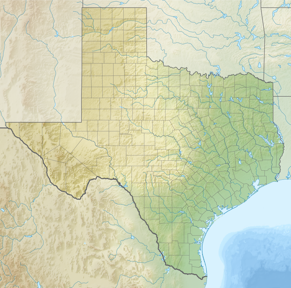
| DescriptionRelief map of Texas.png |
Русский: Физическая карта штата Техас (США). English: Relief map of Texas (USA). |
| Date | |
| Source |
|
| Author | Nzeemin |
| Other versions |
<gallery>File:USA Texas location
|
Licensing
I, the copyright holder of this work, hereby publish it under the following license:
This file is licensed under the Creative Commons Attribution-Share Alike 3.0 Unported license.
- You are free:
- to share – to copy, distribute and transmit the work
- to remix – to adapt the work
- Under the following conditions:
- attribution – You must give appropriate credit, provide a link to the license, and indicate if changes were made. You may do so in any reasonable manner, but not in any way that suggests the licensor endorses you or your use.
- share alike – If you remix, transform, or build upon the material, you must distribute your contributions under the same or compatible license as the original.
Captions
Relief map of Texas
14 October 2012
File history
Click on a date/time to view the file as it appeared at that time.
| Date/Time | Thumbnail | Dimensions | User | Comment | |
|---|---|---|---|---|---|
| current | 13:40, 14 October 2012 | | 1,000 × 989 (1.28 MB) | Nzeemin | User created page with UploadWizard |
File usage
More than 100 pages use this file. The following list shows the first 100 pages that use this file only. A full list is available.
- Abbott, Texas
- Abernathy, Texas
- Abilene, Texas
- Addison, Texas
- Amarillo, Texas
- Amherst, Texas
- Anderson, Texas
- Anton, Texas
- Arlington, Texas
- Astrodome
- Austin, Texas
- Battle of Palmito Ranch
- Battle of San Jacinto
- Beaumont, Texas
- Belton, Texas
- Big Spring, Texas
- Bovina, Texas
- Brownsville, Texas
- Bryan, Texas
- Carrollton, Texas
- Cinco Ranch, Texas
- College Station, Texas
- Comanche, Texas
- Comfort, Texas
- Corpus Christi, Texas
- Dallas
- Denison, Texas
- Devine, Texas
- Earth, Texas
- El Paso, Texas
- Ellington Airport (Texas)
- Floydada, Texas
- Fort Bliss
- Fort Worth, Texas
- Garland, Texas
- Girard, Texas
- Greatwood, Sugar Land, Texas
- Hale Center, Texas
- Harlingen, Texas
- Harper, Texas
- Houston
- Irving, Texas
- Killeen, Texas
- Kingsland, Texas
- Knox City, Texas
- Lady Bird Lake
- Lago Vista, Texas
- Lake Austin
- Lake Kickapoo
- Lake Travis
- Laredo, Texas
- Levelland, Texas
- Littlefield, Texas
- Lockney, Texas
- Longview, Texas
- Lorena, Texas
- Lufkin, Texas
- Midland, Texas
- Midway, Texas
- Morton, Texas
- Nazareth, Texas
- New Braunfels, Texas
- New Deal, Texas
- New Home, Texas
- O'Donnell, Texas
- Odessa, Texas
- Olton, Texas
- Padre Island National Seashore
- Palo Duro Canyon
- Petersburg, Texas
- Plano, Texas
- Port Arthur, Texas
- Ralls, Texas
- Ransom Canyon, Texas
- Ropesville, Texas
- Roscoe, Texas
- Round Rock, Texas
- Rule, Texas
- Sabine River (Texas–Louisiana)
- San Angelo, Texas
- San Antonio
- Shallowater, Texas
- Slaton, Texas
- Smyer, Texas
- Spade, Texas
- Spindletop
- Stamford, Texas
- Stonewall, Texas
- Sudan, Texas
- Sugar Land, Texas
- Temple, Texas
- Texarkana, Texas
- The Woodlands, Texas
- USS Lexington (CV-16)
- Van Horn, Texas
- Victoria, Texas
- Waco, Texas
- Waskom, Texas
- Whiteface, Texas
- Wichita Falls, Texas
View more links to this file.
Global file usage
The following other wikis use this file:
- Usage on als.wikipedia.org
- Usage on ar.wikipedia.org
- Usage on ast.wikipedia.org
- Usage on azb.wikipedia.org
- کون، تکزاس
- سان-خاسینتو ساواشی
- کانادلاریا، تکزاس
- بوکیلاس، تکزاس
- چری اسپرینق، تکزاس
- کرباپل، تکزاس
- قریپتاون، تکزاس
- ویلو سیتی، تکزاس
- بلومنتال، تکزاس
- قریت وود شوقر لند، تکزاس
- استونوال تکزاس
- بووت، تکزاس
- کینقزلند، تکزاس
- برلی، تکزاس
- پیترز، تکزاس
- چسترویل، تکزاس
- دو، تکزاس
- رکسویل، تکزاس
- قلن فلورا، تکزاس
- هانت، تکزاس
- هارپر، تکزاس
- کنت، تکزاس
- سینکو رانچ، تکزاس
- کاتون سنتر، تکزاس
- اسپید، تکزاس
- ویتهرال، تکزاس
- فیلدتون، تکزاس
- بولا، تکزاس
- جرارد، تکزاس
- فلووانا، تکزاس
- کلوز سیتی، تکزاس
- افتن، تکزاس
- قراسلند، تکزاس
- آکوف، تکزاس
- سونزون، تکزاس
- مونتاین هوم، تکزاس
- تایتون، تکزاس
- نازئیرت، تکزاس
- کراب، تکزاس
- نیو هوم، تکزاس
- تاسکوزا، تکزاس
- کوتبرت، تکزاس
- تاونر، تکزاس
- آلتایر، تکزاس
- تی پی سیتی، تکزاس
View more global usage of this file.
Metadata
This file contains additional information, probably added from the digital camera or scanner used to create or digitize it.
If the file has been modified from its original state, some details may not fully reflect the modified file.
| Horizontal resolution | 35.43 dpc |
|---|---|
| Vertical resolution | 35.43 dpc |
| Software used |
Retrieved from "https://en.wikipedia.org/wiki/File:Relief_map_of_Texas.png"