File:River_Hart_-_geograph.org.uk_-_141085.jpg
From Wikipedia, the free encyclopedia
No higher resolution available.
River_Hart_-_geograph.org.uk_-_141085.jpg (640 × 480 pixels, file size: 90 KB, MIME type: image/jpeg)
| This is a file from the Wikimedia Commons. Information from its description page there is shown below. Commons is a freely licensed media file repository. You can help. |
Summary
| DescriptionRiver Hart - geograph.org.uk - 141085.jpg |
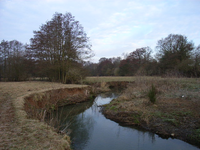
English: River Hart just upstream of the outlet of Hartley Wintney sewage treatment works. The waters of the Hart are destined for the North Sea, via the Rivers Whitewater, Blackwater, Loddon and Thames. (The white speck is not an error of the photo, it's litter.) |
| Date | |
| Source | From geograph.org.uk |
| Author | Andrew Smith |
| Attribution (required by the license) InfoField | Andrew Smith / River Hart / |
InfoField | Andrew Smith / River Hart |
| Object location | 51° 19′ 02″ N, 0° 54′ 00″ W | View this and other nearby images on: OpenStreetMap |
|---|
Licensing

|
This image was taken from the Geograph project collection. See this photograph's page on the Geograph website for the photographer's contact details. The copyright on this image is owned by Andrew Smith and is licensed for reuse under the Creative Commons Attribution-ShareAlike 2.0 license.
|
This file is licensed under the Creative Commons Attribution-Share Alike 2.0 Generic license.
Attribution: Andrew Smith
- You are free:
- to share – to copy, distribute and transmit the work
- to remix – to adapt the work
- Under the following conditions:
- attribution – You must give appropriate credit, provide a link to the license, and indicate if changes were made. You may do so in any reasonable manner, but not in any way that suggests the licensor endorses you or your use.
- share alike – If you remix, transform, or build upon the material, you must distribute your contributions under the same or compatible license as the original.
Captions
Add a one-line explanation of what this file represents
Items portrayed in this file
depicts
some value
23 March 2006
51°19'2.3"N, 0°54'0.0"W
File history
Click on a date/time to view the file as it appeared at that time.
| Date/Time | Thumbnail | Dimensions | User | Comment | |
|---|---|---|---|---|---|
| current | 09:08, 31 January 2010 | | 640 × 480 (90 KB) | GeographBot | == {{int:filedesc}} == {{Information |description={{en|1=River Hart. The waters of the Hart are destined for the North Sea, via the Rivers Whitewater, Blackwater, Loddon and Thames. (The white speck is not an error of the photo, it's litter.)}} |date=2006 |
File usage
The following pages on the English Wikipedia use this file (pages on other projects are not listed):
Metadata
This file contains additional information, probably added from the digital camera or scanner used to create or digitize it.
If the file has been modified from its original state, some details may not fully reflect the modified file.
| Camera manufacturer | RICOH |
|---|---|
| Camera model | Caplio R3 |
| Copyright holder | (C) by Caplio R3 User |
| Date and time of data generation | 07:07, 23 March 2006 |
| Orientation | Normal |
| Horizontal resolution | 72 dpi |
| Vertical resolution | 72 dpi |
| Y and C positioning | Co-sited |
| Exif version | 2.21 |
| Date and time of digitizing | 12:15, 23 March 2006 |
| Image compression mode | 2 |
| Color space | sRGB |