File:The_River_Ching_-_geograph.org.uk_-_41495.jpg
From Wikipedia, the free encyclopedia
No higher resolution available.
The_River_Ching_-_geograph.org.uk_-_41495.jpg (640 × 592 pixels, file size: 244 KB, MIME type: image/jpeg)
| This is a file from the Wikimedia Commons. Information from its description page there is shown below. Commons is a freely licensed media file repository. You can help. |
Summary
| DescriptionThe River Ching - geograph.org.uk - 41495.jpg |
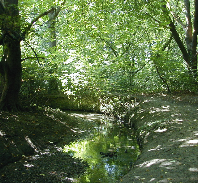
English: The River Ching. The geomorphological formation of the meanders and formation of the ox bow lakes are studied by geologists due to their constant changing |
| Date | |
| Source | From geograph.org.uk |
| Author | Brian Gotts |
| Attribution (required by the license) InfoField | Brian Gotts / The River Ching / |
InfoField | Brian Gotts / The River Ching |
| Object location | 51° 37′ N, 0° 01′ E | View this and other nearby images on: OpenStreetMap |
|---|
Licensing

|
This image was taken from the Geograph project collection. See this photograph's page on the Geograph website for the photographer's contact details. The copyright on this image is owned by Brian Gotts and is licensed for reuse under the Creative Commons Attribution-ShareAlike 2.0 license.
|
This file is licensed under the Creative Commons Attribution-Share Alike 2.0 Generic license.
Attribution: Brian Gotts
- You are free:
- to share – to copy, distribute and transmit the work
- to remix – to adapt the work
- Under the following conditions:
- attribution – You must give appropriate credit, provide a link to the license, and indicate if changes were made. You may do so in any reasonable manner, but not in any way that suggests the licensor endorses you or your use.
- share alike – If you remix, transform, or build upon the material, you must distribute your contributions under the same or compatible license as the original.
Captions
Add a one-line explanation of what this file represents
Items portrayed in this file
depicts
some value
19 July 2000
51°37'23"N, 0°0'36"E
File history
Click on a date/time to view the file as it appeared at that time.
| Date/Time | Thumbnail | Dimensions | User | Comment | |
|---|---|---|---|---|---|
| current | 19:28, 30 January 2010 | | 640 × 592 (244 KB) | GeographBot | == {{int:filedesc}} == {{Information |description={{en|1=The River Ching. The geomorphological formation of the meanders and formation of the ox bow lakes are studied by geologists due to their constant changing }} |date=2000-07-19 |source=From [http://ww |
File usage
The following pages on the English Wikipedia use this file (pages on other projects are not listed):
Global file usage
The following other wikis use this file:
- Usage on arz.wikipedia.org
- Usage on da.wikipedia.org
- Usage on de.wikipedia.org
- Usage on nn.wikipedia.org
- Usage on no.wikipedia.org
- Usage on www.wikidata.org
Metadata
This file contains additional information, probably added from the digital camera or scanner used to create or digitize it.
If the file has been modified from its original state, some details may not fully reflect the modified file.
| Orientation | Normal |
|---|---|
| Horizontal resolution | 100 dpi |
| Vertical resolution | 100 dpi |
| Software used | Adobe Photoshop CS Windows |
| File change date and time | 21:14, 22 August 2005 |
| Color space | sRGB |