File:White_Hart_Lane_Aerial.jpg
From Wikipedia, the free encyclopedia
No higher resolution available.
White_Hart_Lane_Aerial.jpg (586 × 453 pixels, file size: 114 KB, MIME type: image/jpeg)
| This is a file from the Wikimedia Commons. Information from its description page there is shown below. Commons is a freely licensed media file repository. You can help. |
Summary
| DescriptionWhite Hart Lane Aerial.jpg |
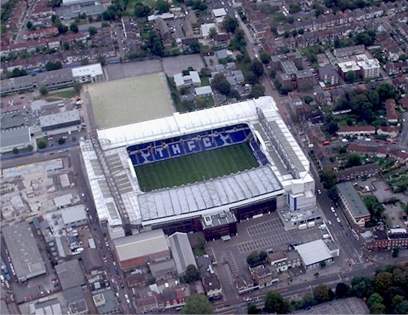
English: Aerial view Tottenham Hotspur Football Club Photograph taken from Helicopter encircling the ground. |
| Date | |
| Source | From geograph.org.uk |
| Author | Alan Swain |
| Camera location | 51° 36′ 12.63″ N, 0° 03′ 55.77″ W | View this and other nearby images on: OpenStreetMap |
|---|
Licensing

|
This image was taken from the Geograph project collection. See this photograph's page on the Geograph website for the photographer's contact details. The copyright on this image is owned by Alan Swain and is licensed for reuse under the Creative Commons Attribution-ShareAlike 2.0 license.
|
This file is licensed under the Creative Commons Attribution-Share Alike 2.0 Generic license.
Attribution: Alan Swain
- You are free:
- to share – to copy, distribute and transmit the work
- to remix – to adapt the work
- Under the following conditions:
- attribution – You must give appropriate credit, provide a link to the license, and indicate if changes were made. You may do so in any reasonable manner, but not in any way that suggests the licensor endorses you or your use.
- share alike – If you remix, transform, or build upon the material, you must distribute your contributions under the same or compatible license as the original.
Captions
Add a one-line explanation of what this file represents
Items portrayed in this file
depicts
some value
51°36'12.625"N, 0°3'55.768"W
September 2005
File history
Click on a date/time to view the file as it appeared at that time.
| Date/Time | Thumbnail | Dimensions | User | Comment | |
|---|---|---|---|---|---|
| current | 12:08, 5 August 2018 | | 586 × 453 (114 KB) | Hzh | Slight trim to remove white edge |
| 09:56, 23 May 2008 |  | 599 × 463 (113 KB) | Northmetpit | {{Information |Description= Picture of White Hart Lane home of Tottenham Hotspur F.C |Source={http://www.geograph.org.uk/photo/689335 Geograph] |Date= September 2005 |Author=[http://www.geograph.org.uk/profile/ Alan Swain] |Permission=Yes |other_ |
File usage
The following pages on the English Wikipedia use this file (pages on other projects are not listed):
- History of Tottenham Hotspur F.C.
- List of Premier League stadiums
- Tottenham Hotspur F.C.
- Tottenham Hotspur F.C. 3–4 Manchester City F.C. (2004)
- White Hart Lane
- Talk:Football in London
- Talk:List of football stadiums in England/Archive 1
- User:Falastur2/Spurs 3 - City 4
- User:Jts1882/maps/stadiums
- User:The Kardiac Kid
- Wikipedia talk:WikiProject Football/Archive 116
- Template:Football map/demo
- Template:Football map/demo3
Global file usage
The following other wikis use this file:
- Usage on az.wikipedia.org
- Usage on ckb.wikipedia.org
- Usage on da.wikipedia.org
- Usage on de.wikipedia.org
- Usage on el.wikipedia.org
- Usage on es.wikipedia.org
- Usage on et.wikipedia.org
- Usage on eu.wikipedia.org
- Usage on fa.wikipedia.org
- Usage on fr.wikipedia.org
- Usage on he.wikipedia.org
- Usage on hu.wikipedia.org
- Usage on id.wikipedia.org
- Usage on it.wikipedia.org
- Usage on ka.wikipedia.org
- Usage on ko.wikipedia.org
- Usage on nl.wikipedia.org
- Usage on nn.wikipedia.org
- Usage on pt.wikipedia.org
- Usage on ro.wikipedia.org
- Usage on ru.wikipedia.org
- Usage on simple.wikipedia.org
- Usage on sr.wikipedia.org
- Usage on sv.wikipedia.org
- Usage on test2.wikipedia.org
- Usage on uk.wikipedia.org
- Usage on uz.wikipedia.org
- Usage on vi.wikipedia.org
- Usage on www.wikidata.org
- Usage on zh.wikipedia.org
Retrieved from "https://en.wikipedia.org/wiki/File:White_Hart_Lane_Aerial.jpg"