Lake Katam
From Wikipedia, the free encyclopedia
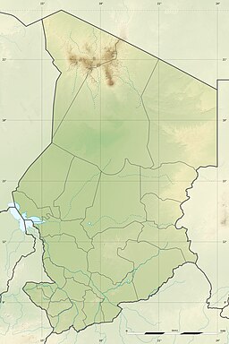
The Lake Katam is one of the larger lakes in Ounianga Kebir, a lake system in the Borkou-Ennedi-Tibesti Region in the north-east basin of Chad. These lakes are notable for their running in the north–south headlands, by the Trade wind are formed. They are the remnant of a much larger lake, that filled the basin during the so-called green Sahara-time, which lasted from about BC 10000–1500.
| Lake Katam | |
|---|---|
 | |
| Location | Sahara Chad |
| Coordinates | 19°1′N 20°30′E |
| Primary inflows | subsurface; evaporation |
| Primary outflows | subsurface |
| Basin countries | Chad |
| Max. length | 2.4 km (1.5 mi) |
| Max. width | 1 km (0.62 mi) |
| Surface elevation | 377 m (1,237 ft) |
See also
Wikiwand in your browser!
Seamless Wikipedia browsing. On steroids.
Every time you click a link to Wikipedia, Wiktionary or Wikiquote in your browser's search results, it will show the modern Wikiwand interface.
Wikiwand extension is a five stars, simple, with minimum permission required to keep your browsing private, safe and transparent.


