Malšovice
Municipality in Ústí nad Labem, Czech Republic From Wikipedia, the free encyclopedia
Malšovice (German: Malschwitz) is a municipality and village in Děčín District in the Ústí nad Labem Region of the Czech Republic. It has about 1,000 inhabitants.
Malšovice | |
|---|---|
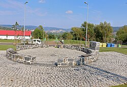
 Park in the centre of Malšovice | |
| Coordinates: 50°44′7″N 14°10′11″E | |
| Country | |
| Region | Ústí nad Labem |
| District | Děčín |
| First mentioned | 1515 |
| Area | |
| • Total | 13.03 km2 (5.03 sq mi) |
| Elevation | 200 m (700 ft) |
| Population (2024-01-01)[1] | |
| • Total | 1,011 |
| • Density | 78/km2 (200/sq mi) |
| Time zone | UTC+1 (CET) |
| • Summer (DST) | UTC+2 (CEST) |
| Postal codes | 405 02, 407 03 |
| Website | www |
Administrative parts
The villages of Borek, Choratice, Hliněná, Javory, Nová Bohyně and Stará Bohyně are administrative parts of Malšovice.
Etymology
The name is derived from the personal name Malša, meaning "the village of Malša's people".[2]
Geography
Jílové is located about 4 kilometres (2 mi) south of Děčín and 12 km (7 mi) northeast of Ústí nad Labem. It lies in the Elbe Sandstone Mountains and in the eponymous protected landscape area. The highest point is the hill Javorský vrch at 617 m (2,024 ft) above sea level. The municipality is situated on the left bank of the Elbe River, which forms the eastern municipal border.
History
The first written mention of Malšovice is from 1515, when the Děčín estate was sold to the Lords of Salhausen. It belonged to the Děčín estate until the establishment of independent municipalities in 1849. In 1849–1911, Malšovice was a part of Vilsnice (today a city part of Děčín). Since 1911, it has been a separate municipality.[3]
Until 1945, Malšovice had a German majority. In 1945, the German-speaking inhabitants were expelled and the municipality was resettled by Czechs.[3]
Demographics
Transport
The I/62 road (part of the European route E442) from Ústí nad Labem to Děčín passes through the municipality.
The village of Choratice has a train station on the railway line Děčín–Kadaň.[6]
Sights

The main landmark is the Church of Saint Procopius in Javory. It was built in the late Baroque style in 1748 as a chapel. In 1772, the wooden tower was added. In 1816, the chapel was further extended and became a church.[7]
References
External links
Wikiwand in your browser!
Seamless Wikipedia browsing. On steroids.
Every time you click a link to Wikipedia, Wiktionary or Wikiquote in your browser's search results, it will show the modern Wikiwand interface.
Wikiwand extension is a five stars, simple, with minimum permission required to keep your browsing private, safe and transparent.


