Nam Từ Liêm (South Từ Liêm) is an urban district (quận) of Hanoi, the capital city of Vietnam.[3] It was formed on 27 December 2013, when the rural Từ Liêm district was split into two urban districts: Bắc Từ Liêm and Nam Từ Liêm.[4] The district currently has 10 wards, covering a total area of 32.19 square kilometers.[1] As of 2019,[2] there were 264,246 people residing in the district, the population density is 8200 inhabitants per square kilometer. The district is known for its many new urban developments and several skyscrapers.[5]
Nam Từ Liêm district
Quận Nam Từ Liêm | |
|---|---|
 AON Landmark 72 and JW Marriott Hanoi hotel seen from Me Tri overpass | |
| Nickname: Mỹ Đình | |
 | |
| Country | |
| Province | Hanoi |
| Seat | Cầu Diễn ward |
| Wards | 10 wards[1] |
| Area | |
| • Total | 32.19 km2 (12.43 sq mi) |
| Population (2019)[2] | |
| • Total | 264,246 |
| • Density | 8,200/km2 (21,000/sq mi) |
| Time zone | UTC+7 (ICT) |
| Area code | 24 |
| Climate | Cwa |
| Website | Official website (in Vietnamese) |
Geography
Nam Từ Liêm is bordered by Bắc Từ Liêm to the north, Cầu Giấy to the east, Thanh Xuân to the southeast, Hà Đông to the south and Hoài Đức to the west.
Administrative division
Nam Từ Liêm is divided into 10 wards (phường):[6]
- Cầu Diễn
- Mỹ Đình 1
- Mỹ Đình 2
- Trung Văn
- Đại Mỗ
- Tây Mỗ
- Mễ Trì
- Phú Đô
- Phương Canh
- Xuân Phương
Education
Transportation
- Mỹ Đình Bus Station – a major bus terminal in western Hanoi, with metropolitan buses and long distance buses to provinces north and northwest of Hanoi.[7]
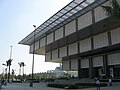
Notable buildings
 A new urban township in Nam Từ Liêm
 The Manor township


References
Wikiwand in your browser!
Seamless Wikipedia browsing. On steroids.
Every time you click a link to Wikipedia, Wiktionary or Wikiquote in your browser's search results, it will show the modern Wikiwand interface.
Wikiwand extension is a five stars, simple, with minimum permission required to keep your browsing private, safe and transparent.
