Nienburg, Lower Saxony
Town in Lower Saxony, Germany From Wikipedia, the free encyclopedia
Town in Lower Saxony, Germany From Wikipedia, the free encyclopedia
Nienburg (German: [ˈniːn.ˌbʊʁk] , official name: Nienburg/Weser) (Low German: Nienborg, Neenborg or Negenborg) is a town and capital of the district Nienburg, in Lower Saxony, Germany.
Nienburg | |
|---|---|
_COA.svg) Coat of arms | |
Location of Nienburg within Nienburg district 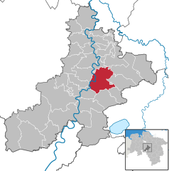 | |
 Nienburg  Nienburg | |
| Coordinates: 52°38′28″N 9°12′25″E | |
| Country | Germany |
| State | Lower Saxony |
| District | Nienburg |
| Subdivisions | 4 districts |
| Government | |
| • Mayor (2021–26) | Jan Wendorf[1] (Ind.) |
| Area | |
| • Total | 64.45 km2 (24.88 sq mi) |
| Elevation | 25 m (82 ft) |
| Population (2022-12-31)[2] | |
| • Total | 32,126 |
| • Density | 500/km2 (1,300/sq mi) |
| Time zone | UTC+01:00 (CET) |
| • Summer (DST) | UTC+02:00 (CEST) |
| Postal codes | 31582 |
| Dialling codes | 05021 |
| Vehicle registration | NI |
| Website | Nienburg.de |
Situated on the scenic German Timber-Frame Road, Nienburg lies on the river Weser, approximately 55 km (34 mi) southeast of Bremen, and 45 km (28 mi) northwest of Hanover. Nienburg is the largest town in the Middle Weser Region.
| Year | 1987 | 1992 | 1997 | 1998 | 1999 | 2000 | 2001 | 2002 | 2003 | 2004 | 2005 | 2006 | 2007 | 2008 | 2009 | 2010 | 2011 |
|---|---|---|---|---|---|---|---|---|---|---|---|---|---|---|---|---|---|
| Population | 29,427 | 31,444 | 32,837 | 32,789 | 32,659 | 32,611 | 32,454 | 32,462 | 32,543 | 32,691 | 32,803 | 32,764 | 32,384 | 32,205 | 32,152 | 31,924 | 31,862 |
(as of Dec. 31st)[3]
 |


Nienburg, including quarters
The major reason for the emergence and development of Nienburg into the largest city in the Middle Weser region was its location at a convenient ford in the Weser River, leading to multiple trade routes radiating from the location. As early as 1025 the location was referred to as Negenborg, i.e. New Castle. In 1215 it began to be referred to as a city, a civitas, when Count Henry I of Hoya began the residence of his ruling line. From 1582 until 1866 the Guelph (Welf) Dukes of Brunswick-Lüneburg controlled the county, except for Napoleonic French rule from 1803 to 1813.[4] In 1871, it became part of the German Empire.
During World War II, it was the location of German prisoner-of-war camps Oflag X-B and Stalag X-C, in which French, Polish, Belgian, Romanian, Serbian, Italian and Soviet POWs were held.
In the wake of the war, a large number of livestock was killed in the region by an unknown predator, called Lichtenmoor Strangler.
The former County of Wölpe was the seat of the Grafen (counts) von Wölpe with its associated castle. The castle (Burg Wölpe) was destroyed in the Hildesheim Diocesan Feud in 1522. [citation needed]
Since the 2021 elections, the mayor is Jan Wendorf (independent).[1] The previous mayor was Henning Onkes (independent). He was reelected in 2014 against three competitors.[5]
The 38 members of the "Stadtrat" are divided among:
The elections in September 2016 showed the following results:
,_Th-01137.jpg)
Seamless Wikipedia browsing. On steroids.
Every time you click a link to Wikipedia, Wiktionary or Wikiquote in your browser's search results, it will show the modern Wikiwand interface.
Wikiwand extension is a five stars, simple, with minimum permission required to keep your browsing private, safe and transparent.
