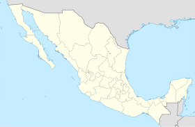
Pabellón de Arteaga Municipality
Municipality in the Mexican state of Aguascalientes From Wikipedia, the free encyclopedia
Pabellón de Arteaga is municipality in the Mexican state of Aguascalientes. It stands at 22°09′N 102°16′W in the central part of the state. The city of Pabellón de Arteaga (2010 population: 28,633) serves as its municipal seat. The municipality had a population of 41,862 and an area of 199.33 km² (76.97 sq mi). Its largest other town is named Emiliano Zapata.
Pabellón de Arteaga | |
|---|---|
 Municipality location in Aguascalientes | |
| Coordinates: 22°09′N 102°16′W | |
| Country | Mexico |
| State | Aguascalientes |
| Municipal seat | Pabellón de Arteaga |
| Area | |
| • Total | 199.72 km2 (77.11 sq mi) |
| Population (2015) | |
| • Total | 46,473 |
| • Density | 230/km2 (600/sq mi) |
Demographics
As of 2010, the municipality had a total population of 41,862.[5]
As of 2010, the city of Pabellón de Arteaga had a population of 28,633.[5] Other than the city of Pabellón de Arteaga, the municipality had 300 localities, the largest of which (with 2010 populations in parentheses) were: Emiliano Zapata (2,995), classified as urban, and Las Ánimas (1,794), Santa Isabel (1,065), Santiago (1,020), and San Luis de Letras (1,018), classified as rural.[5]
References
External links
Wikiwand in your browser!
Seamless Wikipedia browsing. On steroids.
Every time you click a link to Wikipedia, Wiktionary or Wikiquote in your browser's search results, it will show the modern Wikiwand interface.
Wikiwand extension is a five stars, simple, with minimum permission required to keep your browsing private, safe and transparent.


