Poteet, Texas
City in Texas, United States From Wikipedia, the free encyclopedia
Poteet is a city in Atascosa County, Texas, United States. The population was 2,795 as of the 2020 census.[4] It is part of the San Antonio Metropolitan Statistical Area. It was named for its first postmaster, Francis Marion Poteet. It is best known as the birthplace of country music legend George Strait.
Poteet, Texas | |
|---|---|
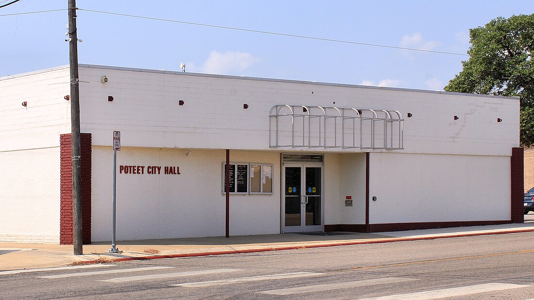
 Poteet City Hall | |
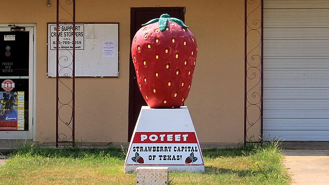
| Nickname: Strawberry Capital of Texas | |
 Location of Poteet, Texas | |
 | |
| Coordinates: 29°02′14″N 98°34′22″W | |
| Country | United States |
| State | Texas |
| County | Atascosa |
| Named for | Francis Marion Poteet |
| Area | |
| • Total | 1.73 sq mi (4.49 km2) |
| • Land | 1.73 sq mi (4.49 km2) |
| • Water | 0.00 sq mi (0.00 km2) |
| Elevation | 436 ft (133 m) |
| Population (2020) | |
| • Total | 2,795 |
| • Density | 1,612.2/sq mi (622.49/km2) |
| Time zone | UTC-6 (Central (CST)) |
| • Summer (DST) | UTC-5 (CDT) |
| ZIP code | 78065 |
| Area code | 830 |
| FIPS code | 48-59084[3] |
| GNIS feature ID | 2411477[2] |
| Website | www |
Poteet is known for its "Poteet Strawberry Festival".[5] Poteet Canyon, Steve Canyon's ward in the long-running comic strip by Milton Caniff, is named after the town[6] (and a mosaic of Poteet Canyon stands in front of the town's fire station).[7]

Geography
Poteet is located about 30 miles (48 km) south of downtown San Antonio.
According to the United States Census Bureau, the city has a total area of 1.7 square miles (4.4 km2), all land.[8]
Climate
| Climate data for Poteet, Texas (1991–2020 normals, extremes 1941–present) | |||||||||||||
|---|---|---|---|---|---|---|---|---|---|---|---|---|---|
| Month | Jan | Feb | Mar | Apr | May | Jun | Jul | Aug | Sep | Oct | Nov | Dec | Year |
| Record high °F (°C) | 96 (36) |
98 (37) |
100 (38) |
109 (43) |
110 (43) |
107 (42) |
110 (43) |
110 (43) |
112 (44) |
112 (44) |
98 (37) |
90 (32) |
112 (44) |
| Mean daily maximum °F (°C) | 65.9 (18.8) |
70.1 (21.2) |
75.9 (24.4) |
82.4 (28.0) |
88.3 (31.3) |
93.9 (34.4) |
96.3 (35.7) |
97.6 (36.4) |
92.0 (33.3) |
84.7 (29.3) |
74.9 (23.8) |
66.7 (19.3) |
82.4 (28.0) |
| Daily mean °F (°C) | 53.3 (11.8) |
57.4 (14.1) |
63.9 (17.7) |
70.3 (21.3) |
77.4 (25.2) |
82.9 (28.3) |
85.1 (29.5) |
85.6 (29.8) |
80.7 (27.1) |
72.2 (22.3) |
62.1 (16.7) |
54.4 (12.4) |
70.4 (21.3) |
| Mean daily minimum °F (°C) | 40.8 (4.9) |
44.7 (7.1) |
51.9 (11.1) |
58.2 (14.6) |
66.5 (19.2) |
71.9 (22.2) |
73.8 (23.2) |
73.7 (23.2) |
69.4 (20.8) |
59.7 (15.4) |
49.3 (9.6) |
42.1 (5.6) |
58.5 (14.7) |
| Record low °F (°C) | −1 (−18) |
5 (−15) |
18 (−8) |
30 (−1) |
35 (2) |
50 (10) |
57 (14) |
58 (14) |
40 (4) |
26 (−3) |
22 (−6) |
9 (−13) |
−1 (−18) |
| Average precipitation inches (mm) | 1.62 (41) |
1.81 (46) |
1.96 (50) |
2.08 (53) |
3.59 (91) |
3.42 (87) |
2.44 (62) |
1.99 (51) |
3.99 (101) |
2.26 (57) |
1.47 (37) |
1.73 (44) |
28.36 (720) |
| Average snowfall inches (cm) | 0.0 (0.0) |
0.0 (0.0) |
0.0 (0.0) |
0.0 (0.0) |
0.0 (0.0) |
0.0 (0.0) |
0.0 (0.0) |
0.0 (0.0) |
0.0 (0.0) |
0.0 (0.0) |
0.0 (0.0) |
0.0 (0.0) |
0.0 (0.0) |
| Average precipitation days (≥ 0.01 in) | 4.1 | 4.1 | 4.8 | 3.3 | 5.5 | 4.3 | 3.9 | 3.2 | 5.4 | 3.9 | 3.9 | 4.3 | 50.7 |
| Average snowy days (≥ 0.1 in) | 0.0 | 0.0 | 0.0 | 0.0 | 0.0 | 0.0 | 0.0 | 0.0 | 0.0 | 0.0 | 0.0 | 0.0 | 0.0 |
| Source: NOAA[9][10] | |||||||||||||
Education
Poteet is served by the Poteet Independent School District, including Poteet High School.
Demographics
2020 census
| Race | Number | Percentage |
|---|---|---|
| White (NH) | 304 | 10.88% |
| Black or African American (NH) | 17 | 0.61% |
| Native American or Alaska Native (NH) | 4 | 0.14% |
| Asian (NH) | 1 | 0.04% |
| Some Other Race (NH) | 1 | 0.04% |
| Mixed/Multi-Racial (NH) | 21 | 0.75% |
| Hispanic or Latino | 2,447 | 87.55% |
| Total | 2,795 |
As of the 2020 United States census, there were 2,795 people, 1,084 households, and 855 families residing in the city.
2000 census
As of the census[3] of 2000, 3,305 people, 1,052 households, and 810 families resided in the city. The population density was 2,224.2 inhabitants per square mile (858.8/km2). The 1,201 housing units averaged 808.2/sq mi (311.2/km2). The racial makeup of the city was 64.99% White, 0.36% African American, 0.27% Native American, 30.11% from other races, and 4.27% from two or more races. Hispanics or Latinos of any race were 88.84% of the population.
Of the 1,052 households, 44.3% had children under the age of 18 living with them, 47.1% were married couples living together, 23.7% had a female householder with no husband present, and 23.0% were not families. About 21.0% of all households were made up of individuals, and 11.8% had someone living alone who was 65 years of age or older. The average household size was 3.11 and the average family size was 3.60.
In the city, the population was distributed as 34.6% under the age of 18, 10.2% from 18 to 24, 25.6% from 25 to 44, 17.7% from 45 to 64, and 12.0% who were 65 years of age or older. The median age was 29 years. For every 100 females, there were 90.8 males. For every 100 females age 18 and over, there were 83.5 males.
The median income for a household in the city was $25,329, and for a family was $27,949. Males had a median income of $23,929 versus $15,608 for females. The per capita income for the city was $9,368. About 23.6% of families and 28.0% of the population were below the poverty line, including 33.1% of those under age 18 and 29.7% of those age 65 or over.
Notable people
- David Lee Garza, Tejano music artist, was born in Poteet
- George Strait, country music singer was born in Poteet
References
External links
Wikiwand in your browser!
Seamless Wikipedia browsing. On steroids.
Every time you click a link to Wikipedia, Wiktionary or Wikiquote in your browser's search results, it will show the modern Wikiwand interface.
Wikiwand extension is a five stars, simple, with minimum permission required to keep your browsing private, safe and transparent.
