Sarawat Mountains
Mountain range in Saudi Arabia and Yemen / From Wikipedia, the free encyclopedia
Dear Wikiwand AI, let's keep it short by simply answering these key questions:
Can you list the top facts and stats about Sarawat Mountains?
Summarize this article for a 10 year old
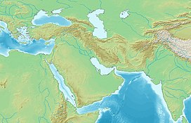
The Sarawat Mountains (Arabic: جِبَالُ ٱلسَّرَوَاتِ, romanized: Jibāl as-Sarawāt), also known as the Sarat in singular case,[1] is a part of the Hijaz Mountains in the western part of the Arabian Peninsula. In a broad sense, it runs parallel to the eastern coast of the Red Sea, and thus encompasses the mountains of Fifa',[2] 'Asir[3] and Taif[4][5] (which can be seen as including the Midian Mountains).[6] In a narrow sense, the Sarawat start in Taif city in Saudi Arabia, and extend to the Gulf of Aden in the south, running along the entire western coast of Yemen, in what used to be North Yemen, and extend eastwards into part of what used to be South Yemen, thus running parallel to the Gulf of Aden.[1][7]
| Sarawat Mountains | |
|---|---|
| Sarat | |
 Sarawat mounatains of Al-Bahah, Saudi Arabia. | |
| Highest point | |
| Peak | Jabal An-Nabi Shu'ayb, Yemen |
| Elevation | 3,666 m (12,028 ft) |
| Naming | |
| Native name | Jibāl As-Sarawāt (جِبَالُ ٱلسَّرَوَاتِ) |
| Geography | |
| Countries | Yemen and Saudi Arabia |
| Range coordinates | 18°16′02″N 42°22′05″E |


