Tafraout
Town in Souss-Massa, Morocco From Wikipedia, the free encyclopedia
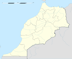
Tafraout, also Tafraoute[1] (Arabic: تافراوت, Tachelhit: ⵜⴰⴼⵔⴰⵡⵜ) is a town in Tiznit Province, Souss-Massa region, Morocco. Situated in the central part of the Anti-Atlas mountains, a mountain range in Morocco which is part of the Atlas Mountains in the northwest of Africa, the town has a population of 4,931 at the 2004 census.[2]
Tafraout
تافراوت ⵜⴰⴼⵔⴰⵡⵜ | |
|---|---|
Town | |
 | |
| Coordinates: 29°43′N 8°58′W | |
| Country | |
| Region | Souss-Massa |
| Province | Tiznit Province |
| Population (2004) | |
| • Total | 4,931 |
| Time zone | UTC+0 (WET) |
| • Summer (DST) | UTC+1 (WEST) |

Name and etymology
The basic meaning of the Shilha feminine noun tafrawt is "basin or cistern in which water drawn from a well is poured", with a derived meaning "valley".[3] The centre of the town of Tafraout is actually situated in a small valley, at the foot of Djebel Lekest, a pink granite mountain formed by erosion.[4] A male inhabitant is called in Shilha "u Tfrawt", (plural "ayt Tfrawt"); a female inhabitant is "ult Tfrawt", (plural "ist Tfrawt").[5]
The area is surrounded by mountains and olive and almond groves, as well as argan and fig trees.
See also
Notes
References
External links
Wikiwand in your browser!
Seamless Wikipedia browsing. On steroids.
Every time you click a link to Wikipedia, Wiktionary or Wikiquote in your browser's search results, it will show the modern Wikiwand interface.
Wikiwand extension is a five stars, simple, with minimum permission required to keep your browsing private, safe and transparent.

