Loading AI tools
The city of Thunder Bay, Ontario was formed on January 1, 1970 with the amalgamation of the cities of Fort William and Port Arthur and the townships of McIntyre and Neebing.[1] Politically, the city's municipal government has designated seven electoral wards—Current River, McIntyre, McKeller, Neebing, Northwood, Red River, and Westfort.[2] Unlike some Canadian cities, Thunder Bay has not defined all of its neighbourhoods so names and boundaries are sometimes ambiguous.
| This is a workpage—an article being developed. When complete, it will go here. |
- Urban growth in the Lakehead was centred on three focal points. The first was Westfort, known then as "the Town Plot". Located on the Kaministiquia River 7km upstream from its mouth, Westfort was the early favourite for development in the Lakehead after being designated by the Canadian Government as the Lake Superior terminus for the Transcontinental railway. This changed in 1883 when the government transferred responsibility for financing the railway to the private Canadian Pacific Railway, which relocated the terminus to the McKellar area, 6km downstream. A second node was developed at this new terminus on land originally owned by the McKellar Family. Centred on the intersection of Simpson Street and Victoria Avenue, this node would be chosen as the administrative centre of Fort William when the town was incorporated in 1893. A third node was the community of Prince Arthur's Landing. Located 5 miles north of the McKellar area, it formed along Cumberland and Water streets, and would become the centre of the town of Port Arthur upon its incorporation in 1884.[3]
- Port Arthur's growth diffused in several directions, but Fort William was more linear. It faced a natural barrier to the south and east with the Kaministiquia River, and a man made one to the north and west with the CN rail line.[4]
- The first parts of Fort William to be developed were the Westfort area, the lands adjacent to the CP Railway and Hudson Bay Company operations along the river, and the McKellar and Vickers areas. While all streets were built on a grid plan, they didn't all have the same orientations which results in numerous grid fractures. The area adjacent to the CP Railway and Hudson Bay Company operations was bisected by the CP mainline. East of the line the grid is oriented to the river, while to the west its oriented to the rail yards. This results in streets having an angular bend between Miles Street and Dease Street where the grid meets the north-south grid of the McKellar and Vickers neighbourhoods. Streets between Pacific Avenue and the Neebing-McIntyre Floodway are aligned with the Vickers block, which results in another grid fracture north of the East End and Simpson-Ogden areas.[5]
- In 1920, the Simpson-Ogden area contained one third of Fort William's residential buildings. With a density of 800 to 1,100 buildings per square kilometre, it was three to five more dense than the neighbourhoods to the west. Fort William's elites built their homes south of the core, in the area along Ridgeway Street and near Vickers Park.[6]
- By 1949, Fort William had filled the area between the Kaministiquia River and the CN rail line. To meet a growing demand for single family homes, the community had to begin developing the land across the tracks. This proved challenging as the land was owned by many different people, and some areas were already developed as farmland. While some streets were already laid out in the area, they were spaced for a grid plan that would accommodate lots with 25-foot frontages. At this time however was the modern practice of designing subdivisions with cul-de-sacs and crescents to decrease the amount of traffic on residential streets was becoming more prevalent, requiring the city to take control in urban planning to design modern subdivisions in 1953. The city created a three-stage process to assemble land for modern subdivisions. In the first stage, the city would design a subdivision. Second, it would allow landowners who were affected by the new layout to review the plan. They could sell their land to the city, or exchange their 25-foot lots for 50-foot lots in the new subdivision, with the city losing some of its own land in the process. A by-law forbidding the construction of new homes on 25-foot lots forced acceptance of this new plan. Once everyone affected had agreed on the plan, the third stage, development of the land, could proceed. Landowners could either develop the land themselves, or sell the land to private individuals. By 1956, the city had developed eight of these plans, mostly located in the Edgewater Park and Green Acres areas. One hundred-eighty land owners were involved, 90% of whom chose the lot exchange over selling the land to the city.[7]
- There were consequences to this new method of urban planning. Suburbs with a street hierarchy consumed land much faster than the traditional grid plans. Estimates received by the city of Fort William from its Hydro Electric Commission for installing electrical service to a 284-lot subdivision noted that a standard grid of 50-foot lots would be able to hold 19 additional lots, and the cost of wiring them would be 25% less. The new layout also altered the street scape with the adoption of new building styles. Homes were typically rectangular, one story bungalows with the longer side facing the street, providing bigger yards and a sense of spaciousness not found in older parts of the city.[8]
- The most significant benefit of Fort William's subdivision creation process was that the city was able to control the rate at which land was developed. As a result, the city grow out at a more steady page instead of "leap-frogging", where gaps would form between areas that were developed. Additional plans for subdivisions would only be put into place once previous subdivisions had run out of room. Victoria Park, the area between Ford and Edward streets, south of Arthur Street, was approved for development in 1955, while the Green Acres area between Edward and Leland streets was approved in 1958. Gateway, a local development company, bought 24 acres of land west of Mountdale Avenue in 1961, marking the first time direct responsibility for designing and servicing subdivisions went from the city to the private sector.[9]
- In the mid-1960s, development north of the Neebing River took place, first filling the area between Edward Street and Chapples Park, and the area west of Edward Street around Sir Winston Churchill Collegiate & Vocational Institute. Housing didn't appear west of James Street until the early 1970s, and College Park was not developed until the 1980s.[10]
Fort William or "Thunder Bay South" was first incorporated as a town in 1892, and became a city in 1907. Throughout the Lakehead's history, Fort William was typically the most populous, but only by a slim margin.[11] It is on a relatively flat terrain dominated by rivers, the most notable of which is the Kaministiquia. Most industry in Fort William is located along the Kaministiquia, including Bowater Forest Products, Bombardier's manufacturing plant, numerous grain elevators, rail yards, oil depots, saw mills, and the Thunder Bay Generating Station, a 326 MW power plant. The mouth of the Kaministiquia is a delta with two islands—Mission Island and McKellar Island—which are largely undeveloped.
Fort William's early growth was sandwiched between the Kaministiquia River and the CN mainline. When space ran out in the 1950s, Fort William began developing north and west of the line.[12]
Downtown Fort William
| Downtown Fort William | |
|---|---|
 | |
| Cuthburtson Block[13] | |
| Population 2,000 |
Ward McKellar and Westfort wards |
 | |
| Location in Thunder Bay | |
Downtown Fort William, also known as Downtown Thunder Bay South or the South Core, is the urban core of the former City of Fort William, Ontario. It is centred on Victoriaville Civic Centre, an indoor shopping mall and civic centre built as part of an urban renewal project in the 1980s.[14] It is separated from the Kaministiquia River by the Canadian Pacific Railway line, and its topography is relatively flat.
Downtown Fort William is the location of Thunder Bay City Hall, and numerous other government offices.
History
Downtown Fort William is one of the three nodes around which urban growth began in the Lakehead area. In the 1880s the Canadian government transfered responsibility for the Transcontinental railway to the private Canadian Pacific Railway, which then relocated the Lake Superior terminus to this location, seven kilometres downstream from Westfort. Growth began at the intersection of Victoria Avenue and Simpson Street on land that was then owned by the McKellar family. When Fort William was incorporated in 1893, this area was chosen for its seat of government,[15] and due to Port Arthur's lack of a city hall, became the location of Thunder Bay City Hall after the amalgamation of the two cities in 1970.
Demographics

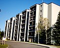
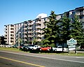
The downtown area has a population of approximately 1,000 and a median age of approximately 47 years. The south core has a larger aboriginal population than much of the rest of the city, and the lowest average income in Thunder Bay.[16][17] The south core is the location of several apartment buildings aimed to low income individuals and seniors. It also has a relatively large homeless contingent and is the location of the Rotary Shelter House.[18] The John Howard Society, an organization dedicated to assist people who have come into conflict with the law, is located in the old YMCA building.[19]
Crime is recognized to be a problem in the south core, especially near the Brodie Street bus terminal. Thunder Bay Police operates the McKellar Neighbourhood Policing Office across the street from the bus terminal and has cruisers drive by on a regular basis.[20]
Economy

Neither of Thunder Bay's downtown cores overshadowed the other, and both are today less important economically than the Intercity area. However, the South Core continues to be an employment centre. Several thousand people work in the core every day. The largest employers in the area include the city government of Thunder Bay, the StarTek Call Centre, and various businesses in the Victoriaville Civic Centre.[21] The core is home to branches of four of Canada's five major banks, and several credit unions.
Several industrial businesses are located in the neighbourhood, primarily on the eastern side of the neighbourhood, and the Canadian Pacific Train Station is located in the southernmost part of the neighbourhood.
Arts and culture
Downtown Fort William is the location of many cultural institutions. The Thunder Bay Historical Museum is located inside a renovated police station on Donald Street, one of the core's many historical landmarks. It is operated by the century old Thunder Bay Historical Museum Society and has three floors of galleries, including a jail cell and recreation of a Fort William street from the early 20th century.[22] Also located along Donald Street is the Brodie Street Art Gallery, which showcases local artists and offers watercolour lessons by local painter Peter Humeniuk.[23]
Brodie Resource Library is located on Brodie Street beside city hall, and was the first library in Thunder Bay.[24]
The CBC's Thunder Bay studio is located in the neighbourhood on Miles Streets. It is the broadcasting centre for CBQ and CBQT. A webcam is mounted on top of its broadcasting antenna, and looks out over the Simpson-Ogden neighbourhood.
Places of worship

Several churches are located in the core, the most prominent being St. Andrews Presbyterian Church, located at the corner of Brodie and Donald Streets. A city designated heritage property, it was built in 1909 by Stinson and Hood architects in the Gothic Revival style. It features a covered entrance supported by granite columns with floral capitals, a unique feature in Thunder Bay, and its bell tower dominates the area's skyline.[25][26] The seat of the Roman Catholic Diocese of Thunder Bay is also located in the south core and is housed in St. Patrick's Cathedral, which was built in 1963 at the corner of Donald and Archibald.[27][28] Other prominent churches include St. Paul's Anglican Church at the corner of Ridgeway and Archibald and Wesley United Church across from the Brodie Street bus terminal at the corner of Brodie and Miles.[29][30]
Sports and recreation
The Northwestern Ontario Sports Hall of Fame is located in the south core on May Street, beside city hall.[31] The Fort William Gardens is located at the corner of Vickers and Miles streets, and is a 4,700 seat arena.[32]
Parks
There are many parks and parkettes in the south core, the most notable is Paterson Park, located on the former site of the Fort William Central School on May Street between Miles and Leith streets. The park was named after Norman M. Paterson, a Senator and founder of Paterson GlobalFoods. The park features a fountain and benches on an artificial hill.[33] Located along the Kaministiquia River is the Kaministiquia River Heritage Park, which features a Via Rail train display, a restored Tugboat, an boardwalk, and a stainless steel sculpture titled "Animikie", which is Ojibwe for "thunder bird".[34]
Education

Many schools have been located in the downtown area but as the population aged and the amount of families decreased, many were closed. The only school operating in the core today is McKellar Park Central School, which has classes from Kindergarten to grade 8 and was ranked by the Frasier Institute as the worst in Thunder Bay in 2008.[35] St. Stanislaus School was a Catholic school located at the corner of Miles and North streets. It is now an office building.[36] Fort William Central School was located at the corner of Miles and May streets, and was demolished in the 1950s for Paterson Park.[33] Fort William Collegiate Institute was a secondary school located just south of the core which closed in 2005. Plans are underway to convert the building to residential uses.[37] A branch of the Sylvan Learning Centre is located on Victoria Avenue.[38]
Infrastructure

The street layout in Downtown Fort William is based on a grid, which is interrupted at several points by Victoriaville Mall, Paterson Park and the former McKellar General Hospital. Thunder Bay Transit operates a bus terminal in the core. Routes that use the terminal include 1 Mainline, 2 Crosstown, 3 Memorial, 4 Neebing, 8 James, and 12 East End. During peak hours, bus frequency in the core is every 15 minutes.[39]
Medical facilities in the core include St. Joseph's Care Group in Victoriaville Civic Centre,[40] the Ridgeway Clinic,[41] the Fort William Clinic,[42] and the Spence Clinic.[43] The Mayo Clinic has an office in Spence Clinic where local residents can receive information about the Mayo Clinic and schedule appointments.[44]
Photo Gallery
 Government of Canada offices at the corner of May and Leith, an example of Beaux-Arts Classicism.[45] Constructed in 1913 of limestone, its architectural elements have been reduced to their bare essentials, representing a movement toward modern classicism.[46]
 Built in 1928 as a hotel, the eight-storey Royal Edward Arms is the oldest "highrise" in Fort William and was designed by Dorr & Dorr architects of Minneapolis.[47] The upper reaches of the building is decorated with an Art Deco stylization of Gothic ornamentation.[48] Today the building is used for low income housing,[49] but during its heyday hosted many famous individuals, including Her Majesty Queen Elizabeth II.[50]
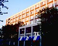 Thunder Bay Independent Living Resource Centre at 130 South Brodie Street.[51] Originally built as a Best Western hotel, today is houses several non-profit organizations and condominium units for seniors.
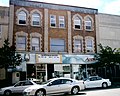
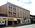 The Roy Building, designed for John King by Stinson and Hood architects and built in 1908 on Victoria Avenue, was once a Zellers department store. Today, the building is vacant.<ref name="Roy Building">Thunder Bay Street Tours - Roy Building
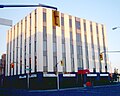 This building at the corner of Syndicate and Donald streets is home to the Thunder Bay Chamber of Commerce, among other businesses.[52]
 The Canada Revenue Agency offices at 130 South Syndicate Avenue, across from the Victoriaville parkade. Designed by T. W. Fuller and built in 1935 this building served as Fort Williams second post office.[53]


Confederation Park
Located northeast of Thunder Bay International Airport, Confederation Park a small neighbourhood where all streets are named with a "confederation" theme.
East End
The east end is a small neighbourhood separated from Fort William by the CP Rail mainline. It is one of the oldest neighbourhoods in Thunder Bay, and one of the poorest. Largely populated by Eastern European immigrants in the late 1800s, it was described by some newspapers as one of the most decrepit slums in the world. The municipal government of Fort William at the time refused to provide basic services such as sewer and water lines to the neighbourhood and its isolation only exacerbated its social ills.
It is surrounded by the Neebing-McIntyre Floodway to the north, the Kaministiquia River to the south, and Lake Superior to the east. It was the original site of Fort Kaministiquia and Magnus Theatre.
Green Acres
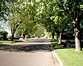
Green Acres is located south of Arthur Street, west of Waterloo Street, east of James Street and north of Walsh Street. It is a largely suburban neighbourhood developed in the late 1950s and early 1960s after the area between the CN mainline and Kaministiquia River was filled by development. It was the first neighbourhood in Fort William to deviate from the traditional grid streets and experiment with modern, suburban-style crescents and cul-de-sacs.
Industrial Islands
The industrial islands are two islands which form the mouth of the Kaministiquia River. The two islands are McKellar Island and Mission Island. They are connected to the city by Island Drive, a causeway from the East End which was built in 2004 to replace the 95 year old Jackknife Bascule Bridge. The two islands are connected over the McKellar River by a similarly aged bascule bridge. Mission Island is the location of OPG's Thunder Bay Generating Station, a coal fired power plant.
McKellar Park
McKeller Park is the residential area surrounding downtown Fort William. Most homes in this neighbourhood are on 25-foot lots, typical of the era. It is home to some of Thunder Bay's first duplexes, row homes, and apartment buildings. It got its name from John McKellar, the first mayor of Fort William.
Northwood
Northwood is one of Thunder Bay's seven municipal wards, represented by Mark Bentz. It was developed between 1965 and 1985. It is bounded by Chapples Park to the east, Arthur Street to the south, the Thunder Bay Expressway to the west and the Harbour Expressway to the north.
Northwood includes many smaller neighbourhoods, such as Edgewater Park, the southernmost third which is located between Arthur Street and the Neebing River; College Park, the part of Northwood generally north of James Street, and Mountview, the area between the two.
Northwood is home to two secondary schools. Dennis Franklin Cromarty High School and Sir Winston Churchill Collegiate & Vocational Institute are located beside each other at the corner of Edward St and Churchill Drive. The neighbourhood is home to Confederation College.
Parks include Chapples Park, the Thunder Bay Soroptimist International Friendship Garden, and the Neebing Watercourse Preserve. Smaller local parks and parkettes are located throughout the ward.
Northwood is home to Northwood Park Plaza, an indoor shopping mall in the heard of the community. Its southern boundary on Arthur Street is the location of several smaller malls and grocery stores.
Parkdale
Parkdale is a new subdivision located north of Arthur Street and west of the Thunder Bay Expressway. Most of the streets are named after animals from the Taiga ecozone. Development in Parkdale began in the late 1990s and it is planned to hold approximately 15,000 people when complete.
Simpson-Ogden
Simpson-Ogden is an historic neighbourhood wedged between Simpson Street and May Street. It is home to the Simpson Street Business Improvement Association (BIA). Simpson Street was the original commercial centre for Fort William.
Vickers Park
Vickers Park is the area around Vickers Park. It is the location of St. Patrick High School. It is located in Westfort Ward.
Westfort
Westfort is the original Town Plot, and is the oldest community in Thunder Bay. It is located along the Kaministiquia River, south of the CN Rail mainline. The streets are laid out in long blocks parallel to the river. It's western edge is the location of Bowater Forest Products. It is the location of Westgate Collegiate & Vocational Institute.
- Urban growth in the Lakehead was centred on three focal points. The first was Westfort, known then as "the Town Plot". Located on the Kaministiquia River 7km upstream from its mouth, Westfort was the early favourite for development in the Lakehead after being designated by the Canadian Government as the Lake Superior terminus for the Transcontinental railway. This changed in 1883 when the government transferred responsibility for financing the railway to the private Canadian Pacific Railway, which relocated the terminus to the McKellar area, 6km downstream. A second node was developed at this new terminus on land originally owned by the McKellar Family. Centred on the intersection of Simpson Street and Victoria Avenue, this node would be chosen as the administrative centre of Fort William when the town was incorporated in 1893. A third node was the community of Prince Arthur's Landing. Located 5 miles north of the McKellar area, it formed along Cumberland and Water streets, and would become the centre of the town of Port Arthur upon its incorporation in 1884.[3]
- Port Arthur in 1885 was confined to the area west of Banning and College streets, north of Bay Street, and south of Dawson Street and McVicar Creek. At first, growth spread north and south from the core along the street railway.[54]
- The area between McVicar Creek and River Street is the "McVicars Addition", and includes what is now the "Harrington Avenue - Ray Court Heritage District". The "O'Brien Addition" was the area located south of Downtown, between Bay Street and John Street, east of Banning. The "Russel Addition" is the area between Red River Road and River Street, east of Pine Street and west of High Street.[55]
- An example of Port Arthur's optimism is evident in a 1914 map of the city, which includes an area labelled "Prince Arthur Heights" covering much of what is today County Park and Grandview Gardens, and located north of that area is Lancaster Heights and Superior Heights, five kilometres from the CBD. Some streets were laid out, such as Lancaster Avenue, but full scale development of those areas never came to fruition. The area that would have been Lancaster Heights and Superior Heights is today home to little more than 200 people.[56]
- The street railway extension to the intersection of Hodder Avenue and Arundel Street opened in 1912. By 1920, Current River has only 100 homes on 17 streets.[57]
- Development of the Mariday Park area was slower than in the area along south Windemere, Empress and Kenogami avenues. As a result, that part of the city actually grew toward the core, not away from it.[58]
- Port Arthur had less municipal involvement in subdivision planning, as the city's displaced growth resulted in large quantities of vacant lots in existing areas. Demand for modern subdivisions didn't come until 1956, several years later than in Fort William. Several streets in the Mariday Park area have conspicuous amounts of wartime housing, and much of the north end of Port Arthur had grid streets laid out prior to the 1950s that were not completely developed until the 1960s.[59]
- When demand for modern suburbs in Port Arthur began in the mid-1950s, the private sector played the leading role. As the municipality owned much of the land beyond the urban area, developing subdivisions in Port Arthur was much less difficult than in Fort William. A private company would buy land for its subdivision, with a clause issuing a time limit for development and requiring a certain number of lots to be sold to individuals to hire their own contractors if they so desired, to prevent companies buying land for speculative purposes. The private land owners would have a minimum size for homes built in their subdivisions, which removed uncertainty over what may be built beside existing homes. These measures resulted in more homogeneous streetscapes than the older parts of the city.
Headway, a Port Arthur development company, developed the 150 lot subdivision Grandview Gardens East located around CD Howe Public School in 1956. Two years later the company would develop the 196 lot subdivision which was then known as "Patricia Park" on the opposite side of River Street. In 1964, they developed Grandview Gardens West, located southwest of Grandview Gardens East. Development in Forest Park began in 1959, in the area north of Windsor Street and between Clarkson and Algonquin. Development south of Windsor Street took place in 1962.
Lakehead Holdings Limited developed St. Joseph's Co-operative in the 1960s. Located north of River Street, east of Elm Street and west of McVicar Creek, it was described as "one of the loveliest tracts of residential land in Western Canada" because of its irregular terrain and views of the lake. It was laid out by V. J. Kostka of the University of Manitoba Faculty of Architecture. The plan consisted of 101 lots on narrow crescent streets and cul-de-sacs, but the Port Arthur Planning Board forced the inclusion of wider streets and a decrease to 85 lots. The intended exclusiveness of the area is indicated by covenants stating that homes could not be less than 1000sqft, and the typical price of a dwelling was 15 to 25 thousand dollars, compared to 13 to 18 thousand dollars in Grandview Gardens. St. Joseph's is unique in North America in that it is rare to see a modern suburb so close to the central business district.[60]
- Like St. Joseph's Co-operative, the street layout in Jumbo Gardens is unique for its location. While St. Joseph's is a suburban style subdivision close to the core, Jumbo Gardens has a grid plan almost 5 kilometres away from the core, and is surrounded by modern subdivisions. Homes had been built in the area as early as the 1930s, which made it almost impossible to develop a modern subdivision in the area. Like many other areas of Port Arthur at the time, Jumbo Gardens had many vacant lots which were developed into the 1980s. As a result, there is an unusual combination of building styles spanning three quarters of a century.[61]
Downtown Port Arthur
The Heart of the Harbour, downtown Port Arthur is centred on Red River Road and Cumberland Street. Downtown Port Arthur is the location of Marina Park.
Downtown Port Arthur is home to Waverly Park and Connaught Square, and the new location of Magnus Theatre. OLG Casino Thunder Bay is located in the southern portion of the neighbourhood at the corner of Park and Cumberland, and area sometimes referred to as "the Entertainment District" due to its many bars and nightclubs.
Harrington Avenue - Ray Court Heritage District is centred along Ray Court and Harrington Avenue. A historically significant neighbourhood.
 Apollo
 Downtown PA
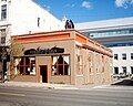 Gargoyles
 Heart of the Harbour
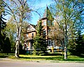 Matthews House
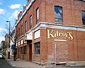 Kilroy's
 Masonic Hall
 Maudslay Court
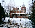 McVicar Manor
 Old Building
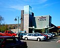 OLG Casino
 Ontario Superior Court
 Polish Alliance
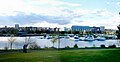 Port Arthur Skyline
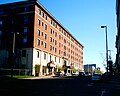 Prince Arthur Hotel
 Prospector Steak House
 RBC
RBC Red River Road
 Regency Court
 Ruttan Block
 St. Joseph's Hospital
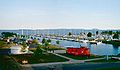 Thunder Bay Marina
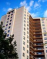 Waverley Park tower
 Hydro Building
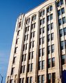 Hydro Building


Academy Heights
Academy Heights, so named because of its proximity to Lakehead University, is located south of Oliver Road, east of Balmoral Street, west of Memorial Avenue and north of the "Hillyard Lands". In the southeastern portion of the neighbourhood is a civic area home to the Canada Games Complex, Port Arthur Stadium, and the Thunder Bay Community Auditorium. The southern and western parts of the neighbourhood are primarily filled with medium to high density housing aimed at students and families, and the northern and eastern portions are home to single family homes from the 1940s to 1960s.
 Holy Trinity Greek Orthodox Church
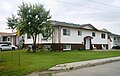 House Academy Heights
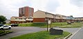 Housing in Thunder Bay 1
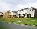 Housing in Thunder Bay 2
 Maple Crest Tower
 Matthews Court
 Suncrest Villa


Bay and Algoma
Bay and Algoma is known for its European community. The neighbourhood is home to large populations from Scandinavia, especially Finland; Italy; and Poland. The Finnish community is most prominent, with the neighbourhood being the location of the Finnish Labour Temple and Hoito Restaurant. The Bay Street Film Festival and is annual film festival held in the neighbourhood in September.
 Bay Street
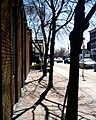 Beside the Madhouse
 Scandinavian House


Carrick, Mariday and Ray Parks
This area is located south of Red River Road, east of High Street, west of Algonquin Avenue and north of John Street. It is made up of several neighbourhoods named after the men who owned the land. Most homes here are from the 1910s to 1940s.
 Street

College Heights
College Heights is located south of River Street, east of High Street, west of Clarkson Avenue and north of Red River Road. It was named because of its proximity to Port Arthur Collegiate Institute.
It is the location of Dougall Media's broadcasting facility, which includes a 300 foot antenna that is visible from much of the city.
Secondary schools include Hillcrest High School and École secondaire catholique de la Vérendrye
 P R Cook
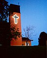 St Andrews Church
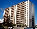 Red River Tower
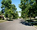 Robinson Street
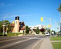 Rockwood Red River


Current River
| Current River | |
|---|---|
 | |
| Looking south at Boulevard Lake | |
| Population 4,780 |
Ward Current River |
|
| |
| Location of Current River in Thunder Bay | |
Current River is a neighbourhood located north east of Port Arthur in the city of Thunder Bay, Ontario. It is separated from the main urban area of Thunder Bay by the Current River Greenway, a large parkland along the river after which the neighbourhood was named. It is home to approximately 4,780 people and has an ageing and declining population.[62]
Current River is located entirely in Current River Ward and is represented on Thunder Bay City Council by Andrew Foulds.
History

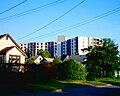
Development of Current River began after World War II, and many homes in the neighbourhood are "Victory Homes", a post-war building style that allowed fast manufacture of single-family dwellings. Development in the neighbourhood progressed northward, and as one travels further north Victory Homes become less common, being replaced with more contemporary building styles. A small cluster of highrise apartments is located beside an outcrop of the Canadian Shield in the southernmost portion of the residential neighbourhood, and offers its residents a view of the Current River Greenway and Thunder Bay.
Geography
Current River is located in the northeast portion of Thunder Bay. It is located east of the Current River and Boulevard Lake and north of Lake Superior. The land inclines as one travels north from the Lake Superior and west from Hodder Avenue.
Economy


Along the shores of Lake Superior to the south and east of the neighbourhood is an abundance of industries. Separated from the main neighbourhood by Hodder Avenue and the CP and CN mainlines is the Port Arthur Shipbuilding Company (PASCO) drydock and shipyard, which has been operating since 1909,[63] and the Thunder Bay Fine Papers mill, formerly Cascades. Further east is the abandoned Smurfit-Stone factory, and the Bare Point water treatment plant which is the main source of drinking water in Thunder Bay. Grain elevators located south of the Current River dominate the view toward the lake.
Current River is home to a small selection of commercial businesses. Mainly located along Hodder Avenue near Arundel Street, the neighbourhood is home to a strip mall with a pharmacy and grocery store, a convenience store and gas station, a bank, and several restaurants and coffee shops. Most businesses in the neighbourhood are locally owned.
Transportation

The main roads in the neighbourhood are Arundel Street, an east-west arterial road that bridges the Current River and connects the community to the Shuniah neighbourhood. Hodder Avenue is the main north-south thoroughfare and forms the backbone of the community's small commercial strip. Grenville Avenue, which is separated into two sections by the Current River Playfield, formed the neighbourhood's original business corridor.
Thunder Bay Transit route 1 Mainline-Current River makes a counter-clockwise loop through the neighbourhood and brings residents south to downtown Port Arthur.
Education
Current River is home to two schools. Claude Garton Public School is part of the Lakehead Public Schools system and offers French immersion classes and is located in the southern part of the neighbourhood. St. Paul Catholic School is located in the northern part of Current River, and is part of the Thunder Bay Catholic District School Board. Public school students from Current River attend Hillcrest High School, and Catholic students attend St. Ignatius, located on the other side of Boulevard Lake.
Recreation
Current River is the location of the largest park in Thunder Bay, the Current River Greenway. The 260 hectare (650 acre) park includes Boulevard Lake, one of the Thunder Bay's most popular summer destinations. The Current River Playfield, located in the middle of Current River, includes a community centre, arena, baseball diamonds, soccer fields, and seasonal ice rinks.
The municipally operated Strathcona Golf Course is located to the east of Current River, and is an 18-hole, 72-par course.[64] Centennial Park, a recreation of a 20th century logging camp, is located northwest of the neighbourhood. The Terry Fox Memorial and Lookout is northeast of the neighbourhood, located along Highway 11/17. It commemorates Terry Fox's Marathon of Hope and offers panoramic views of the lake.
Faircrest
Faircrest is a triangular neighbourhood located between Academy Heights and Mariday Park. It is bounded by John Street, Oliver Road, and Balmoral Street.
Grandview Heights
A modern subdivision located along Clarkson Avenue and River Street, and south and east of the Thunder Bay Expressway and west of McVicar Creek. It was mainly developed between 1955 and 1975. Grandview Mall is located in this neighbourhood.
 Elizabeth Court

Hillcrest Park
Hillcrest Park is a wealthier neighbourhood located beside Hillcrest Park. Many of the homes in the area are large and offer views of the city.
 A house at Hillcrest Park
 A house at Hillcrest Park
 A house at Hillcrest Park
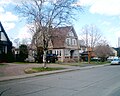 A house on Summit Avenue
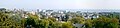 Port Arthur from Hillcrest Park
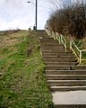 Ambrose Street Stairs
 Port Arthur from Hillcrest Park
 Mount McKay from Hillcrest Park
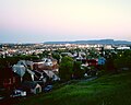 Mount McKay from Hillcrest Park


McIntyre
South of Dawson Road, west of the Thunder Bay Expressway. Mostly suburban, except for Dawson Heights. Dawson Heights is the old part of McIntyre ward. It was developed before World War One and has an interesting mix of homes spanning almost 100 years.
County park is suburban neighbourhood, and includes the Castlegreen Co-operative. County Park is the location of Hilldale Lutheran Church.
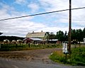 A Barn
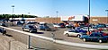 County Fair Mall
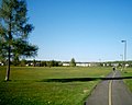 County Park
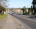 Dawson Road
 House in McIntyre
 House in McIntyre
 John Street
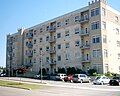 King Arthur Suites
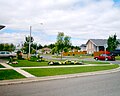 Mayflower Drive
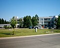 Suomi Koti
 Sidewalk
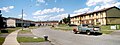 York Street


River Terrace
River Terrace is a group of subdivisions located in Port Arthur's west end, on either side of the McIntyre River. Most homes in the area were built after the 1970 amalgamation. The southernmost portion of the neighbourhood is the location of the Thunder Bay Regional Health Sciences Centre.
Shuniah
Shuniah is the neighbourhood southwest of Boulevard Lake. St. Joseph's Co-operative is one of the city's oldest neighbourhoods with garden style streets, peculiar due to the proximity of such a layout near the downtown core. The northeastern part of the neighbourhood near Boulevard Lake is the location of St. Ignatius High School.
 Hudson Heights Apartments

West End
A group of modern subdivisions located in Port Arthur's west end. It is the location of Hammarskjold High School. It was developed between 1960 and 1990.
The townships of Neebing and McIntyre were the location of several small communities before amalgamation, and today are the location of almost all growth in the city of Thunder Bay.
Neebing
The area north of Rosslyn Road and south of Arthur Street, between the airport and city limits. Also called Neebing Yards as it is the location of CN's Neebing Yard. The community is very spread out. Bus service is provided by Route 4 Neebing, which goes through the neighbourhood ten times between Monday and Saturday.
North McIntyre
Centred on Dawson Road and Government Road, North McIntyre is the location of Five Mile School.
Riverdale
Riverdale is a neighbourhood located south of the Kaministiquia River.
South Neebing
South Neebing is the southernmost neighbourhood in Thunder Bay. Subdivisions include Greengate, Foxborough Place and Rockcliff. Most homes are on large lots. Bus service was once provided by a branch of 4 Neebing, but it was dropped due to low ridership.
Vickers Heights
Vickers Heights is located along Broadway Avenue, south of the CN Mainline and north of the Kaministiquia River. It is the location of Thunder Bay's most visited tourist attraction, Fort William Historical Park.
- Despite the existence of transportation links between both cities as early as the 1890s, development in the intercity area is a recent trend. Prior to the construction of the Neebing-McIntyre Floodway in 1982, much of the area was a swampy, muskeg-like area prone to flooding. Today, Intercity is the primary commercial area of Thunder Bay, due primarily to cheap land and central location.[65]
- Since amalgamation, Thunder Bay has seen an outward growth trend. With few exceptions, the population in areas east of the Thunder Bay Expressway has declined as new subdivisions are built to west of it. As a result, the importance of the former downtown cores has declined significantly. While both cores are focal points for the city's public transport system, it has not played as large a role in transporting people since the boom times of the early 20th century. Since the end of World War II, private cars have replaced demand for public transit, resulting in a less centralized urban structure.[66]
- The construction of Intercity Plaza in 1957 was the first major commercial development located outside of one of the cores. As recently as 1969, much of the intercity area was undeveloped. After amalgamation, its central location was prime for non-residential development. Memorial Avenue, which was originally a tree lined route in memory of veterans of the Great War,[67] is today a commercial strip with few trees remaining. While originally intended to be an industrial area, new types of commercial developments such as business parks and Big-box stores or power centres have become more prevalent in recent years. As this transition continues, it is not uncommon to see unusual neighbours, such as an asphalt plant located beside a business park. The rail lines that once criss-crossed the area have been replaced by streets lines with both businesses and industrial facilities.
With the development of modern suburbs since the 1960s, community shopping malls such as County Fair Plaza, Northwood Park Plaza, and the Arthur Street Marketplace have been developed.
While many organizations are fighting to preserve the original downtown cores, many businesses once found in them are now located in Intercity. The primary factors are likely Intercity's central location, increase in use of private vehicles, and the low cost of the undeveloped land. This trend isn't unique to private businesses. Many public institutions, such as Canada Post, the Thunder Bay District Health Unit, the Thunder Bay Police Service and TBayTel has all relocated to the Balmoral Park area of Intercity since the late 1980s.[68]
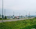
Intercity is the area between the built up portions of Port Arthur and Fort William. It was part of Port Arthur at amalgamation. Intercity was prone to flooding and remained largely undeveloped until the construction of the Neebing-McIntyre Floodway in 1986. Intercity Shopping Centre was the first indoor mall to be built in Thunder Bay, and opened in 1954. It has undergone numerous renovations and expansions since then. The main road in Intercity is the Harbour Expressway, a four lane road.
Intercity was largely an industrial area until the 1990s, and now forms the "downtown" of the unified City of Thunder Bay. It is the location of a variety of big box stores, including Wal-Mart, Superstore, Canadian Tire and Home Depot. It is bisected by a CN Rail line.
 Balmoral Street
 Floodway with lily pads
 Memorial Avenue


Wikiwand in your browser!
Seamless Wikipedia browsing. On steroids.
Every time you click a link to Wikipedia, Wiktionary or Wikiquote in your browser's search results, it will show the modern Wikiwand interface.
Wikiwand extension is a five stars, simple, with minimum permission required to keep your browsing private, safe and transparent.