Top Qs
Timeline
Chat
Perspective
County of Grande Prairie No. 1
Municipal district in Alberta, Canada From Wikipedia, the free encyclopedia
Remove ads
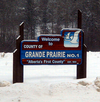
The County of Grande Prairie No. 1 is a municipal district in northwestern Alberta, Canada in Census Division No. 19.
It is bounded on the south by the Wapiti River, on the east by the Smoky River and on the west by the province of British Columbia.
Remove ads
Geography
Summarize
Perspective
Communities and localities
|
The following urban municipalities are surrounded by the County of Grande Prairie No. 1.[3][4]
|
The following hamlets are located within the County of Grande Prairie No. 1.[4]
|
The following localities are located within the County of Grande Prairie No. 1.[5]
- Localities
|
|
|
|
Horse Lakes 152B is an Indian reserve within the County of Grande Prairie No. 1.
Remove ads
Demographics
Summarize
Perspective
In the 2021 Census of Population conducted by Statistics Canada, the County of Grande Prairie No. 1 had a population of 23,769 living in 8,354 of its 9,075 total private dwellings, a change of 5.6% from its 2016 population of 22,502. With a land area of 5,790.59 km2 (2,235.76 sq mi), it had a population density of 4.1/km2 (10.6/sq mi) in 2021.[2]
In the 2016 Census of Population conducted by Statistics Canada, the County of Grande Prairie No. 1 had a population of 22,303 living in 7,684 of its 8,291 total private dwellings, a 13.1% change from its 2011 population of 19,724. With a land area of 5,802.21 km2 (2,240.25 sq mi), it had a population density of 3.8/km2 (10.0/sq mi) in 2016.[13]
The County of Grande Prairie No. 1 conducted a municipal census in 2012, which resulted in an estimated population of 21,157,[14] a 17.6% increase over its 2006 municipal census population of 17,989.[15]
Remove ads
See also
References
External links
Wikiwand - on
Seamless Wikipedia browsing. On steroids.
Remove ads


