Top Qs
Timeline
Chat
Perspective
Benešov District
District in Central Bohemian, Czech Republic From Wikipedia, the free encyclopedia
Remove ads
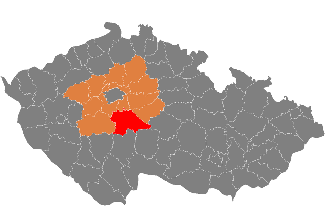
Benešov District (Czech: okres Benešov) is a district in the Central Bohemian Region of the Czech Republic. Its capital is the town of Benešov.
Remove ads
Administrative division
Summarize
Perspective
Benešov District is divided into three administrative districts of municipalities with extended competence: Benešov, Vlašim and Votice.
List of municipalities
Towns are marked in bold and market towns in italics:
Benešov – Bernartice – Bílkovice – Blažejovice – Borovnice – Bukovany – Bystřice – Čakov – Čechtice – Čerčany – Červený Újezd – Český Šternberk – Chářovice – Chleby – Chlístov – Chlum – Chmelná – Chocerady – Choratice – Chotýšany – Chrášťany – Ctiboř – Čtyřkoly – Děkanovice – Divišov – Dolní Kralovice – Drahňovice – Dunice – Heřmaničky – Hradiště – Hulice – Hvězdonice – Jankov – Javorník – Ješetice – Jinošice – Kamberk – Keblov – Kladruby – Kondrac – Kozmice – Křečovice – Krhanice – Křivsoudov – Krňany – Kuňovice – Lešany – Libež – Litichovice – Loket – Louňovice pod Blaníkem – Lštění – Maršovice – Mezno – Miličín – Miřetice – Mnichovice – Mrač – Načeradec – Nespeky – Netvořice – Neustupov – Neveklov – Olbramovice – Ostrov – Ostředek – Pavlovice – Petroupim – Popovice – Poříčí nad Sázavou – Postupice – Pravonín – Přestavlky u Čerčan – Psáře – Pyšely – Rabyně – Radošovice – Rataje – Ratměřice – Řehenice – Řimovice – Sázava – Šetějovice – Slověnice – Smilkov – Snět – Soběhrdy – Soutice – Stranný – Strojetice – Střezimíř – Struhařov – Studený – Tehov – Teplýšovice – Tichonice – Tisem – Tomice – Třebešice – Trhový Štěpánov – Týnec nad Sázavou – Václavice – Veliš – Vlašim – Vodslivy – Vojkov – Votice – Vracovice – Vranov – Vrchotovy Janovice – Všechlapy – Vysoký Újezd – Xaverov – Zdislavice – Zvěstov
Remove ads
Geography
Summarize
Perspective

A rugged and hilly landscape is typical for the district. The territory extends into three geomorphological mesoregions: Benešov Uplands (north), Vlašim Uplands (south) and Křemešník Highlands (smaller part in the east). The highest point of the district is the Mezivrata hill in Neustupov with an elevation of 713 m (2,339 ft), the lowest point is the Štěchovice Reservoir in Krňany at 220 m (720 ft).
The area is rich in watercourses and ponds. The most important river is the Sázava, which forms the north and northeast boundary of the district before crossing it on the northwest. Other important rivers of the district area its tributaries Blanice and Želivka. Slapy and Štěchovice reservoirs, built on the Vltava River, form the western boundary of the district. The largest body of water is Švihov Reservoir, built on the Želivka. It is the fourth largest reservoir in the country.
From the total district area of 1,474.9 km2 (569.5 sq mi), agricultural land occupies 903.0 km2 (348.7 sq mi), forests occupy 414.5 km2 (160.0 sq mi), and water area occupies 33.6 km2 (13.0 sq mi). Forests cover 28.1% of the district's area.[1]
Blaník is the only protected landscape area in the district, covering the surrounding area of the eponymous mountain.
Remove ads
Demographics
Most populated municipalities
Economy
The largest employers with headquarters in Benešov District and at least 500 employees are:[5]
Transport
The D1 motorway from Prague to Brno passes through the northern and eastern part of the district. The European route E55 separates from it, which passes across the district and continues as D3 motorway in its south.
Sights

The most important monuments in the district, protected as national cultural monuments, are:[6]
The best-preserved settlement, which is the only one protected as a monument zone, is Načeradec.[7]
The most visited tourist destination is the Konopiště Castle.[8]
Notable people
References
External links
Wikiwand - on
Seamless Wikipedia browsing. On steroids.
Remove ads

