Top Qs
Timeline
Chat
Perspective
Carmel Point, California
Unincorporated area south of Carmel-by-the-Sea, California From Wikipedia, the free encyclopedia
Remove ads
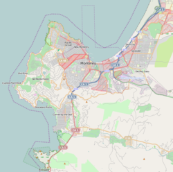
Carmel Point also known as the Point and formerly called Point Loeb and Reamer's Point, is an unincorporated community in Monterey County, California, United States. It is a cape located at the southern city limits of Carmel-by-the-Sea and offers views of Carmel Bay, the mouth of Carmel River, and Point Lobos.[1] Carmel Point was one of three major land developments adjacent to the Carmel city limits between 1922 and 1925. The other two were Hatton Fields, 233 acres (94 ha) between the eastern town limit and Highway 1, and Carmel Woods, 125 acres (51 ha) tract on the north side.[2]
Remove ads
History
The Carmel Point began with the Rumsen Ohlone Native American tribe, who inhabited the area in the 6th-century.[3] The Spanish explorers and missionaries arrived in the late 18th century and erected, within the Ohlone region, the Mission San Carlos Borroméo de Carmelo (founded in 1770). In 1834, the Mexican land grant ranchos took over the mission land and property. In 1848, Mexico ceded to California as a result of the Mexican–American War.[4]
Remove ads
Geography
The Carmel Point land is hilly to the east, but flat to the west, which is closest to the Carmel Bay. The highest point in the vicinity is 1,768.37 ft (539.00 m) high and is 18.7 ft (5.7 m) southeast of Carmel Point. There are about 23 people per square kilometer in Carmel Point's relatively small population. The nearest larger town is Seaside, California, which is 6.46 mi (10.40 km) northeast of Carmel Point.[5]
Remove ads
Climate
See also
References
External links
Wikiwand - on
Seamless Wikipedia browsing. On steroids.
Remove ads


