Top Qs
Timeline
Chat
Perspective
Dehcho Region
Administrative region in Northwest Territories, Canada From Wikipedia, the free encyclopedia
Remove ads
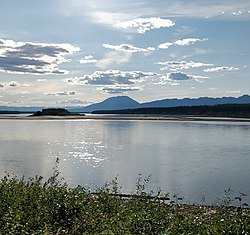
The Dehcho Region[pronunciation?] or Deh Cho is one of five administrative regions in the Northwest Territories of Canada. According to Municipal and Community Affairs the region consists of six communities with the regional office situated in Fort Simpson.[1] All communities in the Dehcho are predominantly Dehcho First Nations.[3][4]
Dehcho Region communities in the Northwest Territories
Remove ads
Communities
The Dehcho Region includes the following communities:
Remove ads
Communities of the Dehcho Region
Climate
Remove ads
References
- Ten Inuvialuit
- Composite data from Fort Liard A: Climate ID: 2201581; coordinates 60°14′08″N 123°28′12″W; elevation: 215.8 m (708 ft) and Fort Liard; WMO ID: 71497; coordinates 60°14′N 123°28′W; elevation: 213.4 m (700 ft)
- Climate data was recorded in Fort Simpson from November 1895 to October 1963 and at Fort Simpson Airport from November 1963 to present. Composite data from Fort Simpson Airport; WMO ID: 71946; coordinates 61°45′37″N 121°14′12″W; elevation: 169.5 m (556 ft) and Fort Simpson Climate; WMO ID: 71365; coordinates 61°45′37″N 121°14′12″W; elevation: 168.0 m (551.2 ft). Sunshine from 1981–2010[13]
- Composite data from Wrigley Airport: Climate ID: 2204005; coordinates 63°12′35″N 123°26′12″W; elevation: 149.7 m (491 ft), temperature extremes, humidex, and wind chill taken from 1991-2020 normals
Remove ads
References
External links
Wikiwand - on
Seamless Wikipedia browsing. On steroids.
Remove ads


